Tag Archive | Hiking Trails

Hot Springs

Arkansas

natural hot springs

My husband and I just visited Hot Springs for the first time. We have driven past the exit to Hot Springs on I-30 dozens of times going to visit family in Tennessee and Mississippi but never actually stopped there. It was finally time to check it out.

Lookout Point Lakeside Inn – lake view

I researched hotels and rentals before finding the perfect place for us. Reviews for the Lookout Point Lakeside Inn caught my attention and ended up being a fantastic place to stay! They are ranked the #1 Hotel in Hot Springs (Trip Advisor), #2 Most Romantic Hotel in the U.S. (Trip Advisor), #3 Small Hotel in the U.S. (Trip Advisor), one of the Top Ten Most Romantic Hotels in the U.S. (NBC Today Show), a Top Ten Best Lakeside Hotels (Good Morning America) and #9 Hotel for Service in the U.S. (Trip Advisor). It didn’t take too long for us to see why this beautiful inn had received all these accolades. The service, staff, location, amenities, design, food, rooms, gardens, and views were all exceptional.

our balcony view at the inn

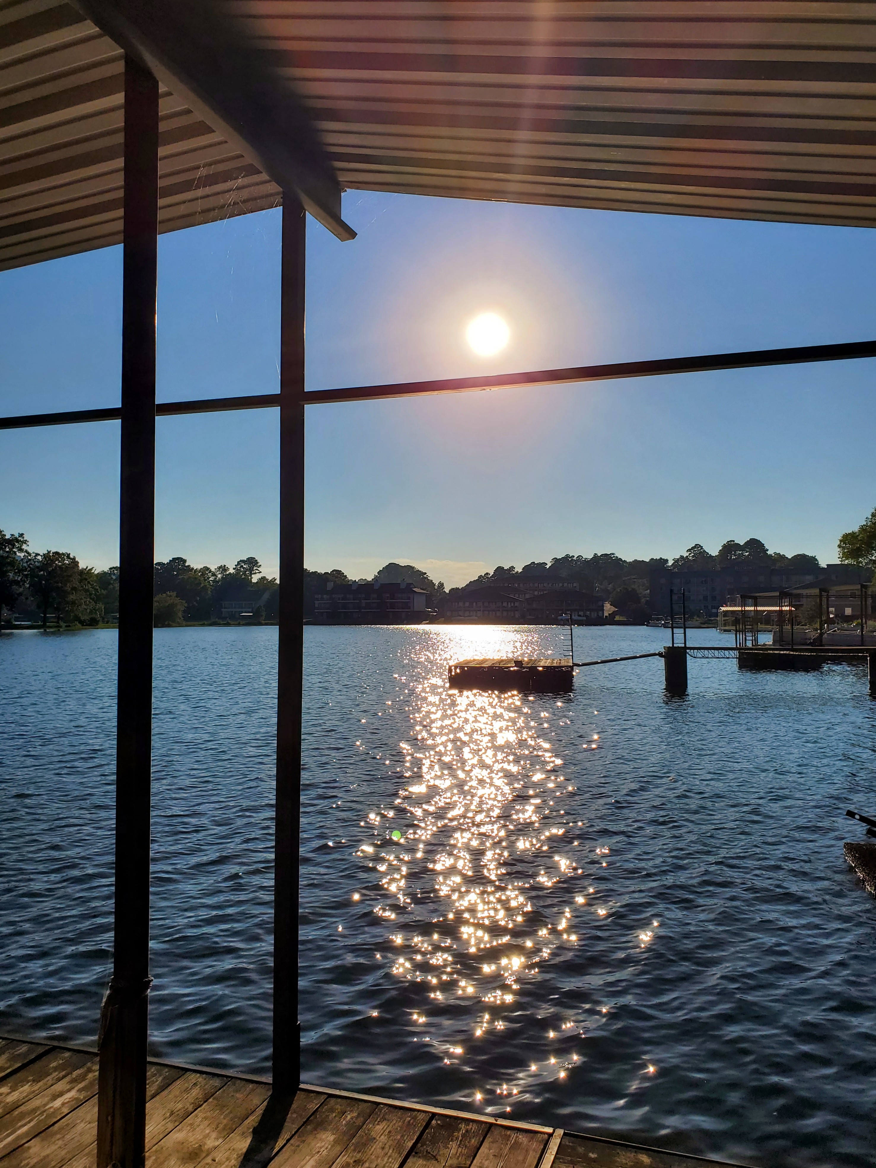
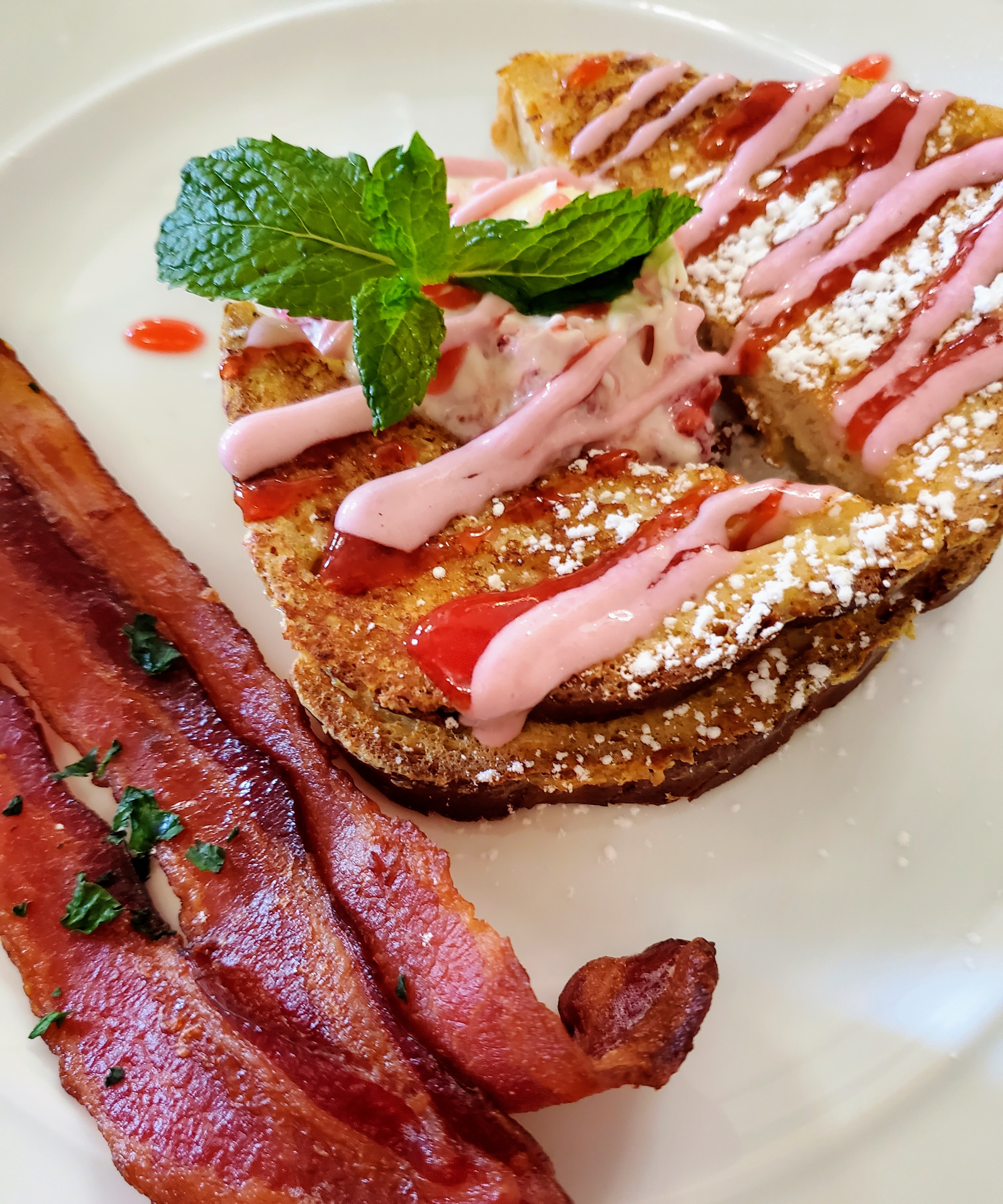
My husband and I particularly enjoyed the gourmet breakfasts in the beautiful dining room and the fresh gluten-free cookies brought to our room each day. Our second floor room and balcony looked out over the manicured gardens, waterfalls, bird feeders, grassy labyrinth, fire pit, boat dock and lake. It was perfect for relaxing. We had a paddleboat, canoe and kayaks for our personal use. The inn also provided us with bug spray, beach towels, DVD movies, hammocks, emergency flashlights, soft drinks, cookies & chocolates, and a Keurig for coffee/tea/hot chocolates. The kitchen was open each day until 7:00 p.m. for snacks, meals, cocktails or wine. The staff was friendly, attentive, and very professional. We had a wonderful stay and I highly recommend this charming, quiet and well-decorated inn.

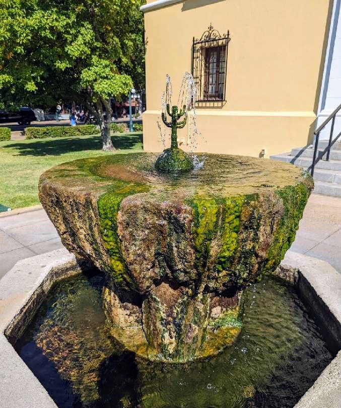
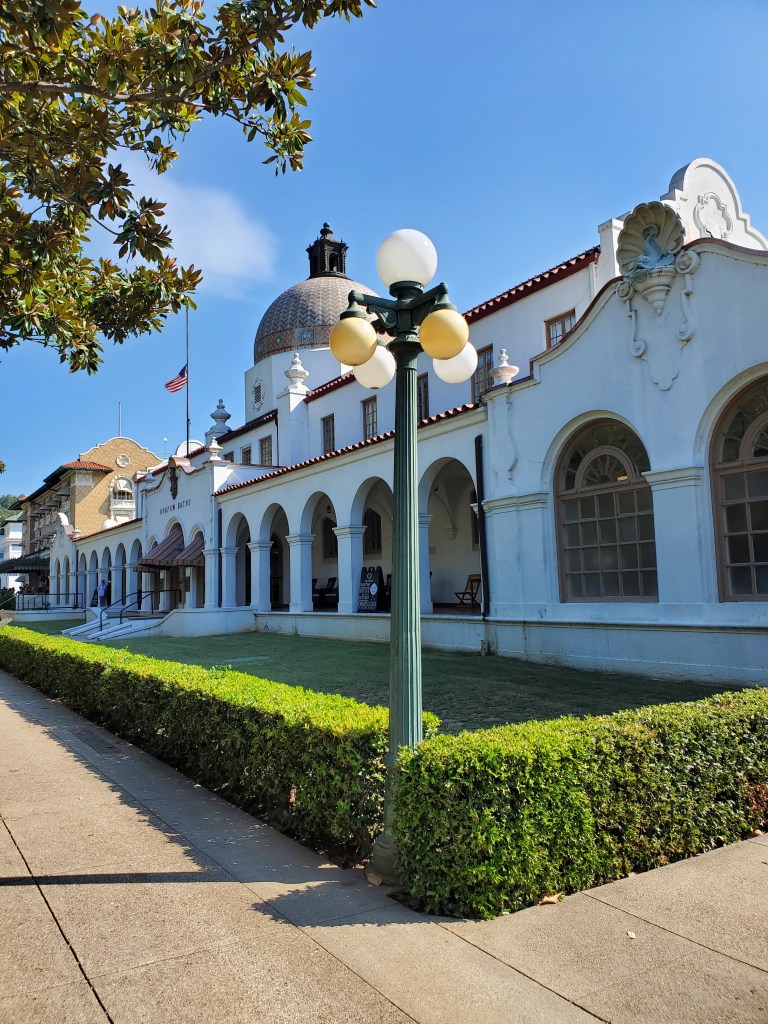
Our first full day was set aside to explore the Hot Springs National Park. This is an urban park located in the heart of downtown Hot Springs and is surrounded by shops, diners, busy roads, gangster museums and tourist attractions. The bathhouses lined up on Bathhouse Row seem to be the park’s most popular attraction. The grand architecture of these eight bathhouses and the stories of the healing waters continue to attract curious visitors as they have since the early 1900s. The therapeutic spas, ancient thermal springs, mountain views, unusual geology, forested hiking trails, and abundant creeks all make this “park” quite unique.

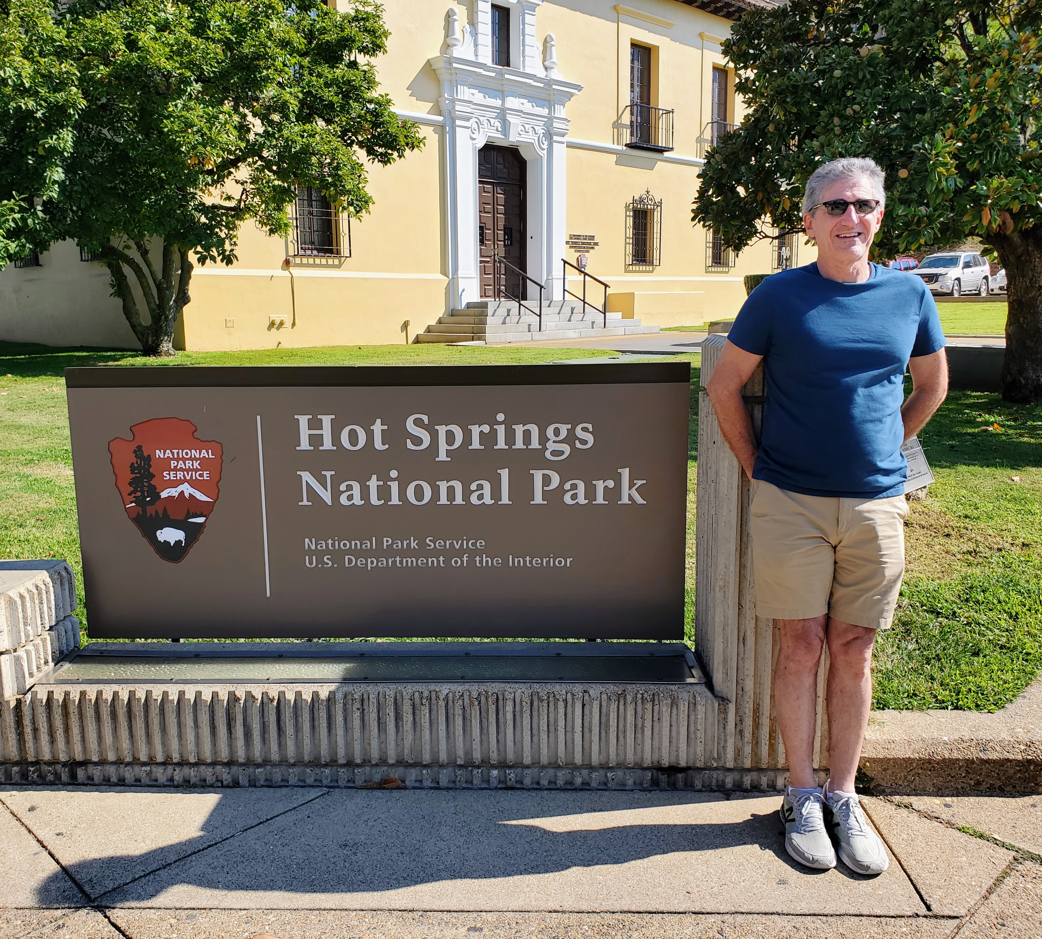
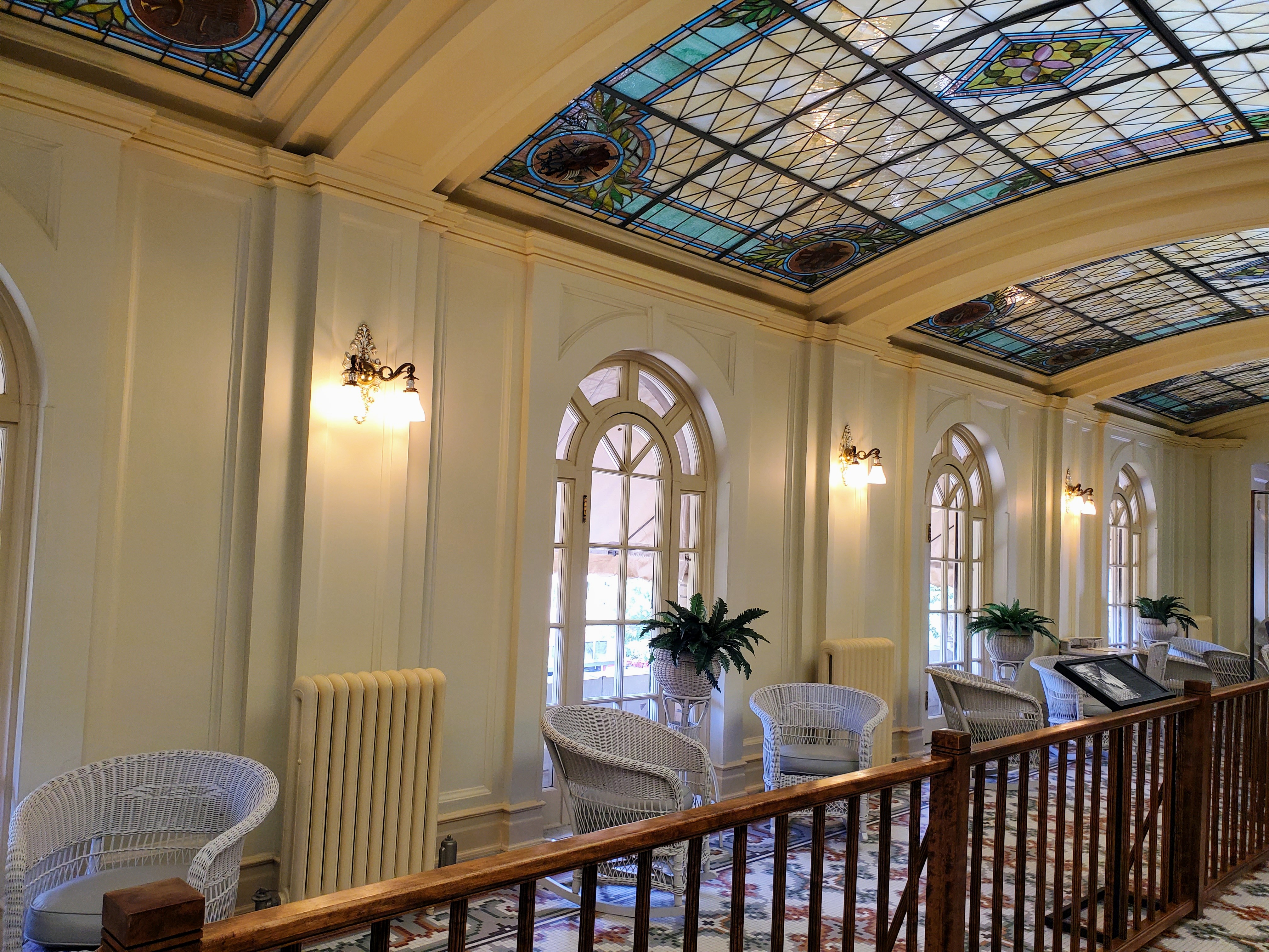
We stopped by the Fordyce Bathhouse which houses the National Park Visitor Center and toured the museum. The three-story bathhouse has informative exhibits, original spa rooms (with equipment) and a short film about the history of the area and Bathhouse Row. We got a more detailed glimpse into the history, grandeur and attraction of this special place. Afterwards, we joined a 45-minute tour led by a National Park Ranger.

the beginning of Bathhouse Row

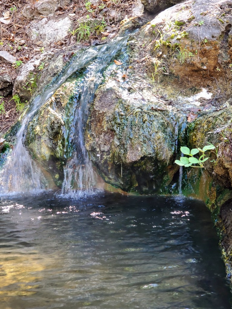
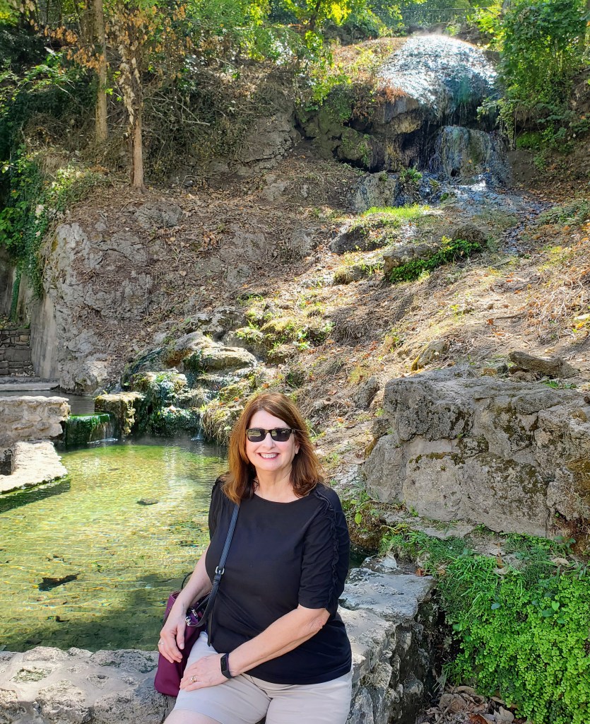
Ranger Lisa was great! She was a Hot Springs native and her walking tour was both interesting and entertaining. We learned about the geology of the area, tasted the 140 degree water, walked the Grand Promenade (on the hill behind Bathhouse Row) and saw a momma groundhog and her baby. We were told that the thermal waters contain potassium, magnesium and sodium – these were the medicinal properties that prior generations found to be so “healing” (today we just take a multivitamin!). Generations ago, most people had poor diets and dirty drinking water. Regular bathing was labor intensive due to large amounts of water having to be carried from the source and then heated. It was quite obvious what was so appealing about these natural springs with clear, clean, nutritious, and heated water just bubbling out of the ground.

the Hot Water Cascade

Only two bathhouses along Bathhouse Row are currently operational. One of the bathhouses, Superior Bathhouse is now a restaurant and brewery. This is the only brewery in the world that uses thermal spring water to create craft beers. We chose this as our lunch spot and it didn’t disappoint! The other bathhouses currently function as a hotel, a park store, a cultural center, and office building.

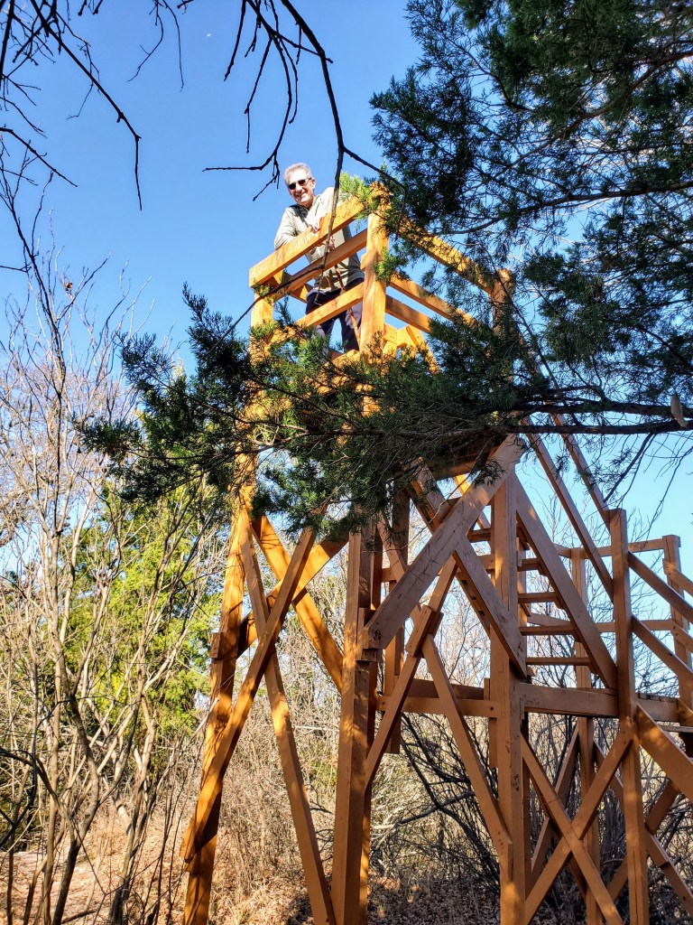
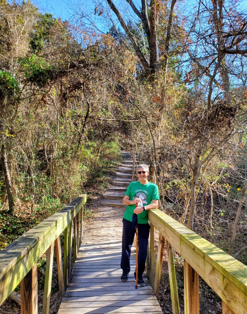
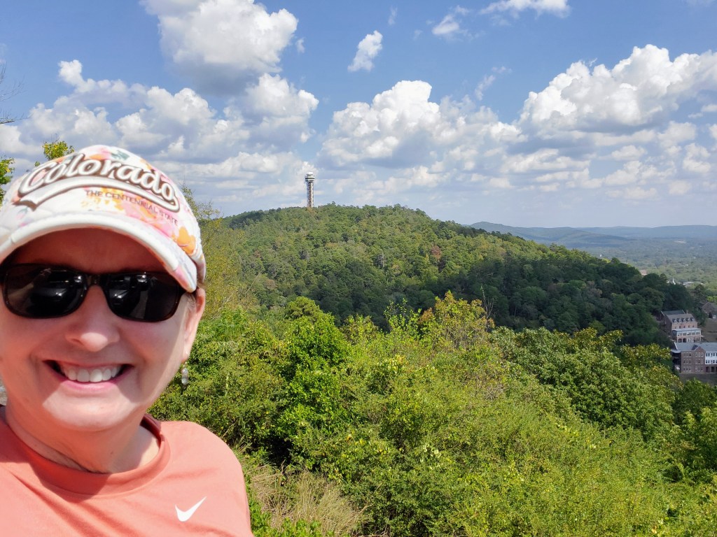
After lunch, we continued touring the park and drove up the winding Mountain Tower Road and West Mountain Road. Both drives provided scenic forested drives and great mountain lookouts. We had clear, beautiful views of Hot Springs and the Ouachita Mountains. For the more adventurous, there are almost 30 miles of hiking trails within the park boundaries that wind up, down and around these mountains overlooking the city. We decided to bypass hiking this time and just enjoyed the scenery from the comfort of our air-conditioned car (it was a humid 97 degrees in late September!).

view from the West Mountain of the Hot Springs Mountain Tower

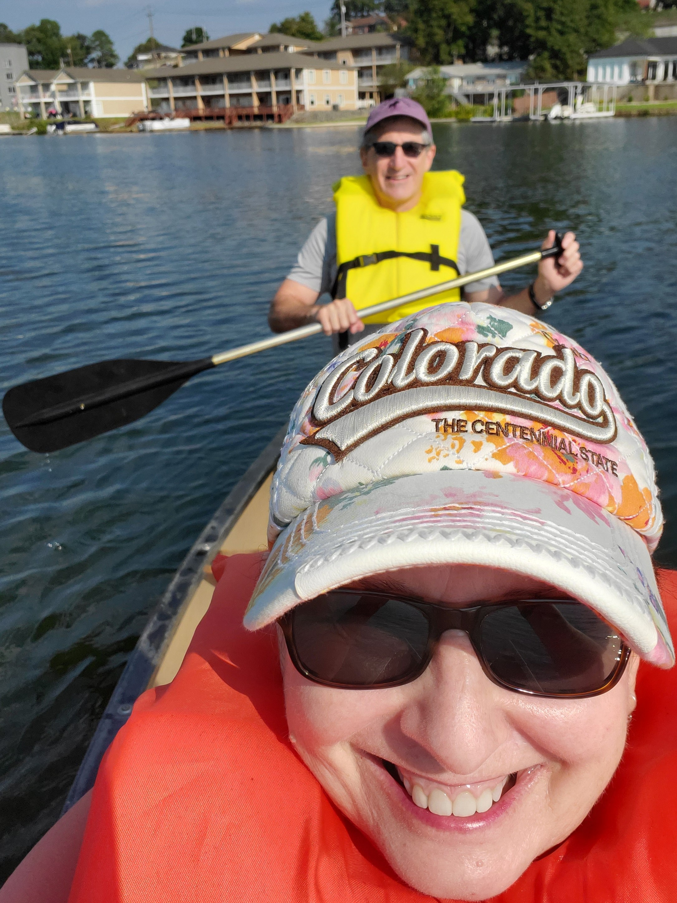
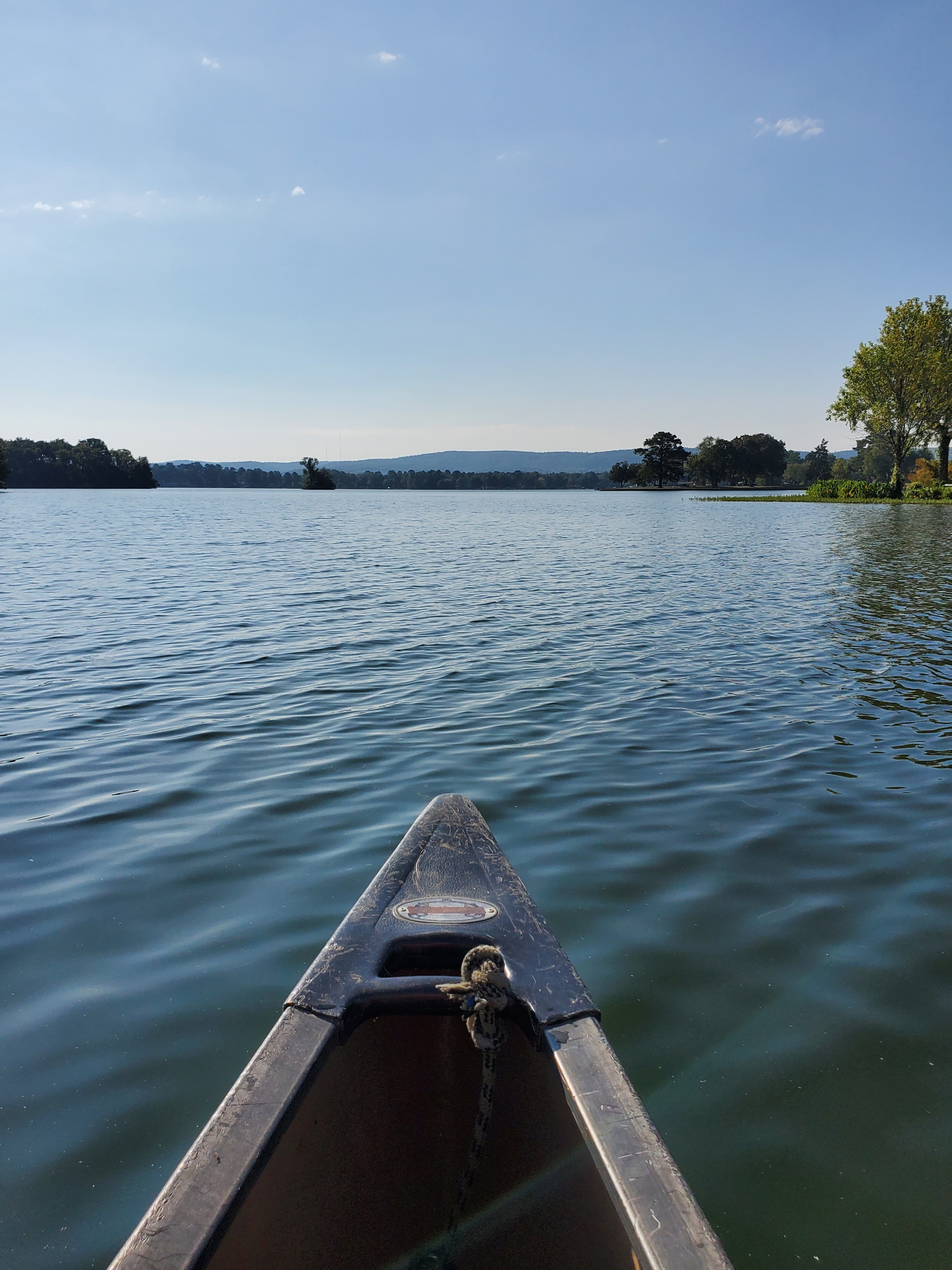
Day Two – we decided to beat the heat, get an early start and canoe from our inn’s dock on Lake Hamilton. After another wonderful breakfast, we grabbed lifejackets, paddles and loaded up in a canoe. It was a beautiful day and the water was clear and calm. We explored the part of the lake and small islands scattered just off the shore from our inn. It was fun!

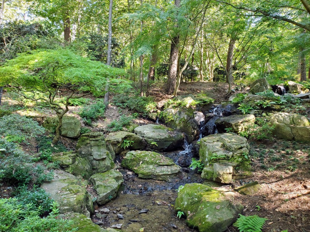
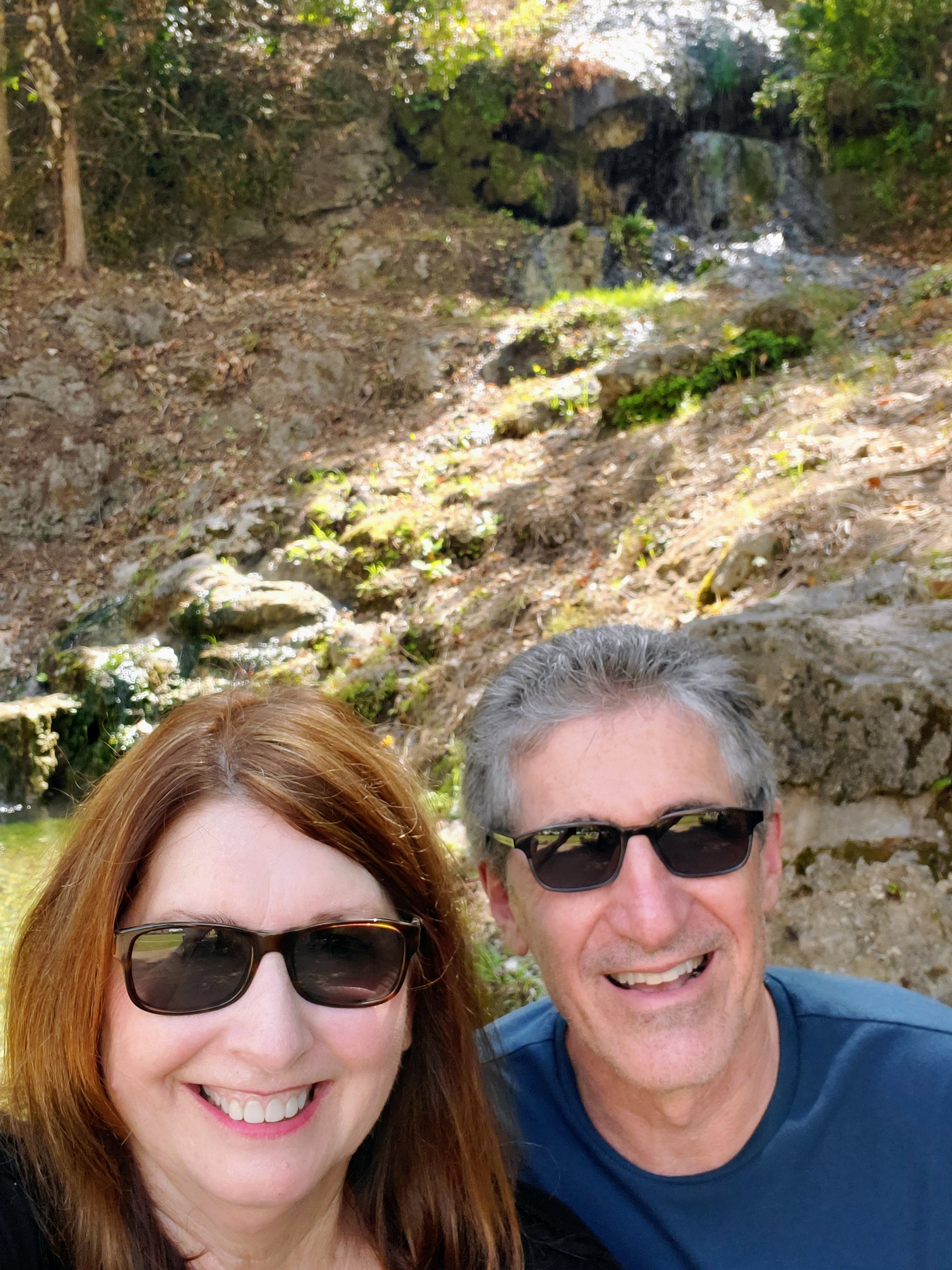
A couple of hours later, we were off to Garvan Woodland Gardens, a 200-acre botanical garden that is sponsored by the University of Arkansas. It was a short drive away and we got there early to beat the heat and the crowds.

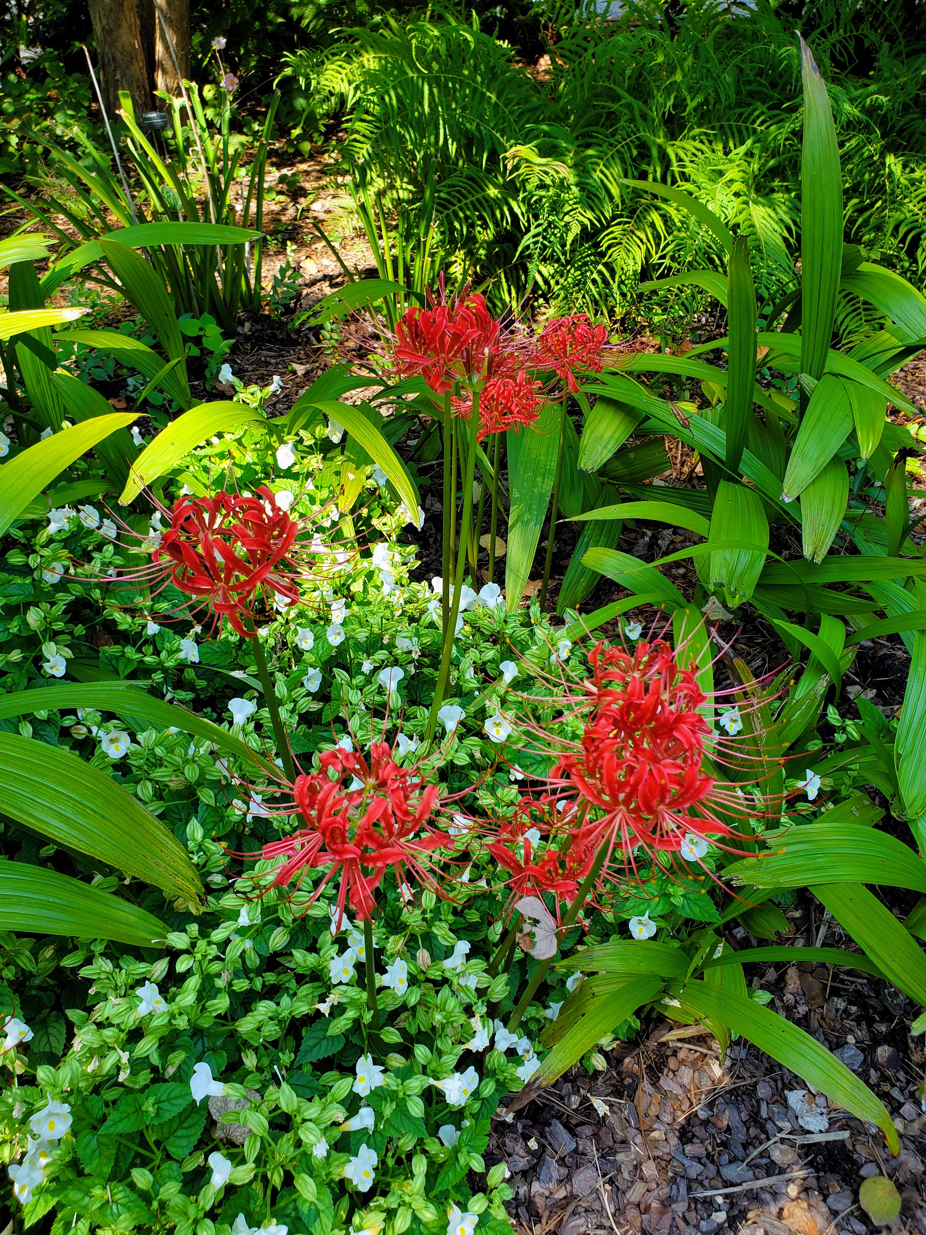
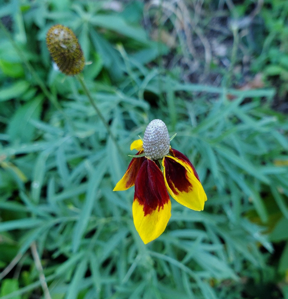
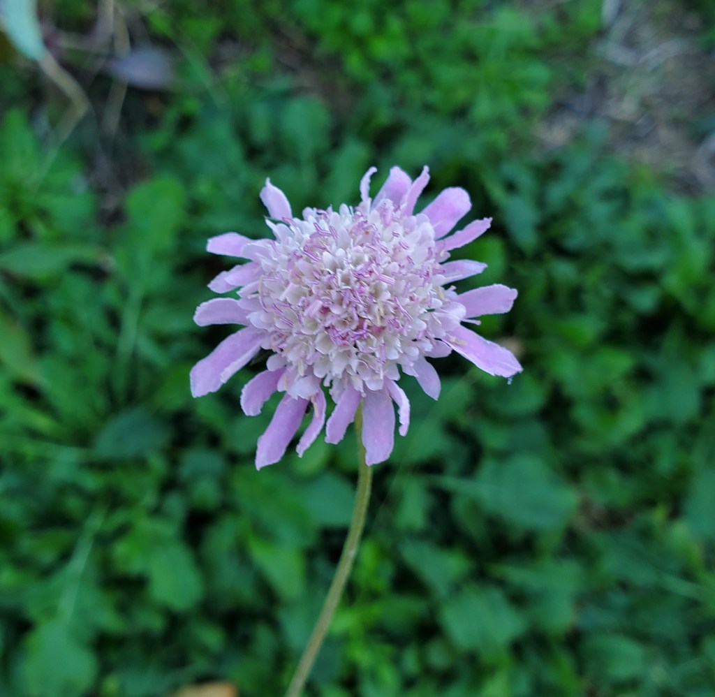
Garvan Woodland Gardens was most enjoyable. The paved pathways through the flower gardens, waterfalls, dense ferns, towering pine canopy, rocky inclines, koi pond and the wooded shoreline provided beautiful sights at every turn. There are 4 miles of trails covering this entire garden so wear comfy shoes! We didn’t see every nook and cranny but hit all the major points. It was a fun spending the day outdoors.

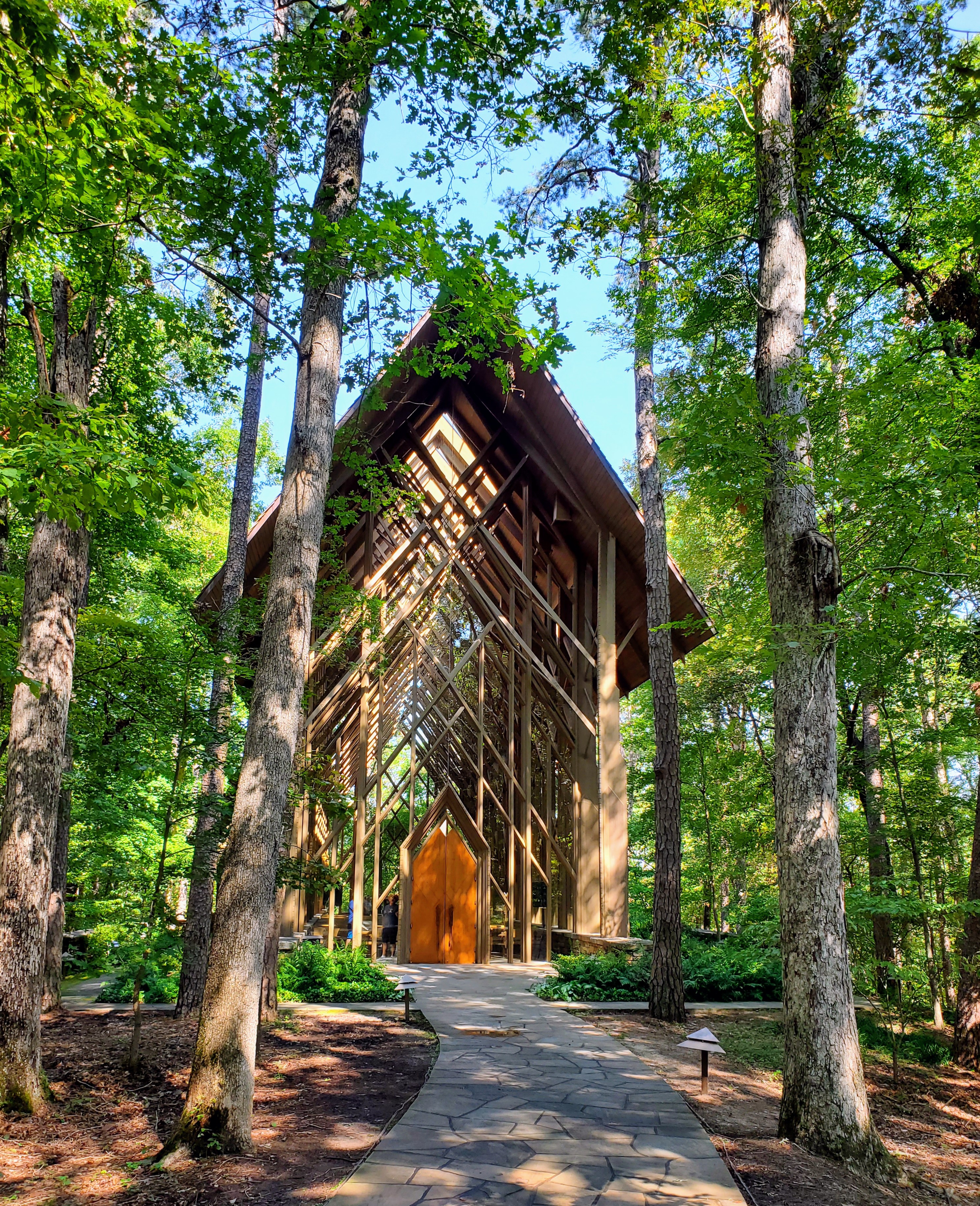
I particularly enjoyed viewing the Anthony Chapel (just didn’t care for the two snakes that greeted us on the way there!). This stunning chapel appears to “be one” with the forest. The lofty pine columns, high ceiling, tall glass windows and oversize skylights all are designed to blend in with the surrounding pine trees. It was quite impressive – both inside and out. I could only imagine how beautiful a wedding ceremony would be here and certainly understood the popularity of this venue.

One of my favorite parts of any trip is the food! We began each day with a great breakfast at the inn. We had one lunch at Superior Brewery where I had a delicious Sweet Potato Salad and a Root Beer Float (with house-made root beer). Another enjoyable lunch was at Rolando’s Restaurante (near Bathhouse Row) where we enjoyed Ecuadorian food and flavored margaritas. Yum!

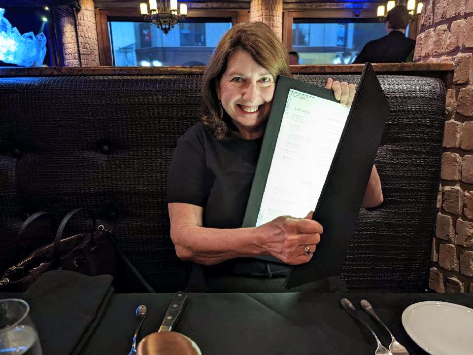
We found a couple of very good dinner spots in Hot Springs. The Vault (my favorite) was located in an old bank building near downtown Hot Springs. It was classy, dark and well-decorated. The menus had a backlight, which I thought was ingenious! David and I thoroughly enjoyed a delicious steak dinner here. The ambiance, service and food were all topnotch. A dinner at 501 Prime was also a standout. This restaurant and bar (known for its bourbon) served some great oyster dishes and we had exceptional service. A very special “treat” was a cupcake from Fat Bottomed Girl’s Cupcake Shoppe. I knew of this bakery from the Food Network Cupcake Wars competition. There were dozens of flavors to choose from and it was very difficult picking out just one. Decisions, decisions. Ooey Gooey Butter Cake was my final choice. OMG, it was good!

a backlit menu – so cool!

Hot Springs was a great weekend get-away for us. I really enjoyed seeing and learning about the bathhouses, the natural springs and the history of the park. Without a doubt, I would stay at the Lookout Point Lakeside Inn again. Heck, I would even drive three hours again for one of those cupcakes!

Happy travels!


Glacier National Park

Montana

view at Logan Pass

I have an unhealthy fear of bears. The grizzly bear attack in the book/movie “The Revenant” still haunts me to this day. With that being said, why in the world did I choose Glacier National Park as a vacation destination? This is the one park where your chances of running into a grizzly bear or black bear on a trail, on the road, or in a parking lot are well above zero. Bear spray is a necessity at all times. Just great. What had I gotten myself in to?

I planned an itinerary, booked a cabin and rental car, got our park passes, purchased our vehicle registration, reserved our park road permits, booked flights to Kalispell, and my husband and I were off to great adventures. Montana, here we come. A canister of bear spray would become my newest and most valuable accessory.

West Glacier entrance

Why did we choose to visit Glacier National Park in spite of the bear population? Glacier National Park is one of the most beautiful of the US national parks and is nicknamed the “Crown of the Continent.” The park encompasses over one-million acres of glacier-carved peaks and valleys, two mountain ranges, pristine turquoise lakes and streams, meadows full of wildflowers, numerous waterfalls and ancient evergreen forests. It was established as a national park in 1910 after the Blackfeet tribe ceded the area to the government. Glacier National Park is the 10th most visited park (3.1 million annual visitors) making it not only one of the most beautiful, but also one of the most popular national parks to visit in the United States.

Grinnell Lake in Many Glacier

More park visitors over the last couple of years caused restrictions to be put in place that prevent overcrowding within the park, hence purchasing vehicle passes/registrations was necessary prior to our trip. We appreciated that the crowds were very manageable throughout our visit and we never had long lines or traffic problems.

tunnel on Going-to-the-Sun Road

There is one main highway that cuts through the center of the park, the Going-to-the-Sun Road (GTTSR). The scenic GTTSR connects the west entrance to the park with the east entrance (50 miles/2 hours drive time). We drove it easily and without any access issues due to the pre-purchased passes that were required for each vehicle driving within the park boundaries.

our cozy little cabin

I found us a great little Vrbo rental in Essex, Montana that bordered the southern edge of the park, perfectly located about halfway between the west and east entrances to the park. The cabin was clean, cozy, comfortable and well-stocked. We cooked breakfast each morning, packed up our picnic lunch, went on our daily adventure, and returned each evening to cook/grill our dinner. A large mule deer welcomed us on our very first morning and a mink and chipmunks scampered around near our firepit each day. We had found a great little “home away from home.”

behind Lake McDonald Lodge
the beautiful lobby at Lake McDonald Lodge

Day #1 – We drove through the West Glacier entrance that morning and headed to Lake McDonald, the largest lake in the park. We explored the historic Lake McDonald Lodge (built in 1914) and grounds before taking a boat ride on the beautiful lake. After a picnic lunch, we drove the Going-to-the-Sun Road and stopped at several turn-outs to view McDonald Creek and the amazing scenery along the way. Mid-afternoon, we parked and hiked The Trail of the Cedars. This was one of our favorite hikes! The trail was a raised boardwalk or gravel trail that winds its way through a thick forest of towering cedar trees. The highlight for us was the view of Avalanche Gorge from the trail with its turquoise water tumbling down colorful moss-covered rocks. The damp weather made it feel like we were exploring a rainforest. Even though it was a drizzly afternoon, nothing could take away from the beauty of this trail. We loved it!

Avalanche Gorge as seen from the Trail of the Cedars
hiking the Trail of the Cedars

Walking back to our parked car after our hike, we heard our names being yelled from the parked car at the crosswalk. Really?! The people in the car were actually close friends from our hometown in Texas. One million acres of national park, 1749.5 miles away from home, and we happened to be at the exact same place at the exact same time. It was just plain weird! All you math geniuses can figure out those odds – it hurts my head just to think about it.

Mick & Lisa Tune, our friends from Rockwall, Texas
McDonald Creek along the GTTSR

Day #2 – We got an early start and drove east to the park’s St. Mary’s entrance. We had a morning boat ride scheduled on beautiful St. Mary’s Lake that included a hike to a waterfall. It was a gorgeous day and we enjoyed our morning adventures. David and I found a little restaurant nearby in the park and had a great lunch (huckleberry pulled pork stuffed baked potatoes!) and continued our drive on The Going-to-the Sun Road with a few scenic stops along the way. We found ourselves at Logan Pass that afternoon, the highest point of the Going-to-the-Sun Road (6646 feet) and located along the Continental Divide. The road in this area had only opened 4 days prior to our visit due to the difficulty of snowplowing such late, heavy snows. The scenery at this high elevation was amazing! We parked and hiked the Hidden Lake Trail as far as we could but it was quite difficult with the packed, icy snow underfoot. Seeing all the snow, the jagged mountains, fields of wildflowers, waterfalls, marmots, ground squirrels, and big horn sheep made for a very memorable afternoon and gave us some great photo ops!

ready for our St. Mary’s Lake boat ride
selfie at Logan Pass
Bighorn sheep at Logan Pass

Day #3 – David and I ventured to Two Medicine, a less-popular part of the park that we entered not far from East Glacier that feels off-the-beaten-path. This day actually turned out to be one of our favorites. The drive in had beautiful views and the crowds were sparse. We hiked to Running Eagle Falls, a sacred Native American burial site that celebrates an infamous female warrior and tribal leader. It was easy to feel the spirituality of this place. The double falls were very unusual and we spent quite a bit of time here. We hiked for a bit on a nature trail and soon decided it was lunch time. We drove a short distance to Two Medicine Lake and found a table at the General Store overlooking the picturesque lake with Sinopah Mountain towering in the background. Good food, great views.

Running Eagle Falls in Two Medicine
Two Medicine Lake and Mount Sinopah

After our picnic lunch and a cold huckleberry soda, we were ready for our next hike. We parked at a trailhead and headed up to Apikuni Falls. This was a tough hike for me due to the incline and it was very hot and humid. There were very few people on this trail and we were on a constant lookout for bears. Luckily, we made it to the falls and back without getting eaten. By late afternoon, we headed back out of Two Medicine admiring the scenery and the colorful wildflowers that lined the road and meadows in this scenic valley that is adjacent to the Blackfeet Reservation.

hiking at Two Medicine

We stopped for huckleberry bear claws near East Glacier when we saw our first bear! It appeared to be a younger bear and we spotted it running through a pasture near some horses. The horses seemed a little nervous at first but soon went back to grazing. The bear found a pizza box in the pasture that fully captured his/her attention for quite a while. This is exactly how I wanted to see a bear – from a distance and from the safety of my car!

bear near East Glacier

Day #4 – This was the day we ventured to Many Glacier, located on the farthest side of Glacier National Park from our cabin. Many Glacier is on the northeast side of the park and was the most difficult to get to. With that being said, I felt it was the most scenic part of the park. We arrived at Many Glacier early in the morning to secure a parking place, which worked in our favor. We spent the morning exploring the historic hotel and grounds and enjoyed a coffee while waiting for our scheduled boat tour.

Many Glacier Hotel from Swiftcurrent Lake

The Many Glacier boat tour was a “two-parter.” The tour began on the shores of beautiful Swiftcurrent Lake. We cruised across the lake, docked, disembarked and then walked 0.2 mile (over a steep hill) to the shores of Lake Josephine. We then boarded another small boat and cruised to the head of Lake Josephine. We disembarked there to do a self-guided hike to Grinnell Lake. This was a beautiful trail that led us through wooded areas, over streams, along narrow hillsides and over a swinging bridge before we arrived on the shoreline. Grinnell Lake had beautiful turquoise waters and was surrounded on three sides by towering mountains and snowy glaciers. It was breathtaking! David and I sat and ate a picnic lunch on a fallen log and took in all the beauty around us. We were even lucky enough to spot a grizzly bear loping through snowfields on the opposite side of the lake before it disappeared into a valley on the far side of the lake. Bear sighting number two….check! We also saw a huge bull moose standing waist-deep in Lake Josephine on our return boat trip. Wildlife abounds!

selfie at Lake Josephine
Lake Josephine with Salamander Glacier and Grinnell Glacier in background

We returned to the Many Glacier Hotel later that afternoon after an amazing day. We located the bar and treated ourselves to a Huckleberry Margarita, a snack, and a short rest before the long ride back to our cabin. Another unforgettable day was in the books.

hiking to Grinnell Lake from Josephine Lake

Day #5 – We woke to another cloudy, drizzly day but decided not to let it stop our exploring. We headed back to West Glacier and spent the day at Apgar Village on the shores of Lake McDonald. We walked the shoreline, snapped a few iconic “colored rock” photos, hiked a wooded trail, shopped in the gift stores, and enjoyed coffee/lunch/huckleberry ice cream during the hours we spent there. It was a very relaxing day. On the way back to our cabin, we stopped at the Goat Lick overlook to see a herd of mountain goats that hang out on some rocky cliffs. We saw several of them!

the iconic “rock photo” at Lake McDonald
baby mountain goat

We then returned to the cabin, cleaned up, and drove back to West Glacier where we had dinner reservations. David and I wanted a nice meal on our final night and we enjoyed a lovely dinner at the Belton Chalet Restaurant. It was delicious and made for a great ending to a great trip. We returned our unused bear spray, packed up, and left for home the following morning.

We made memories that will last a lifetime. GNP, thanks for an unforgettable trip!

See you on the trails!

cloudy morning on Lake McDonald
Lake McDonald selfie
near the entrance to St. Mary’s
on the Trail of the Cedars
McDonald Creek from the GTTSR

West Glacier entry

Dinosaur Valley State Park

Glen Rose, TX

One day, a long time ago, a family of plant-eating longnecks was walking along the muddy water’s edge grazing on yummy plants and ferns. Unbeknownst to them, a herd of hungry meat-eaters was hot on their trail. Let’s just say the day ended quite poorly for the plant-eaters.

What we are left with today at Dinosaur Valley State Park is the fossilized footprint evidence of this journey and the encounter. The round, elephant-like footprints were the plant-eaters and the three-toed prints were the meat-eaters. Over 100 million years ago, many types of animals lived in this shallow Mesozoic sea area. Tidal pools and coastal swamps covered what is now the state of Texas. Today, these lower Cretaceous rocks are where we find the Paluxy River and its shoreline containing hundreds of dinosaur prints.

One area within the park contains so many preserved footprints that it is named “The Ballroom” due to hundreds of tracks moving in all directions – as if they were all dancing (or trying to keep from being eaten!). Some of the prints are on the dry limestone creek beds, some are in shallow water, and some have (unfortunately) eroded over time. The park provides detailed maps showing all the track sites.

When I stood looking at some of these well-preserved footprints, I could barely wrap my head around seeing something from 105 million years ago. How is that even possible? It was the highlight of my trip, for sure.

Besides seeing the dinosaur prints in the park, my husband and I did quite a bit of hiking with our yorkie “trail dog.” There are over 20 miles of hiking trails running all through the park and the beautiful Paluxy River Valley. Trails lead into and along the river, up over limestone ridges, through shady cedar brakes, and beside grassy prairie lands. I really enjoyed our walks alongside the clear, shallow river spotting unusual rocks, dinosaur tracks, crawfish, and fish. We also saw lots of lizards, animal tracks, and beautiful wildflowers along the grassy and wooded trails.

A few of the trailheads start near the popular and more crowded attractions within the park. The Blue Hole (definitely green) looked like a family-friendly swimming area, as there were quite a few people there. The Main Track Site had the most visitors with ample parking and easy access to prints on dry land for close-up viewing. When we ventured off on many of the other trails, there were fewer people.

I suggest wearing good hiking shoes for all the varying terrain (rocks, dirt, roots, gravel) and bringing a pair of water shoes to get up close and personal to some of the tracks in shallow water and for river crossings on some trails. Pack a picnic lunch, bring plenty of water, and enjoy the park and all it has to offer!

Reservations are highly recommended as the park limits the numbers of visitors per day. The cost for a one-day pass is $7 per car. Overnight camping is also available with reservations.

See you on the trail!

Black Canyon of the Gunnison

Montrose County, CO

Another Covid-19 vacation is in the books! My family is vaccinated but we are still trying to avoid crowds when traveling. We have spent the past year renting homes/cabins and cooking most of our meals when out of town. This rural southwest part of Colorado seemed like the perfect place to check out a National Park and visit with our adult children for a few days. It turned out to be a great trip.

We took a morning flight from DFW to Montrose. The direct flight was only an hour and thirty-eight minutes – quick trip! The Montrose airport was small (4 gates) and very easy to navigate. Getting our rental Jeep was a breeze. Our Vrbo house actually ended up being a convenient ten minute drive from the airport. So far, so good! We were ready to explore the area.

The first excursion to check off our list: The Black Canyon of the Gunnison National Park. This area has only had National Park status since 1999 and I was not that familiar with it prior to our trip. After seeing a few pics on a National Park social media page recently, it got on my radar. Though not as popular as the Grand Canyon, it certainly seemed less crowded and had some spectacular views with towering walls, spiky peaks, narrow openings and startling depths. I put in a little bit of research, found out how to get there, and off we went!

The Black Canyon National Park entrance was only twenty minutes from downtown Montrose and the drive up to the park was quite scenic as our elevation changed (and ears popped!). This route took us to the park’s visitor center that featured cool displays, info on the canyon, picnic areas, restrooms, a gift shop, campgrounds, a nature trail and a great observation platform. It was well worth a stop. I got a map, a walking stick and went on my merry way.

The route through the park along the South Rim Road was easy to drive and well-marked. It allowed us beautiful views of the Black Canyon from many overlooks, most of which only required short walks. I loved seeing all the different landscapes, plants and trees along the way. Hiking there can be as simple as strolling to the various viewpoints and overlooks or as challenging as a 2,700 foot descent down into the inner-canyon to the Gunnison River, which we didn’t do (because we are sane people!).

The Black Canyon itself was breathtakingly beautiful with its dark, solid granite canyon walls that tower almost 3,000 feet above the greenish river snaking far, far below. The canyon gets its name due to the fact that certain parts of the gorge only get thirty total minutes of sunlight per day. The walls literally look black due to the shadows. It is very, very narrow and very deep! For you geology nerds, the canyon has some of the world’s oldest exposed rock that dates back two billion years to the Precambrian era. Today the impenetrable, steep cliffs provide homes and protection to the world’s fastest bird, the peregrine falcon.

We enjoyed many of the twelve lookout points along the rim with Pulpit Rock, the Painted Wall and Dragon Point being my favorites. The Painted Wall is the highest cliff (tallest vertical wall) in Colorado. From the rim down to the river, it stands 2250 feet high and as my daughter described it, “it looks like a big ole slab of marbled steak.” It is a huge, dark granite wall with wide, white “marble” streaks running through it. The size is somewhere in the neighborhood of ginormous!

At Dragon Point, the Painted Wall was across the gorge from us and far below was the Gunnison River. The river actually looked very curvy and small from our vantage spot so high above. Our view was quite deceiving. The Gunnison River actually drops an average of 43 feet per mile through the canyon, which is six times more than the Colorado River through the Grand Canyon – just to put it in perspective.

If we had more time, I would have liked to experience the canyon from the bottom up. There is a road at the park entrance that follows a steep, switch-back route into the canyon’s depths. This would certainly be a memorable day for hiking, fishing, kayaking or rock climbing. I would have loved to have seen the mighty river up close and personal. Maybe next time…

The Ute Tribe that inhabited these tribal lands for thousands of years referred to this area as “much rocks, big water.” I don’t think anyone could have said it any better.

.

Beavers Bend State Park

Hochatown, OK

Our pandemic trips continue and we recently revisited Beavers Bend State Park and Broken Bow Lake in Oklahoma for a long weekend. We had rented a cabin and stayed in this same area earlier in the fall and enjoyed it so much that we decided to go back.

Sweetwater Cabins has some lovely rentals in this area and we chose one this time called Just-A-Swingin. The cabin was appropriately named, with a porch swing on the lower level, and had a beautiful, open-concept interior. The neighborhood is a hilly, pine-forested area just minutes off the highway and a stone’s throw away from the park entrances. Location, location, location! This cabin was perfect.

My husband and I had taken our yorkie on the last visit and she did so well that she was invited along again this trip! She seemed to enjoy hiking the nature trails with us so we are turning this nine-pound, nine-year-old spoiled lap dog into a decent trail dog!

We were lucky enough on this trip to experience great weather again. We grilled hamburgers on our deck the first night and prepared for two days of hiking to follow. Our days were full of activity and our evenings were quiet and lazy – just the way we like it!

The first full day inside the park, we chose the Beaver Lodge Nature Trail for our first hike. This was a 1.2 mile hike that started at the base of the Broken Bow Lake’s hydro-electric dam and was a great one-way hike with gorgeous scenery. The trail head was a little tricky to find since it began away from the dam’s parking lot, across a stream, and was not marked. Once we spotted some people coming off the trail, it was much easier to locate and follow.

This trail led us through a forested area, along a high ridge, and stayed parallel to the Mountain Fork River. I enjoyed the busy sounds of the rushing water and the wind in the pines. It was a truly beautiful hike. We saw several trout fishermen in the water and a few tourists climbing on the river boulders. We hiked until the trail became too narrow and treacherous and turned back around.

We explored the shoreline on the way back, climbed over some boulders, and took a short rest in the middle of the rushing water on a rocky plateau . This is where “said trail dog” plunged into the shoulder-deep water after slipping on a mossy rock. She was wet and smelly but took it like the true trooper she is!

After lunch, we were back on the trails. Our next destination was the Lakeview Lodge Trail. This is a 1.4-3.5 mile trail that started at Lakeview Lodge on Broken Bow Lake. There were three loops to chose from and it is meant to be hiked in a clockwise direction. The trail had beautiful pine trees, great views of the lake, clear streams, colorful rocks and a varied terrain. It was very quiet and peaceful. We never saw anyone else on the trail and I was quite surprised that we didn’t see any wildlife other than birds. If there had been a chance of stumbling upon a wild animal, this would have been the place!

Day one was in the books. After a delicious dinner picked up from Rolling Fork Takery (wings and potato salad), all three of us were tired and ready for a good night’s sleep.

Day two found us inside the state park again on the 3/4 mile Pine Ridge Nature Trail. The trail looped like a figure-eight and winded through an evergreen forest, a lagoon, a piney ridge, and a floodplain. It was a short trail but had varied vegetation and different elevations that were unlike any other trails. We followed the path up, down and around some very beautiful spots on this easy, shaded walk. Lime green moss, ferns, cane, and new spring flowers were the highlights.

We took a break and explored the main areas in Beavers Bend State Park and played around on the rocks in the Mountain Fork River. We drove through the park and checked out the campgrounds, pony rides, train depot, fishing spots, and kayak/paddleboat/canoe rentals. There was more to do here than we ever imagined! Another trip may be in order.

Our afternoon hike was the toughest of them all. Cedar Bluff Nature Trail is listed as a “moderate trail with minimal terrain.” What the trail guide doesn’t tell you is that the 1-mile hike is all straight uphill through a pine forest! After a little huffing and puffing on my part, we made it to a beautiful rock cropping overlook. At that elevation, we were overlooking the river, bald cypress trees and rocky cliffs below. The stunning views were well worth the effort and we took a few minutes to soak it all in.

We met another couple at this overlook where we exchanged pleasantries and took each other’s photo before we headed off. Hiking down the trail was a much easier than the hike up!

We picked up a pizza and salad on the way back to the cabin and had a quiet dinner. All three of us were tired but energized from all that we had seen and done. Once again, our trail dog had done extremely well and exceeded expectations (she also slept the entire way home!).

Another great trip to Beavers Bend State Park was in the books. I would love to return in the early fall to hike a few more trails and see the colorful foliage. I highly suggest this area for a quick weekend getaway or for a longer stay to do more activities with family or friends. Check it out if you haven’t already – it is beautiful country.

I hope to see you on the trails soon!

Cedar Hill State Park

Cedar Hill, TX

Duck Pond

Between Covid-19 and Snowmageddon 2021 keeping us all indoors, it is time for a little outdoor adventure! Personally, I am very tired of always being inside and try to plan a weekend outing for me and my husband when the weather cooperates. During this pandemic, we have discovered that Cedar Hill has some great areas for hiking. We have already ventured to Dogwood Canyon, Cedar Mountain Nature Preserve and Cedar Ridge Preserve – all located in this area south of Dallas. Our last planned adventure was to Cedar Hill State Park.

Cedar Hill State Park is located just twenty minutes from downtown Dallas in Ellis County along the shores of Joe Pool Lake. We had to make reservations to enter the park ahead of time at the cost of $7 per person. This is easily done online prior to your visit. If you have a Texas State Park pass, the visit will be free but you still need a reservation to enter due to the pandemic or you will be turned away.

Once you are admitted into the park and pass the entrance, the roads are well-paved and there is plenty of signage to guide you. We studied our map, chose our destination and headed to the Talala Overlook. We parked here in the small parking lot at the trailhead and began our first hike of the day. The word “talala” is actually a Cherokee wood meaning “woodpecker.” I kept an eye out for one on the way to the overlook but sadly I never saw one.

Talala Overlook is one of the highest points in the park with great views of Joe Pool Lake. There is a 1.5 mile loop trail that led us through diverse terrain. The dirt path meanders through thickets, over creeks, and among the Blackland Prairie head-high grasses. This was definitely an enjoyable nature hike for me! I would rank this as a “moderate” trail for hikers due to all the ups, downs, tree roots, rocks and overgrown sections. We saw lots of wild animal scat on the trail making us wonder what animals had been on the same trail very recently! Yikes!

Dogs are welcome on all the hiking trails but they must be kept on a leash. If you do bring your pet into the park, make sure you have proof of a Rabies vaccination handy if asked by a ranger or upon admittance at the gate. It is a state park regulation.

After our first hike and a lunch break on the lakeshore, we loaded up and headed to our next stop – the Duck Pond Trail. This is the shortest trail in the park at just .7 miles long (unless you miss the signs like we did and make it about a 3 mile hike!). It is a partially shaded, wide trail that starts at the trailhead near the parking area and loops back. This is a very popular trail for families with children or anyone that prefers an “easy” trail.

The Duck Pond Trail runs through a forested area with several small bridges over the “rough” parts. The actual pond is located on the edge of the park and is a perfect place to spot deer, ducks and other wildlife coming for a drink. We saw several tracks but no actual animals. It is very pleasant, peaceful and beautiful here. This is a great spot for a picnic, rest stop or photo op.

When you take a wrong turn on the Duck Pond Trail like we did, you end up on the Plum Valley Overlook Trail. It was a fortunate mistake! This trail was a bit more intensive but still pretty easy. The trail led us mostly uphill, through prairie grasses and cacti, and ended up in a heavily forested area. The scenic overlook gave us great views of the Tallgrass Blackland Prairie and where it converges with the White Rock Limestone Escarpment that covers much of this area.

One area we did not explore within the park boundaries was the Penn Farm. Our trail map stated the following: The Penn family farmed this area for over 100 years, beginning in 1854. Today there are remains of old buildings, the estate house, and antique farm equipment on the grounds. There is a nice little trail here with old photos and scripted descriptions of what you are viewing. We will have to explore this area on our next visit!

Overall, we had a lovely day here. It was so nice being able to get outdoors, stretch our legs, exercise, and breathe in the fresh air. We truly enjoyed this state park and all the trails on a gorgeous winter day in Texas. The best part – our little spoiled yorkie is becoming quite the “trail dog!” Who knew?

Dogwood Canyon

Cedar Hill, TX

My pandemic adventures continue!

The only “safe” travel plans for me these days are those that are outdoors and where I can socially distance from others. This has led me to explore areas around Dallas when weather permits. This blog details a recent Saturday visit to Dogwood Canyon in Cedar Hill. Located just thirty minutes south of downtown Dallas, the landscape here looks as if you have driven five hours south, down around the Texas Hill Country.

Dogwood Canyon is a 200-acre wildlife refuge and forested nature preserve with hiking trails and bird-viewing areas. Due to Covid-19, the visitor center, classrooms, picnic area, restrooms, etc. are all closed but the trails are open. After researching the park, I made reservations online one week prior to our visit. The available admission times are Fridays and Saturdays from 8:00 a.m. – 2:00 p.m. and the center currently only allows 10 reservations per hour. The trails and parking lot gates are locked promptly at 2:00 so make sure you allow enough time to enjoy your visit.

Dogwood Canyon is a true canyon that rises 300 feet from the canyon floor to the highest hilltop ridge. Most of Texas lies in the Blackland Prairie region but this area is actually part of the White Rock Escarpment (once part of an ancient sea). When driving into the park on I-20 you will notice the white Austin chalk hills that reach an elevation of 800 feet in some areas. This is very unique geology for Dallas County.

This park opened in 2011 after the land was donated by a wealthy conservation-minded owner who had bought the land from a communications station. He had originally chosen to build a house but decided against it. There is an unusually large concrete pit in front of the visitor center that remains from the previous AT&T site when it was in operation. Instead of the land being a single-family home with acreage, it is now a natural ecosystem and home to many native trees, plants, birds and wildlife – some very rare or endangered.

As far as hiking options, there are three miles of trails within the forested canyon area. The Canyon Loop Trail is an easy half-mile trail near the visitor center. My husband and I took the more strenuous West Rim Trail which is a 1.65 mile trail with a modest 150 ft. elevation incline. This trail allows you panoramic views of the canyon, nearby areas, and Joe Pool Lake. It was very tranquil, quiet and most enjoyable. We only saw three other couples the entire time we were on the trail. Let’s just say this excursion was well within the Covid-19 guidelines for safety!

The leafy, unpaved trails are well-marked and lead hikers through wooded areas of oaks, junipers, dogwoods, and ash trees. We noticed many dormant greenbrier, grapevines, poison ivy and Virginia creeper vines in the undergrowth off the trails. There were rocks, boulders, fallen trees, small creeks, and moss-covered stumps all along the way. There was much more “color” on the trails than we expected during this time of year. We spotted lots of green winter grasses, blue & red berries, yellow & white lichens, neon green mosses, and many colorful leaves underfoot. With clear blue skies overhead and warm temps, it was a most enjoyable day.

We didn’t spot any wildlife other than birds on this hike but we did see scat on the trail. There are several species of plants (orchids and lilies) and birds (warblers and hummingbirds) that are very rare and call this canyon home. I would love to return here in the Spring months to see the forest wildflowers, flowering vines and dogwood trees in full bloom. I bet it would be beautiful!

I highly suggest visiting Dogwood Canyon for a day hike. It is a great place for a change of scenery and a nice walk in the woods. Get out of the house, unplug, recharge, connect with nature and get moving! It does a body good.

I’ll see you on the trail!

Cedar Ridge Nature Preserve

Dallas, Texas

During this pandemic, all travel plans had to be postponed. Since I am one who craves adventure and loves to visit new places and see new things, my only option has been exploring local nature preserves, parks and trails. My husband and I have a list of day trip options to choose from so that we can get outdoors and explore new places while socially distancing and staying safe.

We have had a couple of “just okay” excursions (trashy urban parks). Our latest really enjoyable outing was to Cedar Ridge Nature Preserve which is located about twenty minutes southwest of downtown Dallas. This is a 600 acre tract of “hill country-like” land that I didn’t even know existed!

Our research revealed that the park is maintained by Audubon Dallas and includes 10 miles of walking trails (13 trails total) that loop through a hilly, heavily-forested area that is well-known for its unusual topography. We were sold! Cedar Ridge Preserve sounded like a great choice for an excursion so we packed a picnic lunch, loaded up, and made the 45 minute drive.

We arrived mid-morning on a warm, sunny weekend and the parking lot was packed. Note to self: next time get an earlier start! The main park buildings, education center and water fountains are closed due to the pandemic (restrooms were open). I highly suggest bringing your own water or snacks and wearing sturdy shoes for the trails.

Once inside the preserve, there was a large signage board where the trail heads begin. It shows a detailed map of all the trails, routes, and the distances. There is also information depicting plants and animals you may encounter. There seemed to be trails for all skill levels. We began with the 1 mile Bluebonnet Trail and it was lovely and not crowded. The trail is unpaved with natural rocks, roots, and leaves this time of year. The Bluebonnet Trail had a gentle terrain with a lookout point midway that overlooked the valley and Joe Pool Lake. We also took a few minutes to stand in a “nature blind” to watch a rare bird species (black-capped vireos) dart to and from a watering hole. There was a wide variety of prairie grasses, trees, mosses, plants, cacti and birds that we spotted along the way.

After looping back to the main trailhead, we chose an intermediate trail for our next hike. This second trail had more limestone hills, good canopy cover, several bridges, and more steps. This more diverse terrain was rich with juniper, honeysuckle, yucca, sumac, prickly pear, oak and other types of native trees, grasses and wildflowers. It also granted us a pretty good workout!

There are trails with varying degrees of difficulty. Some are very flat. Some have more inclines, descents, and more cardio challenges. No matter what trail you choose, you will not be able to miss the unique and beautiful limestone hills, bluffs, and ridges that resemble the terrain found in and around the Texas Hill Country.

I was really impressed with this little slice of nature within the Dallas metro area and thoroughly enjoyed my day here. I think we all deserve a place where we can unplug, get outdoors, breathe fresh air, exercise and connect with nature in a personal way. Cedar Ridge Nature Preserve is a bright spot among all the asphalt, heavy traffic, and the grind of our daily lives. Check it out!

I’ll see you on the trail!

Note: Dogs on leashes are welcome. The preserve requires no fee but suggests a $3 donation. Check the website before venturing out due to closures of the park and trails during the pandemic.

Yosemite Valley

California

IMG_20190408_064531960

In early April this year, my husband and I visited California and explored three national parks – Sequoia National Park, Kings Canyon National Park, and Yosemite National Park. My previous blog detailed our trip to the first two parks and our journey along the Majestic Mountain Loop. Now we venture on to Yosemite.

After spending a busy couple of days exploring the previous two parks, we drove to Oakhurst, California and spent the night in this lovely little town located fourteen miles south of the entrance to Yosemite National Park. We felt like we needed some rest, a good meal (had some great Italian food!), and some time spent outside of the rental car. It turned out to be a smart choice for us.

We awoke that next morning, had a great breakfast, and began our short drive to the park. It was only a twenty minute drive until we crossed the border into the park but little did I know that Yosemite Valley and our hotel were at least 90 minutes ahead. The slow speed limit, road construction, winding roads, morning traffic, and park entry lines took a little longer than expected. Luckily, the drive was entertaining. We spotted mule deer by the roadside. I enjoyed seeing the snow that was still packed on the shaded sides of the road from the heavy winter snowfall. We passed through acres and acres of total devastation from last summer’s horrendous forest fires (this caused the traffic delays with crews removing trees and debris from the main road). Overall, it was an enjoyable and very scenic drive. About an hour into the park, following the curvy mountain roads – we entered Wawona Tunnel.

IMG_20190406_120110936

All I can say here is WOW!

You exit the tunnel and you are at Tunnel View, the first of many astonishing sights. This view places you at one end of the valley looking straight out at Half Dome, El Capitan, granite walls, waterfalls, rivers, and vast evergreen forests. I understood immediately why this valley is referred to as “one of the most beautiful places on earth.” The Yosemite Valley is only seven miles long and two miles wide and this lookout point pretty much presents it to you in all its glory.  We parked in one of the large parking lots and joined dozens of others taking photos from this gorgeous, panoramic spot.

090

After this photo-op stop, we  drove down into the valley and followed the circular one-way road that leads you past all of the major Yosemite landmarks. Sights that I had only seen in books, photos, and on screens appeared before me in real life: Half Dome, El Capitan, Bridalveil Falls, Yosemite Falls, Cathedral Rocks, Arches Rock, and the Merced River. Everything was larger, higher, brighter, and more spectacular than I had ever imagined. I stood in the footsteps of John Muir and Ansel Adams and soaked it all in – another one of life’s “pinch me” moments.

097

David and I were lucky enough to stay at the historic Majestic Yosemite Lodge (awesome place!) located within the park. The parking, rooms, restaurants, amenities, and location couldn’t have been any better. We could easily walk to several of the park sights or catch a shuttle at the hotel to venture farther. The free park shuttles run every 20-30 minutes and allow you to “hop on / hop off” at any stop within the valley – they were very convenient and saved us a lot of time.

077

We hiked up to the rock-strewn base of the three-tiered Yosemite Falls. We hiked to the base of Bridalveil Falls and got drenched with the ice-cold spray. We walked the trails through Ahwahnee Meadow and stood still as a herd of deer fearlessly walked by us. We stood and gazed up at the gigantic El Capitan. We enjoyed the visitor’s center and  the film that covered the history of the park. We browsed through the Ansel Adam’s Gallery and saw photographs from this area that brought him fame and fortune. We walked along the Merced River and relaxed a bit on the beautiful, sandy Cathedral Beach. We sat out on the hotel lawn one evening after a fantastic dinner and watched the stars in the night sky. We took a two-hour guided bus tour of the valley and learned a lot about Yosemite’s history, geography, geology, wildlife, and sights we saw along the way that are not in the guide books. When all was said and done, we crammed as much into two days as we possibly could and enjoyed every second!

066081IMG_20190407_132243720

There was no way we could see as much as we wanted to in such a short amount of time, but we gave it our best effort. Yosemite National Park actually covers 1200 square miles and over 95% is wilderness, with the valley being a very small part of the whole park. Luckily, April turned out to be a perfect month to visit. The temperatures ranged from the fifties at night to the seventies in the day – and we experienced warm days, blue skies, spring flowers, and fewer tourists than other months of the year.

IMG_20190407_131512817

The hotel, the weather, and the sights of Yosemite Valley were all better than we could have ever anticipated. Everything seemed to work in our favor. My one and only wish that was not fulfilled was a bear sighting! Maybe next time…

IMG_20190407_130726246_HDRIMG_20190407_115642687_HDRIMG_20190407_150822539_HDR058072


Lake Agnes Teahouse

Alberta, Canada

177

Let me start by saying I am not a very athletic person. I am not competitive and never have been. I am an out-of-shape, almost sixty-year-old female with an artificial knee. Keep that in mind as I share this story that happened last month when my husband and I visited Canada and we will call it “Susan vs the Mountain.”

We stayed in a lovely little hotel in Lake Louise and decided for our first full day in Canada to hike up to the Lake Agnes Teahouse that was located on one of the mountains behind the Fairmont Chateau. This is a very popular hiking trail and we were told to arrive early due to limited parking. So at 7:45 a.m. – carrying our backpacks, water supply, and bear spray – we pulled into the parking lot and headed towards the trail head beside the shore of beautiful Lake Louise.

20180806_075641

Our research told us that this is a half-day hike (1-2 hours one way) with a total distance of  7 km (4.5 miles). Our elevation gain would be 1300 feet (which soon seemed like 1300 miles!) and we would end up at 7005 feet. The trail began along the wooded lake shore and soon started leading upwards. When I say “leading upwards”…..I mean leading UPWARDS  (body bent in half, head forward, toes digging in) upwards. The trail zigzagged back and forth through the trees at a pretty steady incline. The trail was well-maintained, though we had to be mindful of loose rocks, gravel, and tree roots. Immediately the altitude became an enemy. Every few yards I had to grab a tree or sit on a rock and wheeze a little to catch my breath. Whose idea was this?

During these multiple moments of trying to breathe, I would look up and be amazed at the gorgeous scenery around me. We were in dense evergreen forests with colorful wildflowers,  scrambling chipmunks, and silence…..except for my wheezing. When the trail would switch back in one direction, we had gorgeous views of the turquoise Lake Louise which was now below us as we rose higher on the mountain.

155

About halfway up this trail with a racing heart rate, burning thighs, and parched throat – my attitude changed. I went from “oh, how lovely” to “who in their right mind would build a  @%$#&*!  teahouse on the side of a mountain?” I was sweating, my face was bright red, and a cup of hot tea was not what I wanted at this particular moment in time. Tequila? Maybe. Chamomile or Earl Grey? Nope.

Being the hard-headed ole broad that I am, I pushed on and finished the hike in a little under two hours. The trail had been long and difficult but I was determined not to give up – I had come too far to quit at this point. We soon heard voices through the trees and knew that we were close to the end of our hike. A beautiful waterfall appeared around the final bend and the views below us were amazing. We stopped and caught our breath only to discover that the only way up to the teahouse from this point was a wooden staircase with what seemed like a thousand steps. Really? We hadn’t suffered enough? Once again I thought – who in their right minds would do this?


After a little more (okay, a lot more) griping, pulling and pushing – we made it up to the Lake Agnes Teahouse.  I was not prepared for what awaited us. The scene was breathtaking! The teahouse is a very rustic, two-story log structure situated on a scenic mountain lake and is surrounded on three sides by snowy mountain peaks. There were dozens of people here ahead of us (these crazy people hiked up here too?) and everyone was chilling and enjoying the place. We found a table on the teahouse porch, dropped our backpacks, and ordered lunch.

The Lake Agnes Teahouse was originally built as a shelter for hikers and began serving tea in 1905.  There is no running water or electricity so the menu is quite simple. All supplies and foods are transported manually by workers, by horseback, or flown in by helicopter. Staff members bring supplies up and carry garbage back down. They offered loose leaf teas, hot chocolate, soups, scones, sandwiches, salads and chips – nothing fancy and cash only.  We sat outside with views of the Canadian Rockies and Lake Agnes and enjoyed a pot of tea, scones, and sandwiches and it was all delicious. This was another of my life’s “pinch me moments.” I have never felt such a sense of accomplishment and contentment as I did at that very moment.

After enjoying our refreshments, a brief rest period and the views here for an hour or so, we decided to head back down the trail. Getting up there was the hard part but was well worth it. Walking down was going to be a breeze. Right?

20180806_104242

The first part of going back down was very pleasant and the trail was so much easier. I was riding on an emotional high – I had completed the uphill hike and had my bragging rights for one of the most difficult things I had ever attempted. All was well until I took a step and my left hiking boot felt “odd” and heavy. Lo and behold, the front sole was detaching from my boot! I found the nearest boulder to plop down on to examine the damage while David searched our backpacks for a cord or something to tie my boot back together. He found his earbuds and did a quite nice job of wrapping them around my foot and held the boot sole on for the remainder of my hike. David’s Boy Scout training had paid off. All was well.

“All was well” until five minutes later when my other boot came apart. Yep! The thick rubber sole almost completely detached from the bottom of the right boot as well. It felt like I was walking downhill on a rocky trail in swim fins! We didn’t have any more earbuds or anything string-like. The best thing to do at this point was go ahead and pull this sole completely off and hobble on down the trail on the thin leather bottom. That is exactly what I did. It felt like I was walking down a steep mountain while wearing one cheap house slipper and one utility work boot, with one leg much shorter than the other.

This was one of those days that covered a full range of emotions. We laughed, I cried, we worried, and then we laughed some more. I may have even cursed a little. When all was said and done, this day will forever be etched in my brain as one of the most memorable days of my life. I was so proud of myself for not giving up and pushing myself to my physical limits. I was so proud of my husband who deserves a medal for his patience and kindness. I felt so privileged to be able to see “in person” the breathtaking sights we saw that day – scenes that cannot be replicated by videos or photos. After all was said and done…it was simply The Best.

191


I hope you get the opportunity to visit Lake Louise and take this hike to the Lake Agnes Teahouse. Words cannot describe it and photos cannot come close to capturing the real-life experience. I do have a few words of advice for you though: travel with a great partner, take drinking water & bear spray, wear new hiking boots (with stitched – not glued – bottoms), be in decent physical shape, and ALWAYS take duct tape with you wherever you go!

One final chapter to our adventure – David left me at the trail head when we finally finished the hike and volunteered to go get our car. He did not wish for me to continue walking unevenly and risk another knee injury, which I very much appreciated. So I sat….for a long time. After walking back to find our car and trying to get back to me through heavy traffic, David made an illegal u-turn to shorten his driving time back to the start of the trail to pick me up. Unfortunately for him, he turned right in front of a Canadian policeman. A $155 traffic ticket became the “cherry on top” of this day.

I always did love a bad boy.