Utah
If I had to describe Zion National Park to someone, I would just say, Wow!” Words will never do it justice and neither will photographs. You have to be there in person to experience the full, authentic Zion experience.
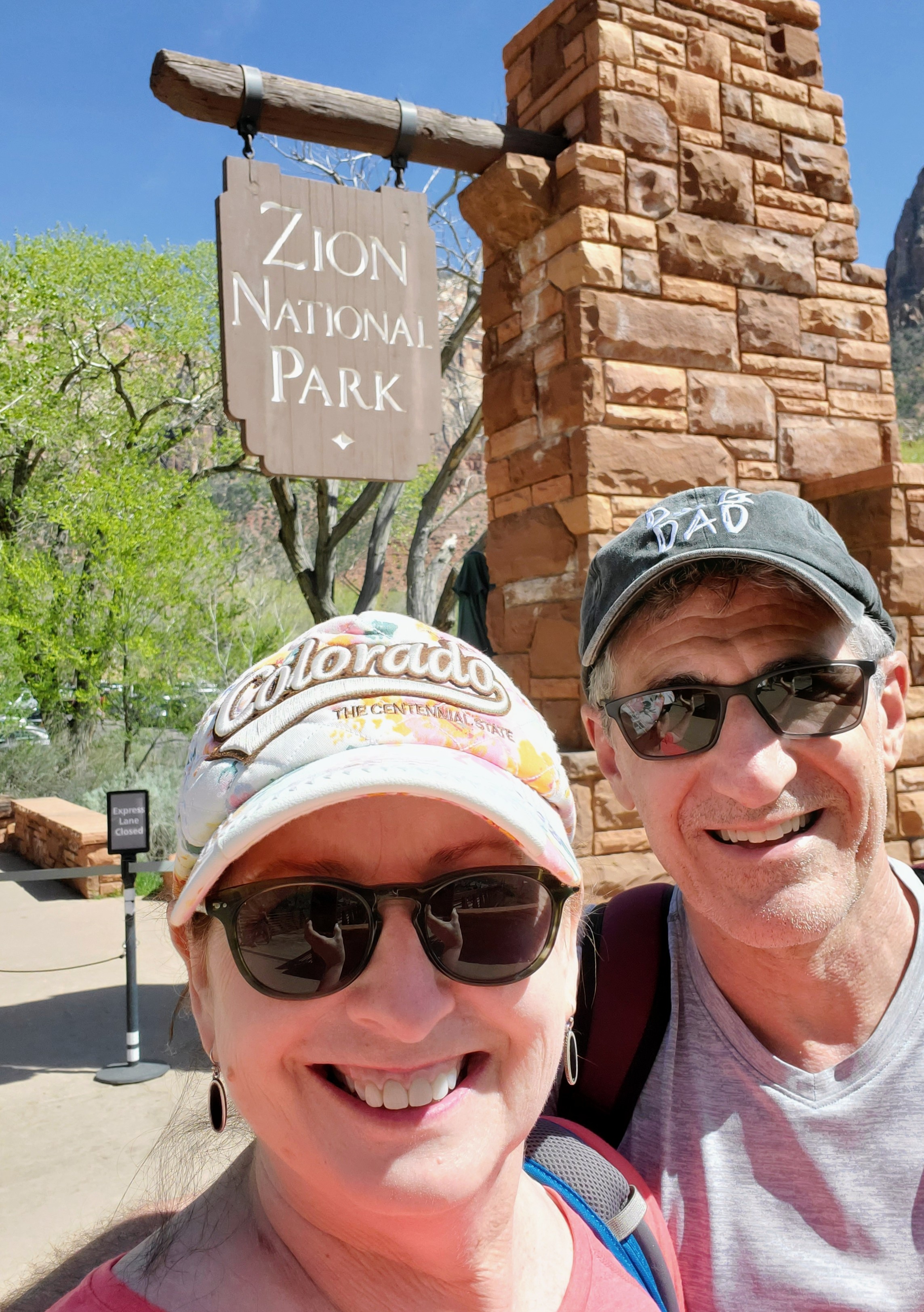
Zion National Park is one of Utah’s “Mighty Five” National Parks. Located in the southwest corner of Utah, it is an hour from St. George, two-and-a-half hours from Las Vegas and four-and-a-half hours from Salt Lake City. My husband and I flew into Las Vegas and rented a car there for our drive into Springdale, where we booked a hotel very near the park entrance.
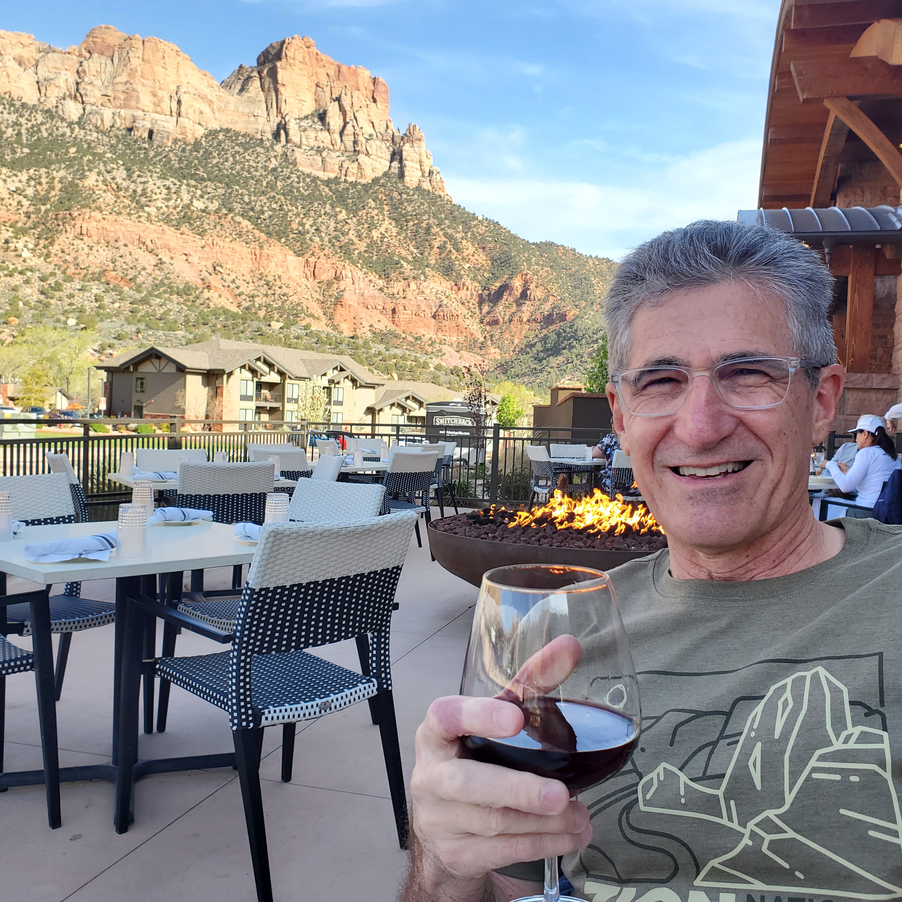
Staying in Springdale worked out perfectly for us. We had designated parking (which can be very scarce near the park) and had several restaurants in easy walking distance. The City of Springdale also runs a shuttle service that had a stop right in front of our hotel. The city shuttle bus took us right to the park’s south entrance and brought us back each day. An added “plus” for Springdale – the entire town has some pretty gorgeous views of the red-striated mountains that make Zion so unique. We felt very connected to the beauty of the area while in town. Springdale was a perfect location and had all the amenities that we wanted. It made our stay “easy, peasy!”

A trip to Zion can be a little confusing until you figure out the logistics. First of all, cars are not allowed in Zion National Park. The park has a free shuttle system in place (March thru November) that reduces road congestion and resolves parking issues that we experienced in other parks. The shuttles do not require tickets or reservations. You just hop on and off wherever you choose. The shuttle system made getting around the park super easy and convenient. We never waited more than 5 minutes for a shuttle at any of our stops throughout the park and the drivers were friendly and helpful. I was very impressed and certainly wish more of the National Parks would use this system.

The park shuttles run from the Zion National Park Visitor Center (stop #1) up the canyon road, stopping at several stops, until the last stop (#9) the Temple of Sinawava. The shuttle stops are located at various viewpoints, waterfalls and trailheads including Zion Canyon Scenic Drive, Zion Human History Museum, Canyon Junction, Court of the Patriarchs, Zion Lodge, the Grotto, Weeping Rock, and Big Bend. Maps and signage are plentiful and easily to navigate. While on the park shuttle, pre-recorded tapes inform riders about the park’s geology, plant & animal life, trails and history. The ride from the Visitor Center to the final stop (Temple of Sinawava) takes about 45 minutes (approximately 9 miles). The full route, out and back without getting off, would run about 90 minutes.
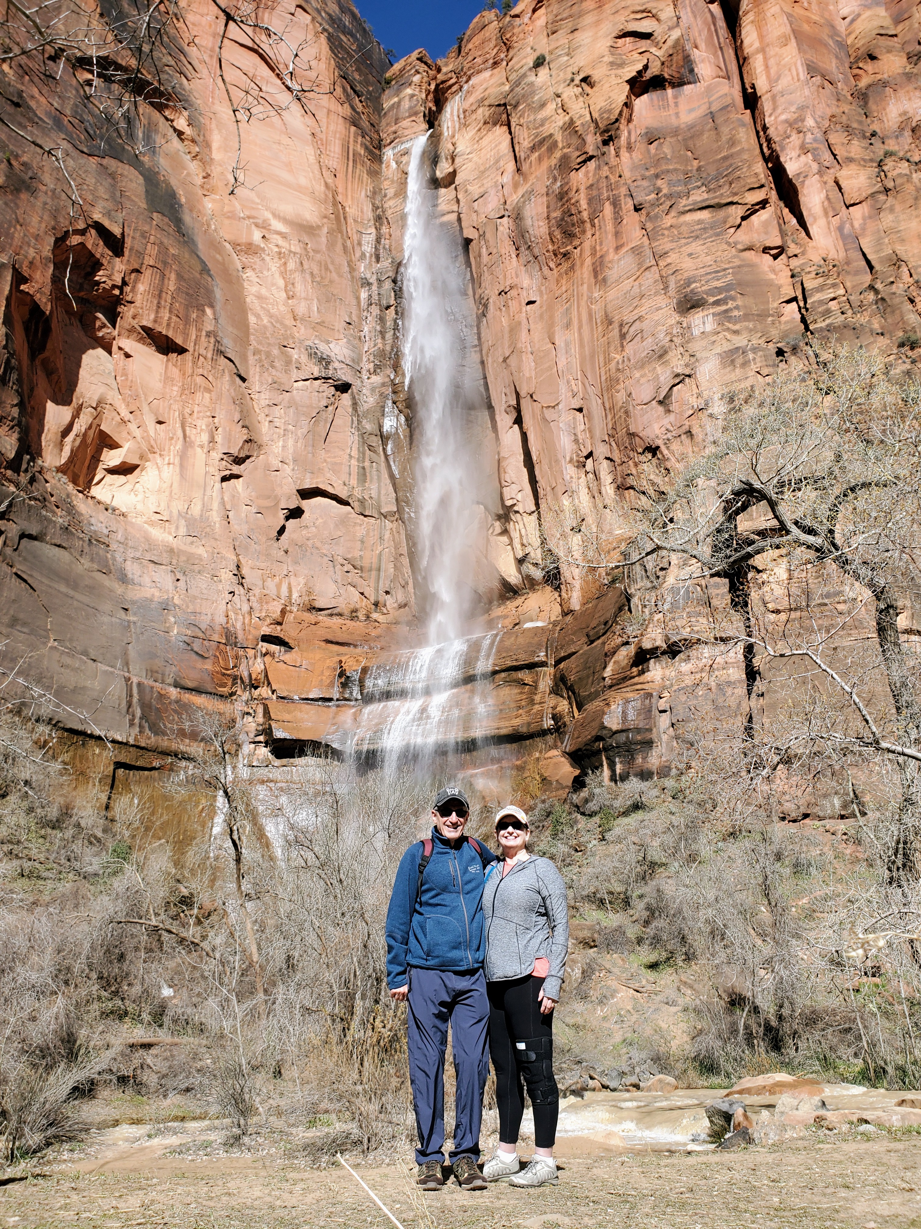
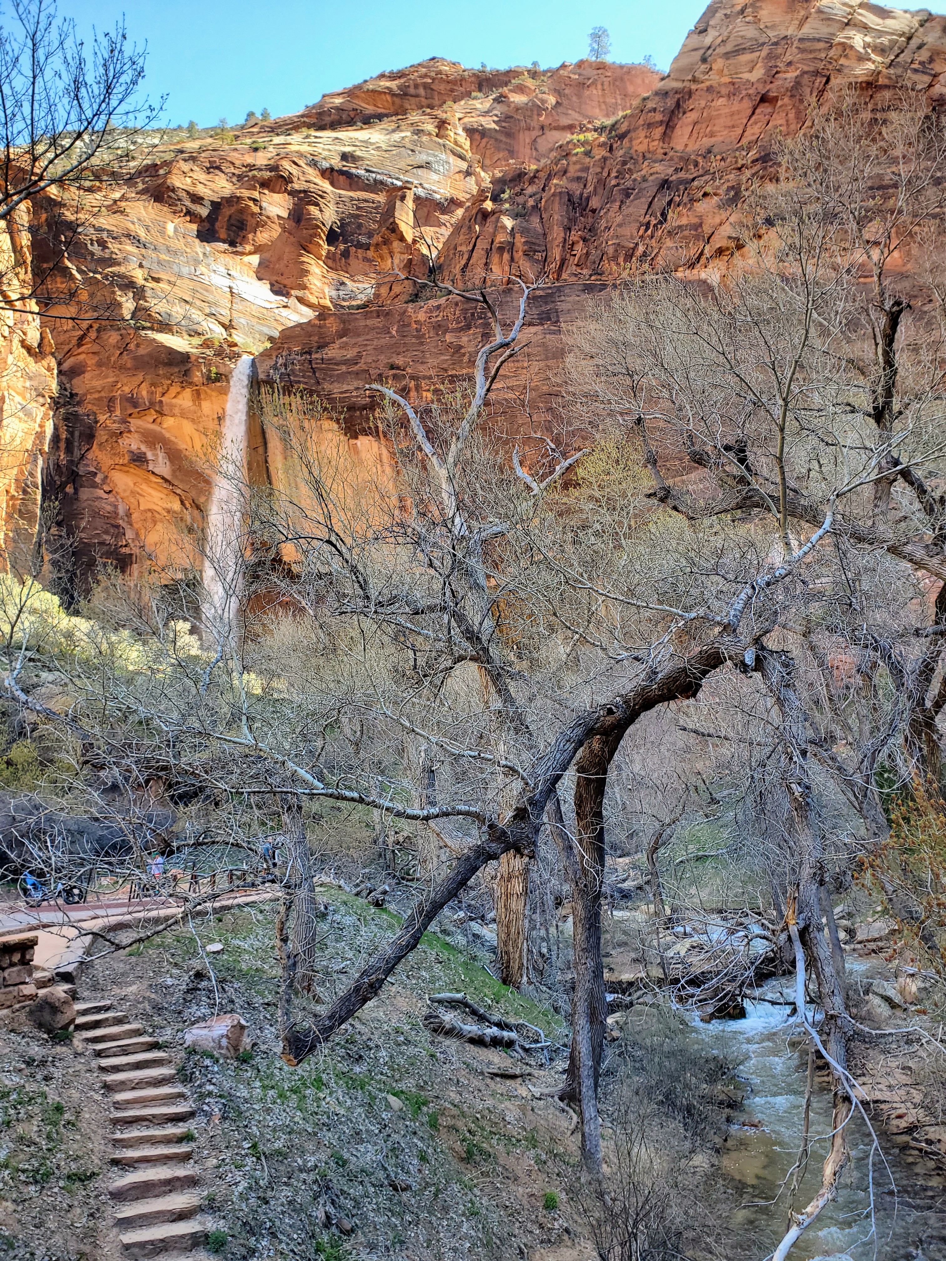
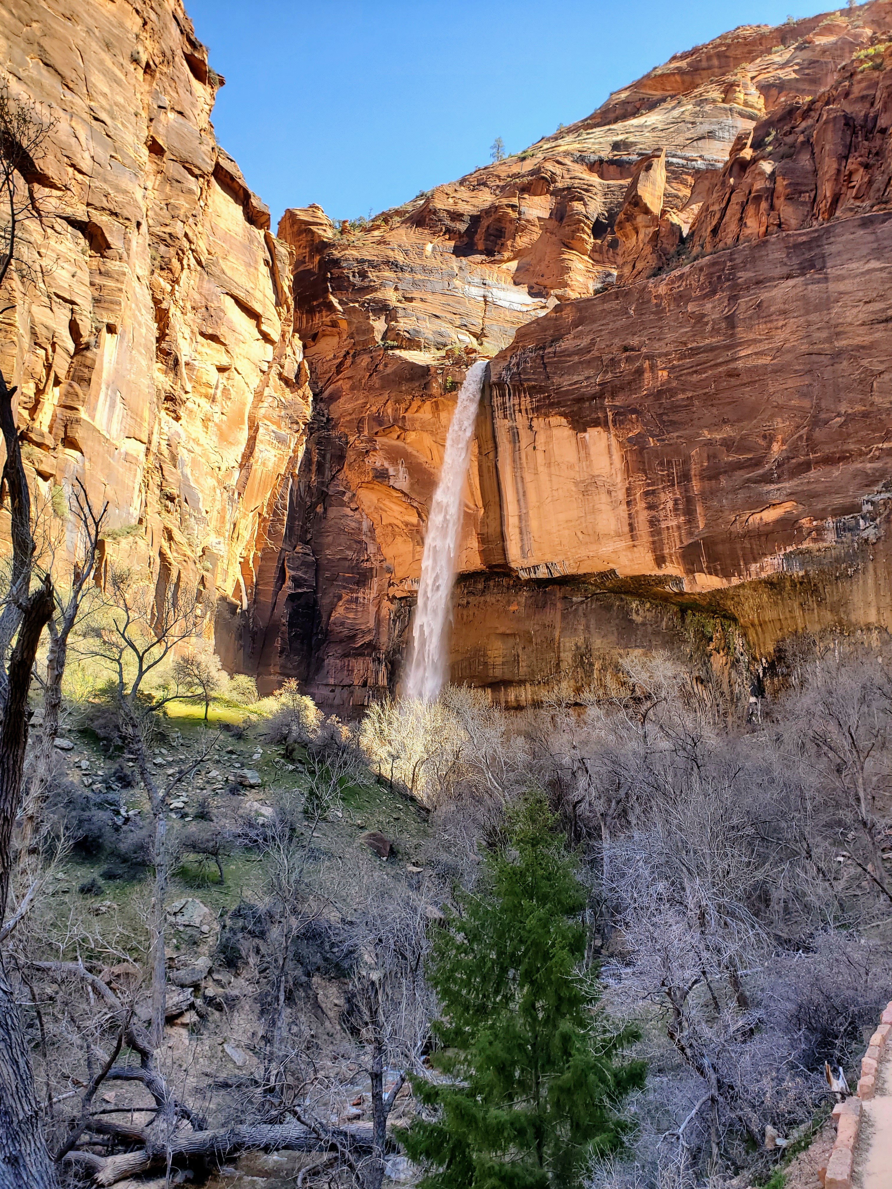
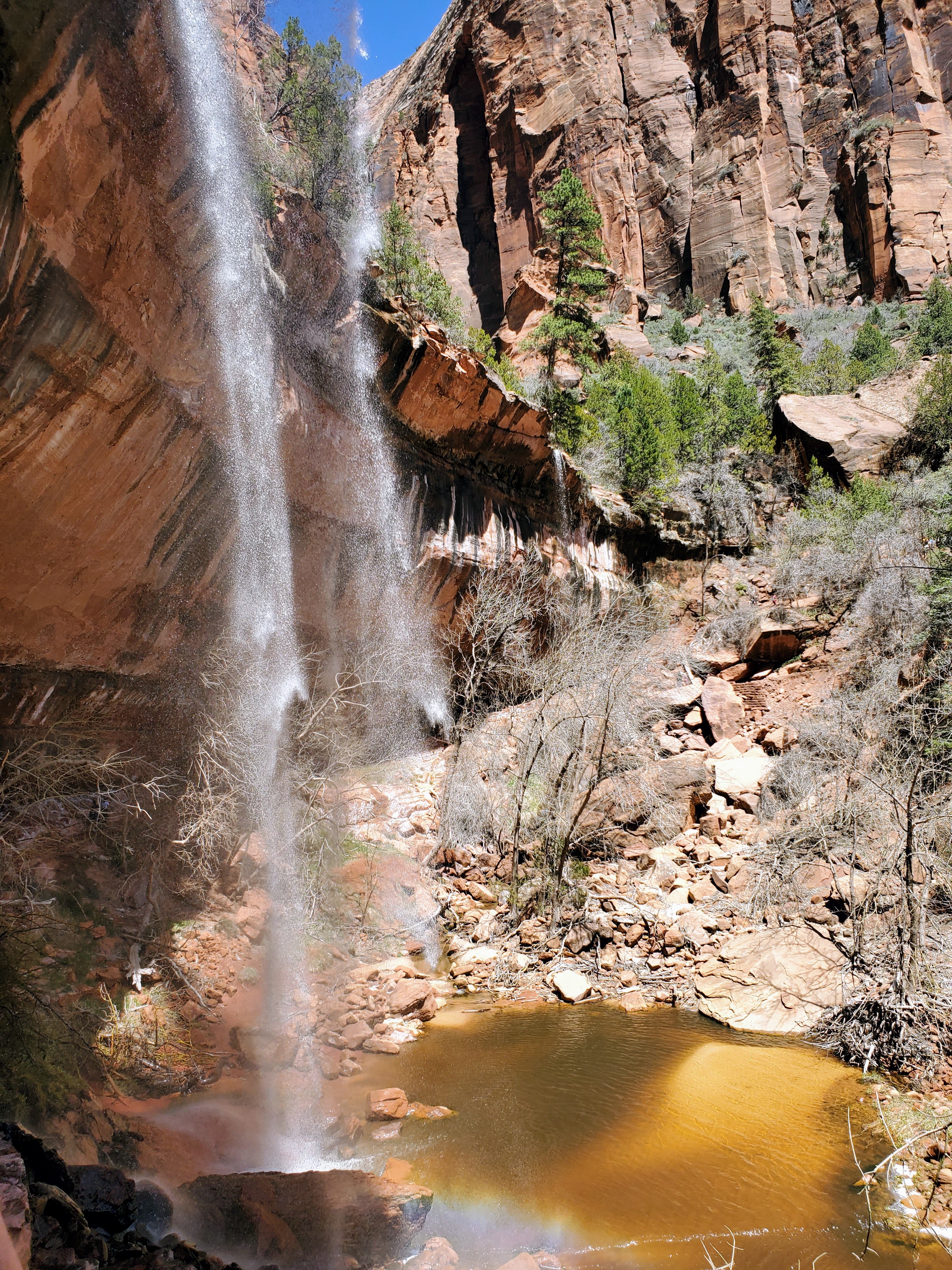
We visited the park in mid-April and the crowds were minimal and the weather was perfect! The temperatures were very pleasant but the water levels were extremely high due to snowmelt and spring rains. The famous Narrows hike through the Virgin River was closed due to the dangerous conditions. Fortunately, these same weather conditions made the waterfalls spectacular! Zion National Park will be its busiest from late April to early October, with summer being the most popular time to visit. Long lines, heavy crowds and the extreme heat may not be ideal for you or your family. Plan accordingly.


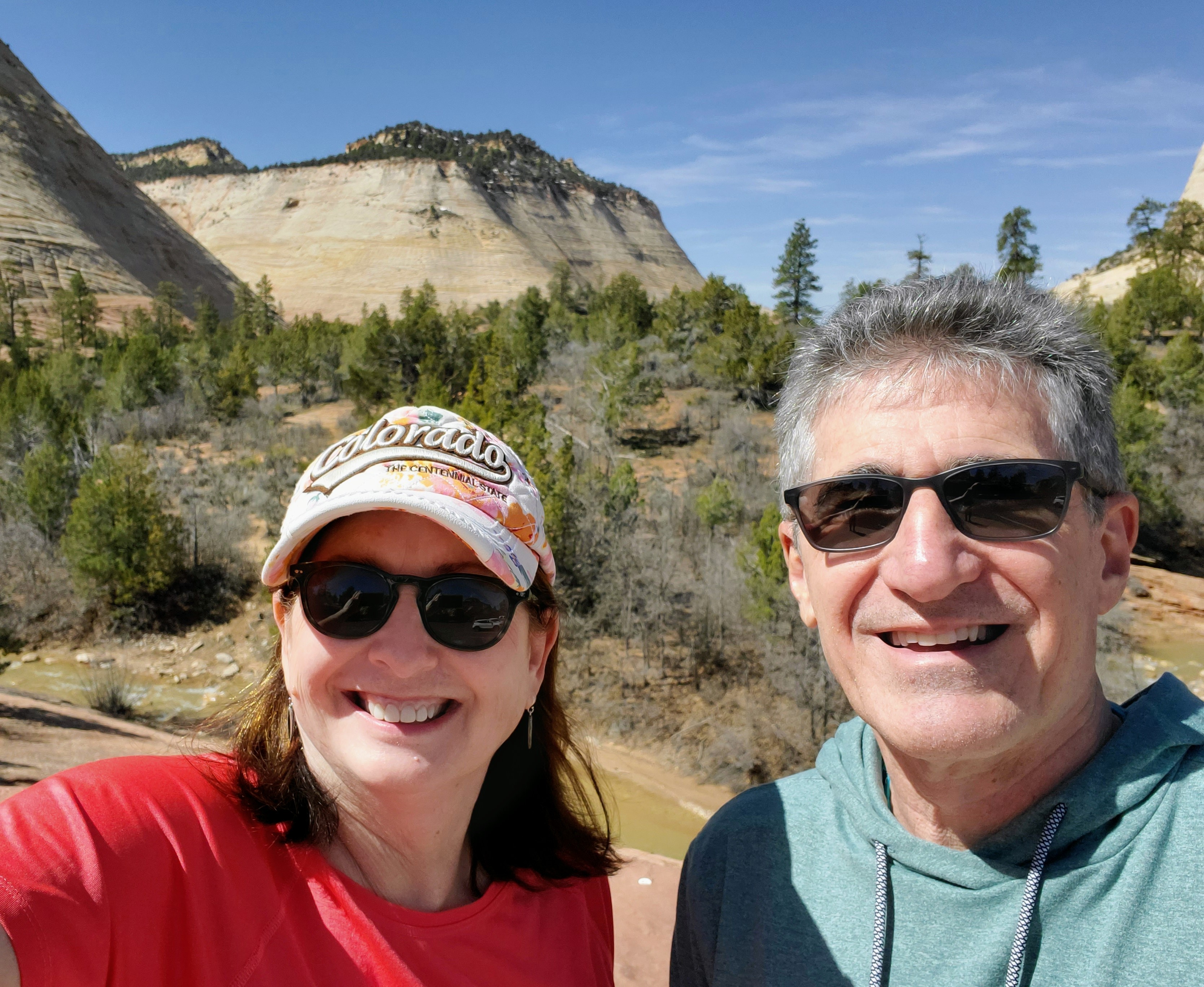
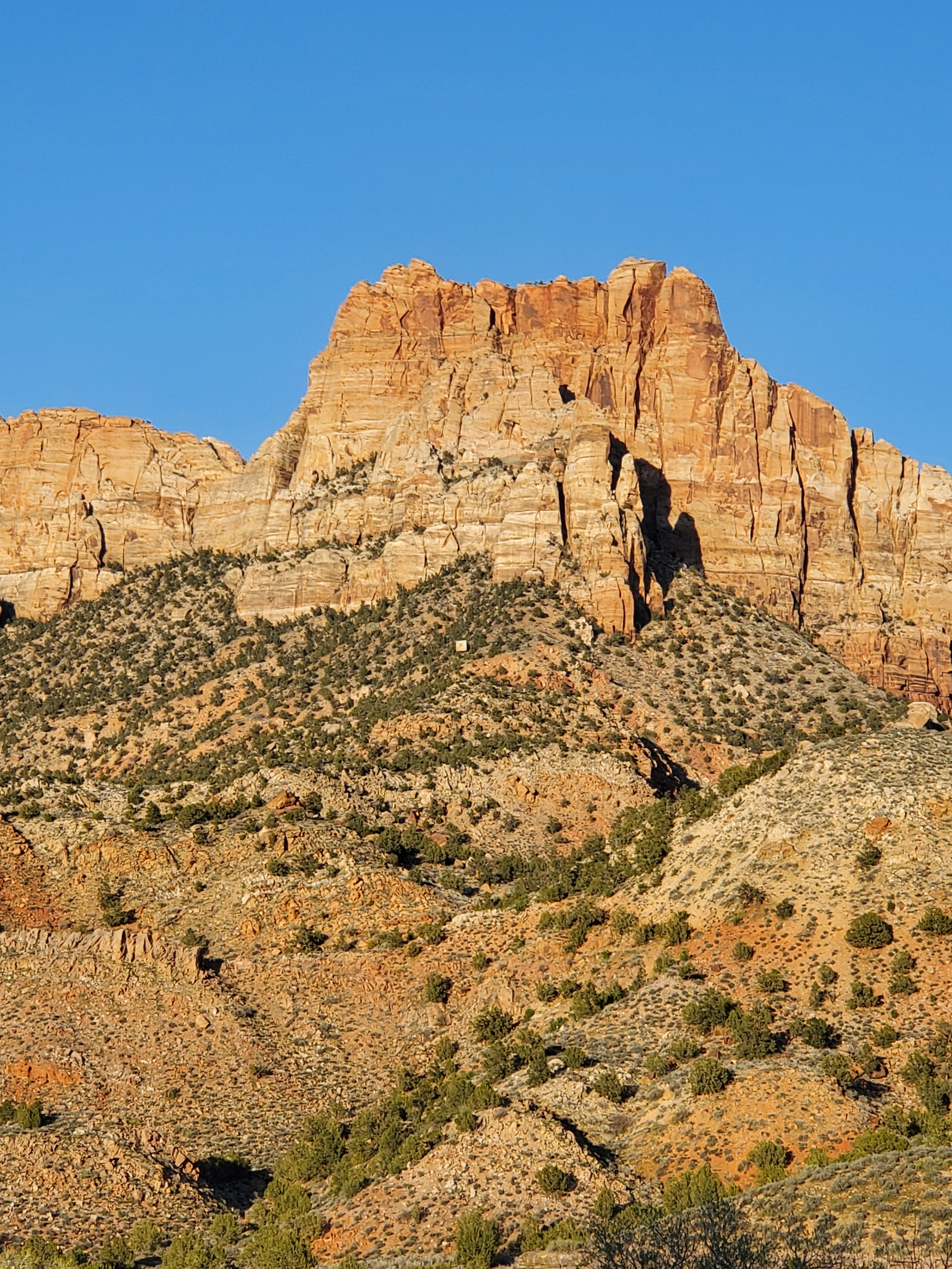
This was my first visit to Zion National Park and I had always wondered what the big deal was with a park in southern Utah that is surrounded by deserts. It was in the middle of nowhere and was difficult to get to. Could it really be that great? I was skeptical until we were driving in and got about half an hour from Zion (Hurricane, Utah). The scenery changed quickly and the landscape went from boring to beautiful. Maybe there was something to this place after all.

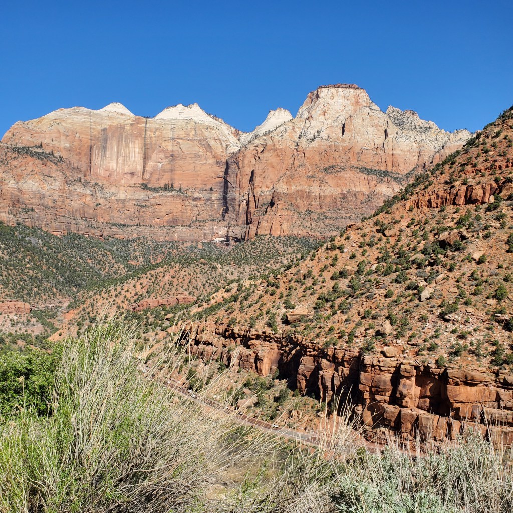
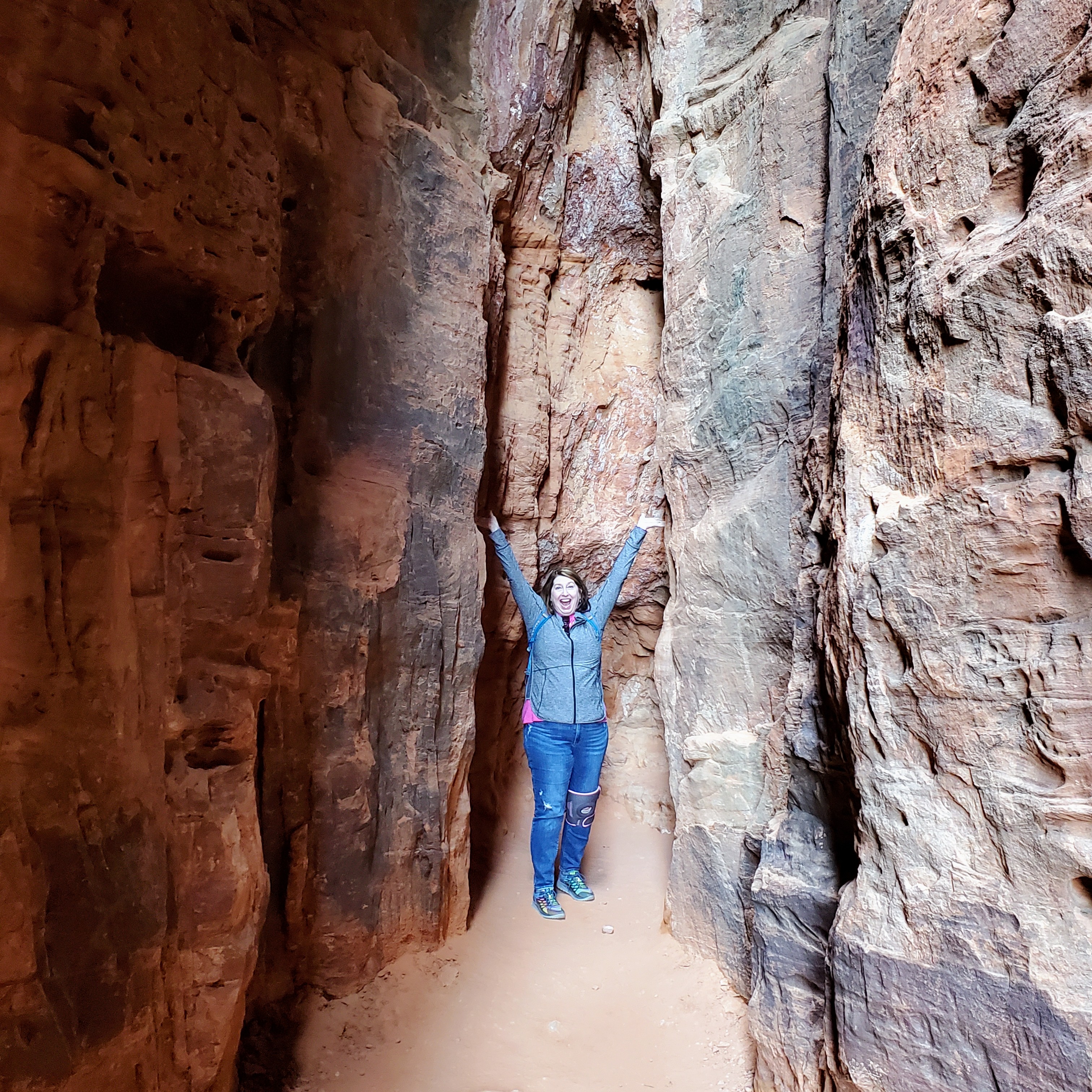
Zion was simply an explosion of shapes, colors and textures. The green grasses in the valley were surrounded by towering white, pink, orange, brown and red sandstone and limestone mountains, cliffs and canyon walls. The fast-running, silty Virgin River carved its way through the valley and ran alongside the highways and byways. We noticed craggy peaks, colorful boulders, fields of wildflowers, brushy cacti and clusters of pine trees. Zion National Park was postcard perfection. I quickly saw the appeal of this place.

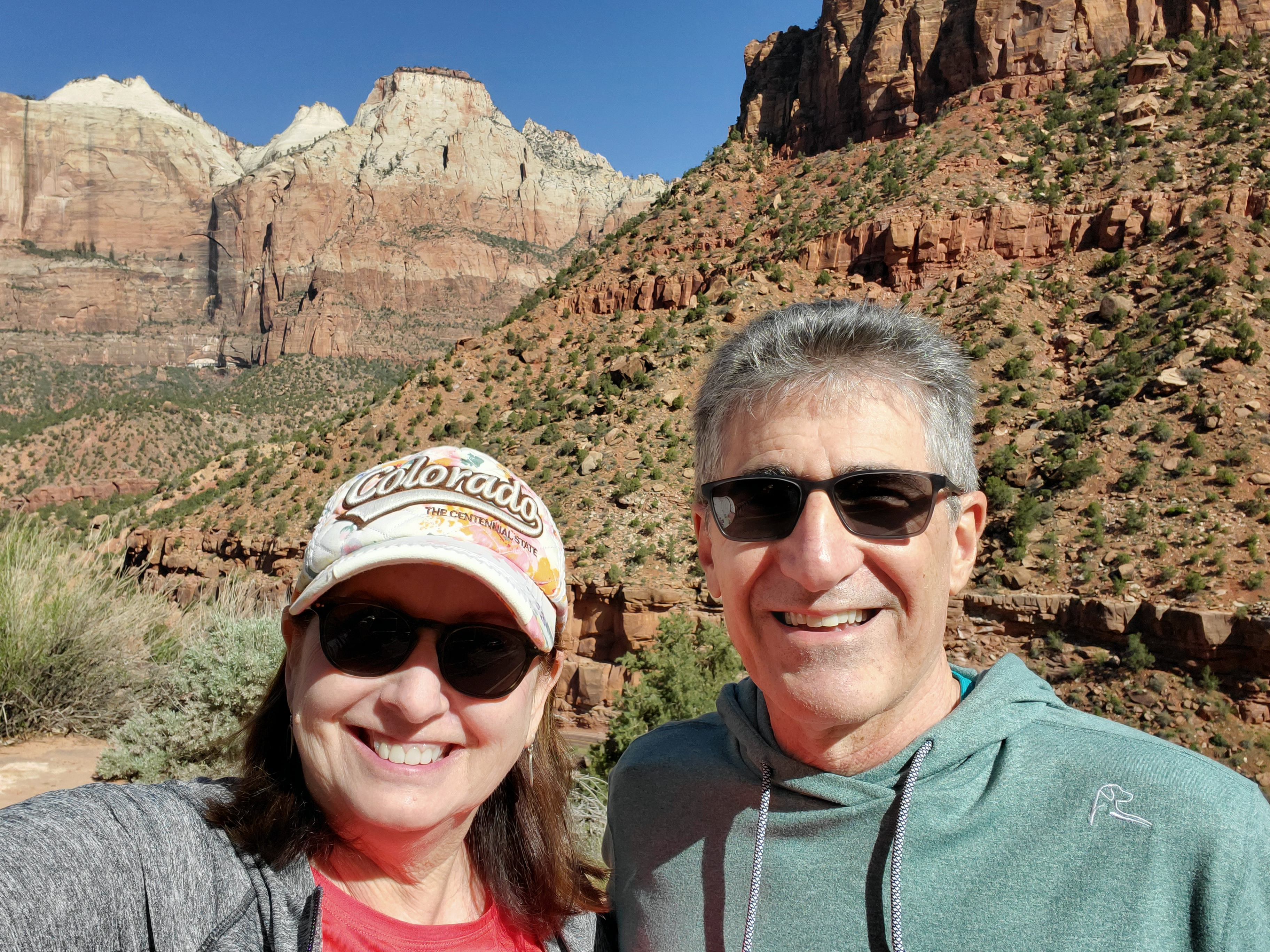
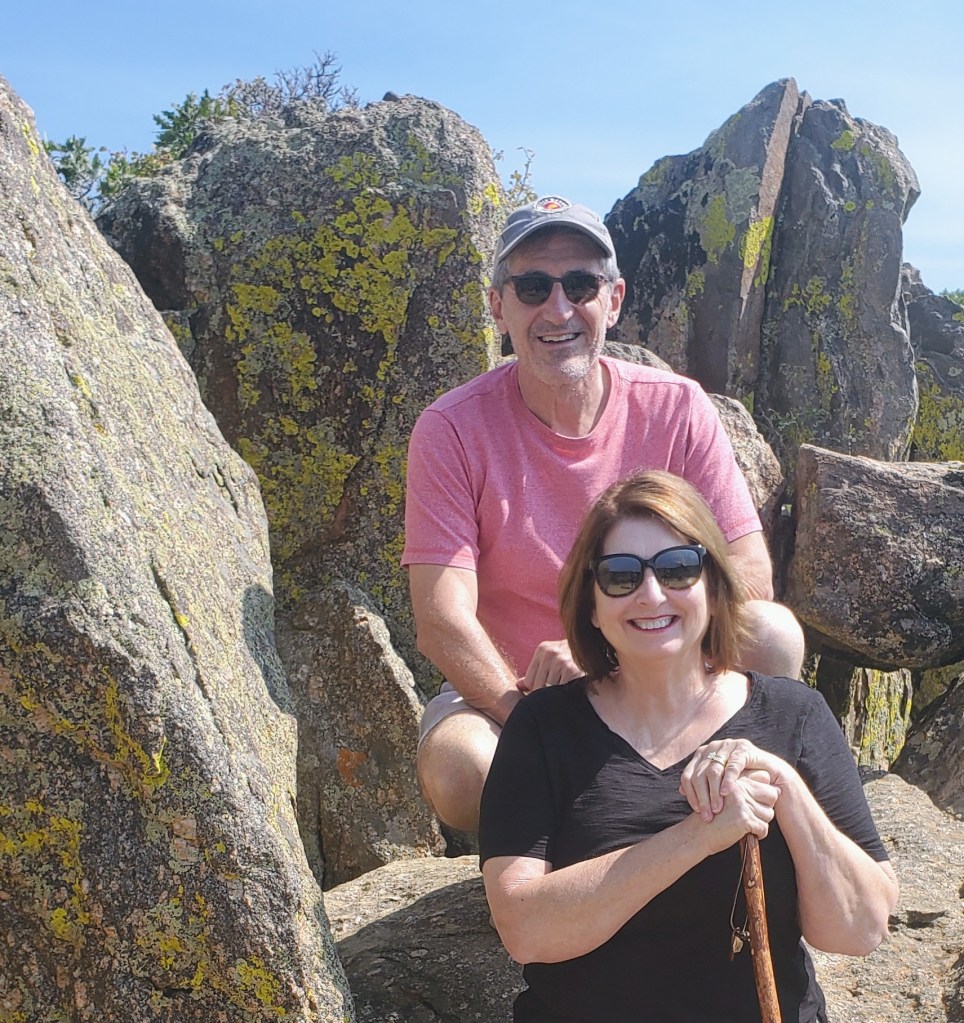
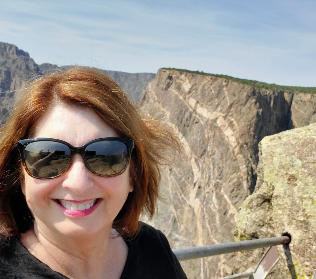
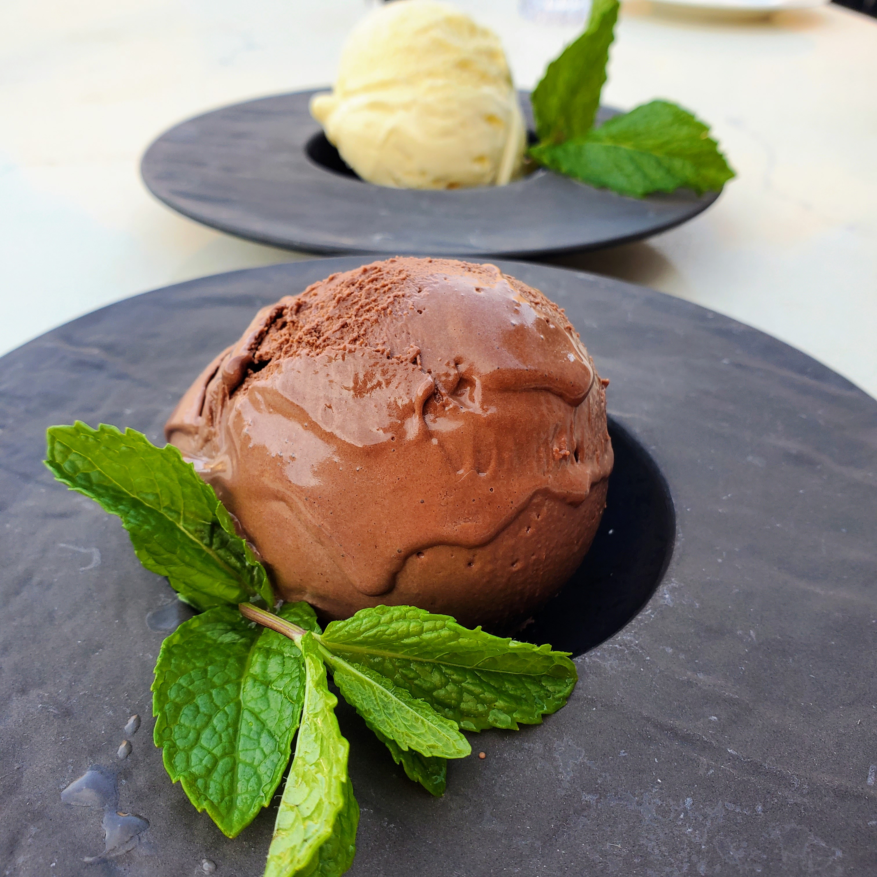
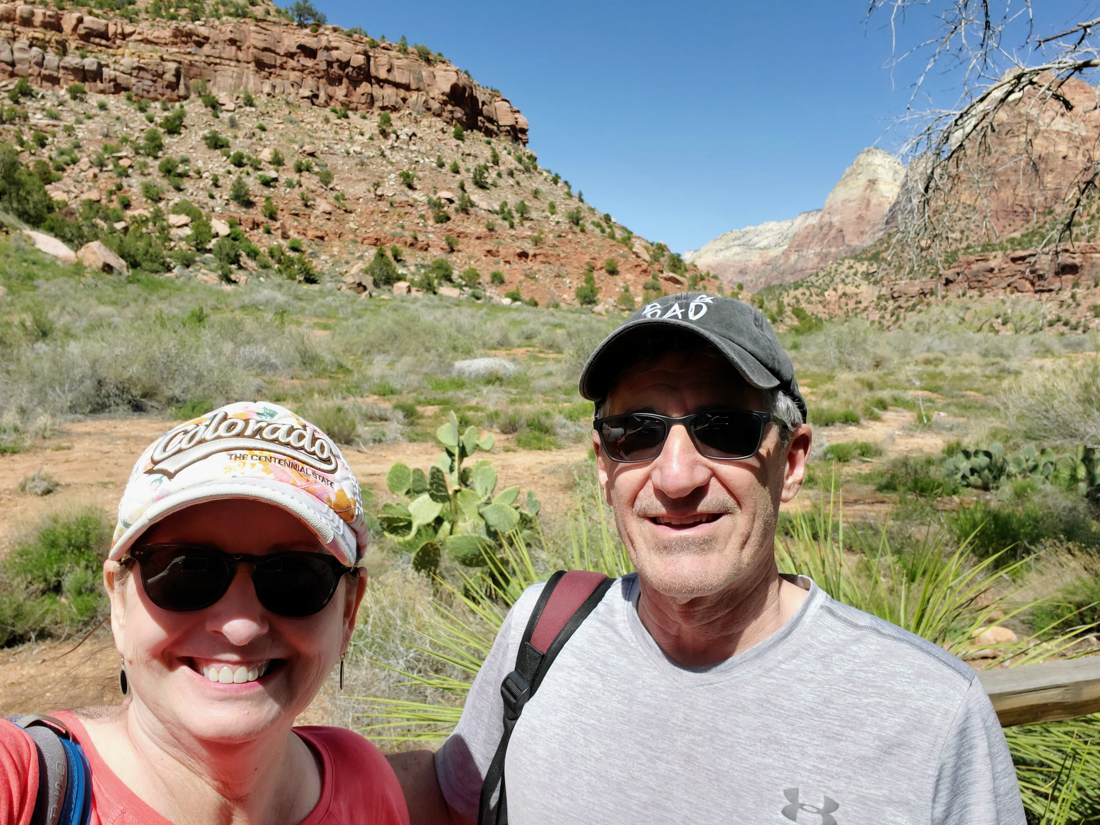
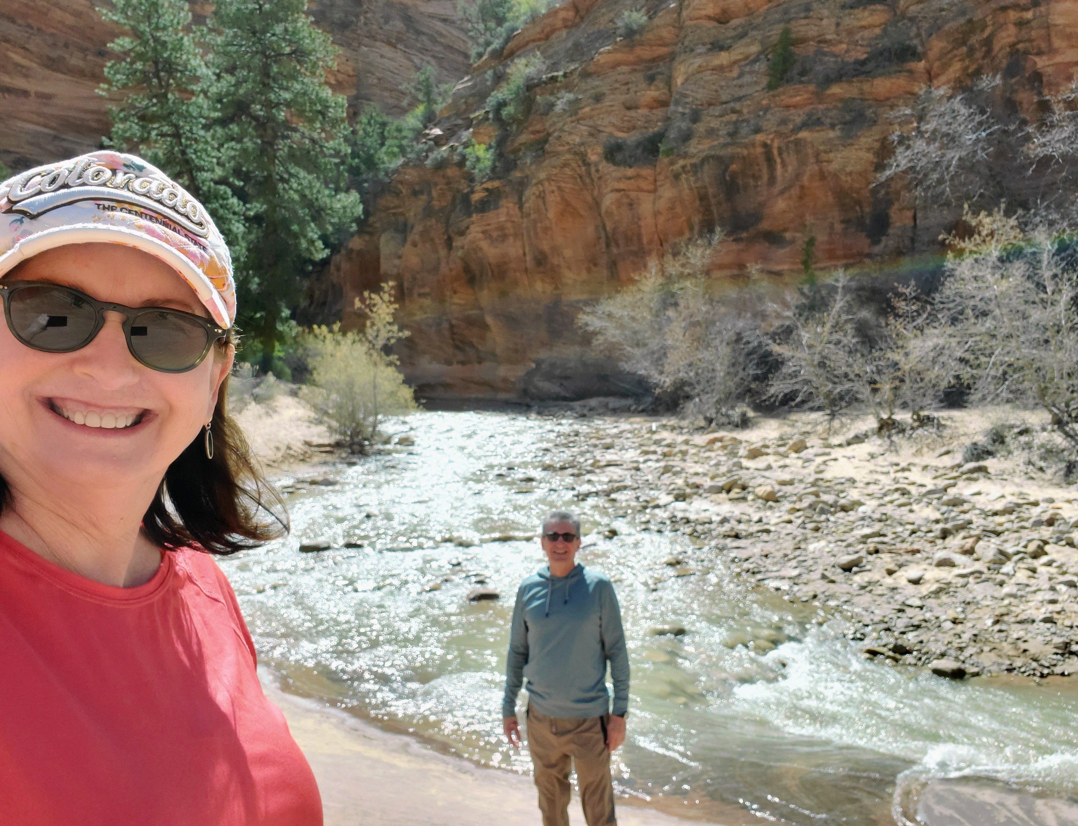
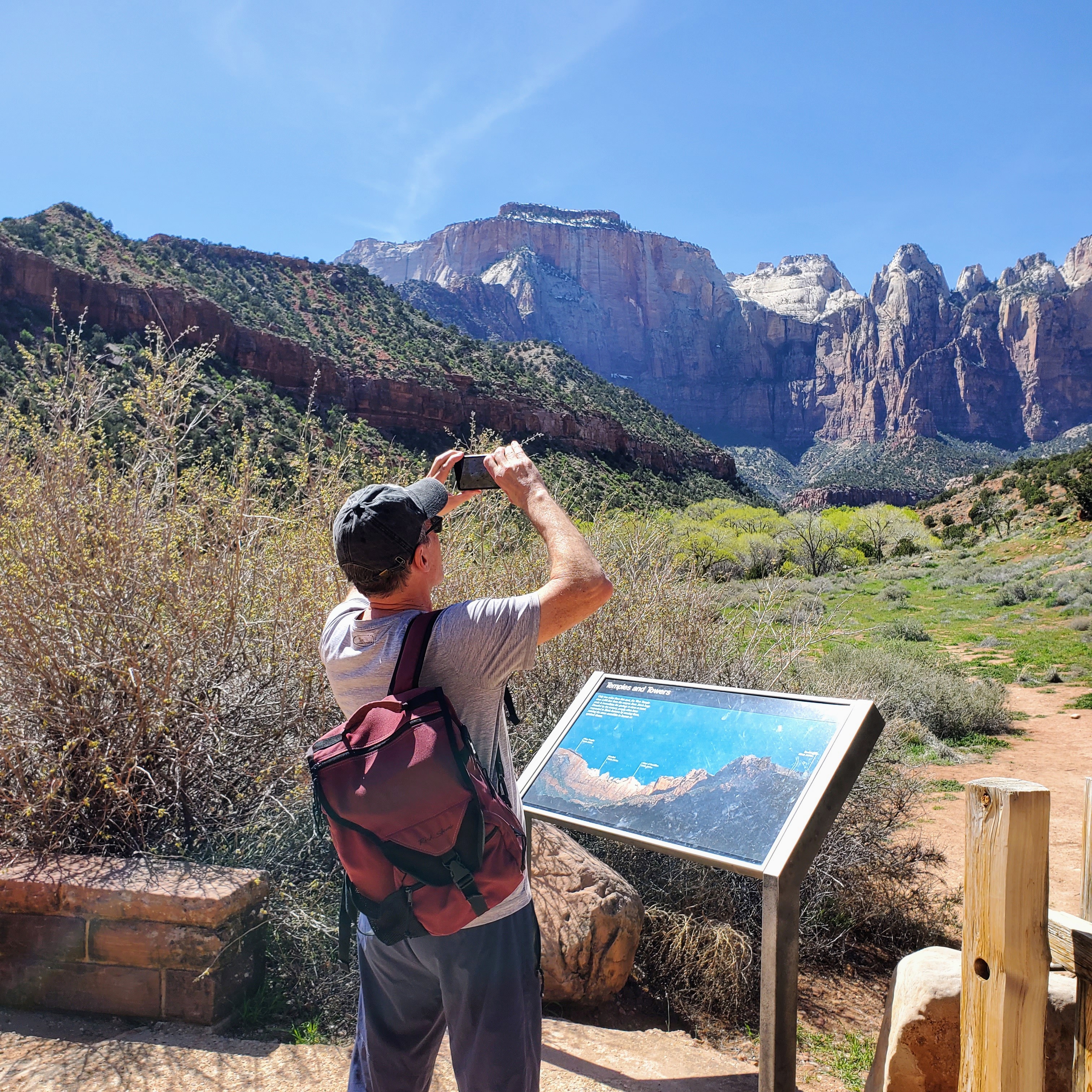
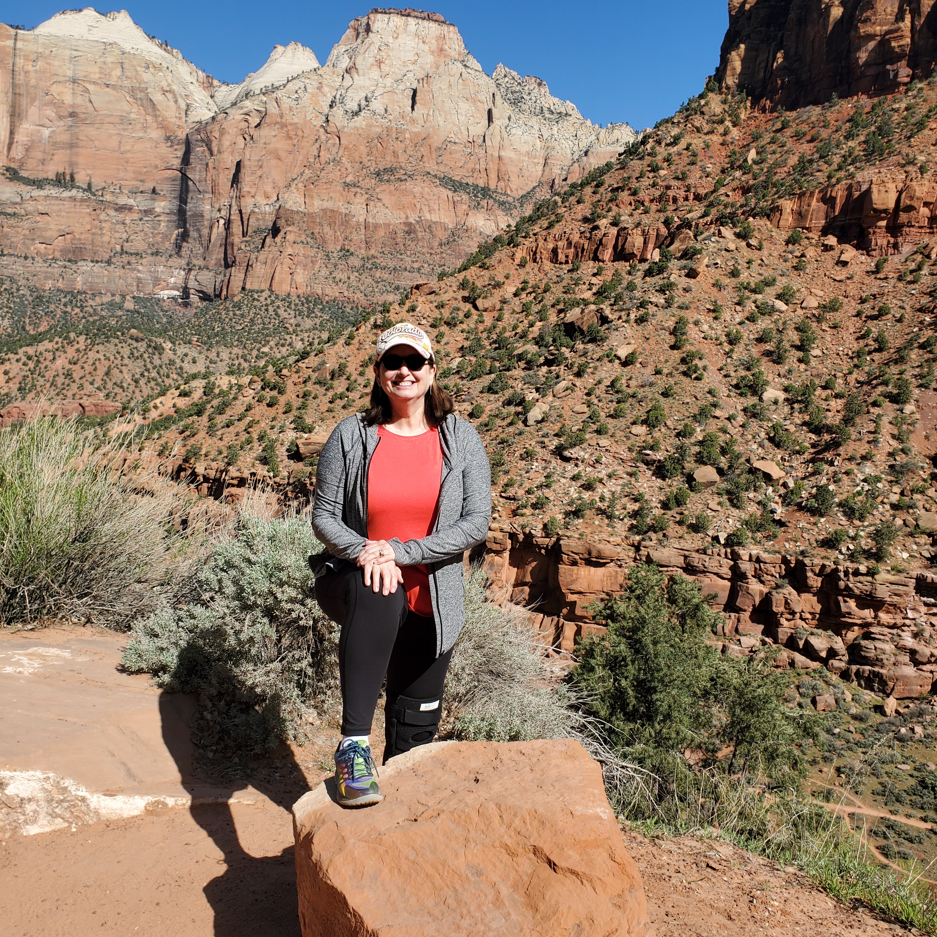
David and I entered the park early on our first full day. No lines! We decided to ride the shuttle all the way to the final stop and work our way backwards. We hiked approximately 7 miles the first day and saw many beautiful sights. We hiked paved, sandy, rocky, forested and dirt trails. We saw mule deer, beautiful waterfalls, clear pools, bridges, sandy beaches, ancient trees, mountain ranges and towering cliffs. We ate a leisurely lunch, snacked on ice cream and shopped at The Zion Lodge gift shop. Quite simply, we had the perfect day. We slept like logs that night!


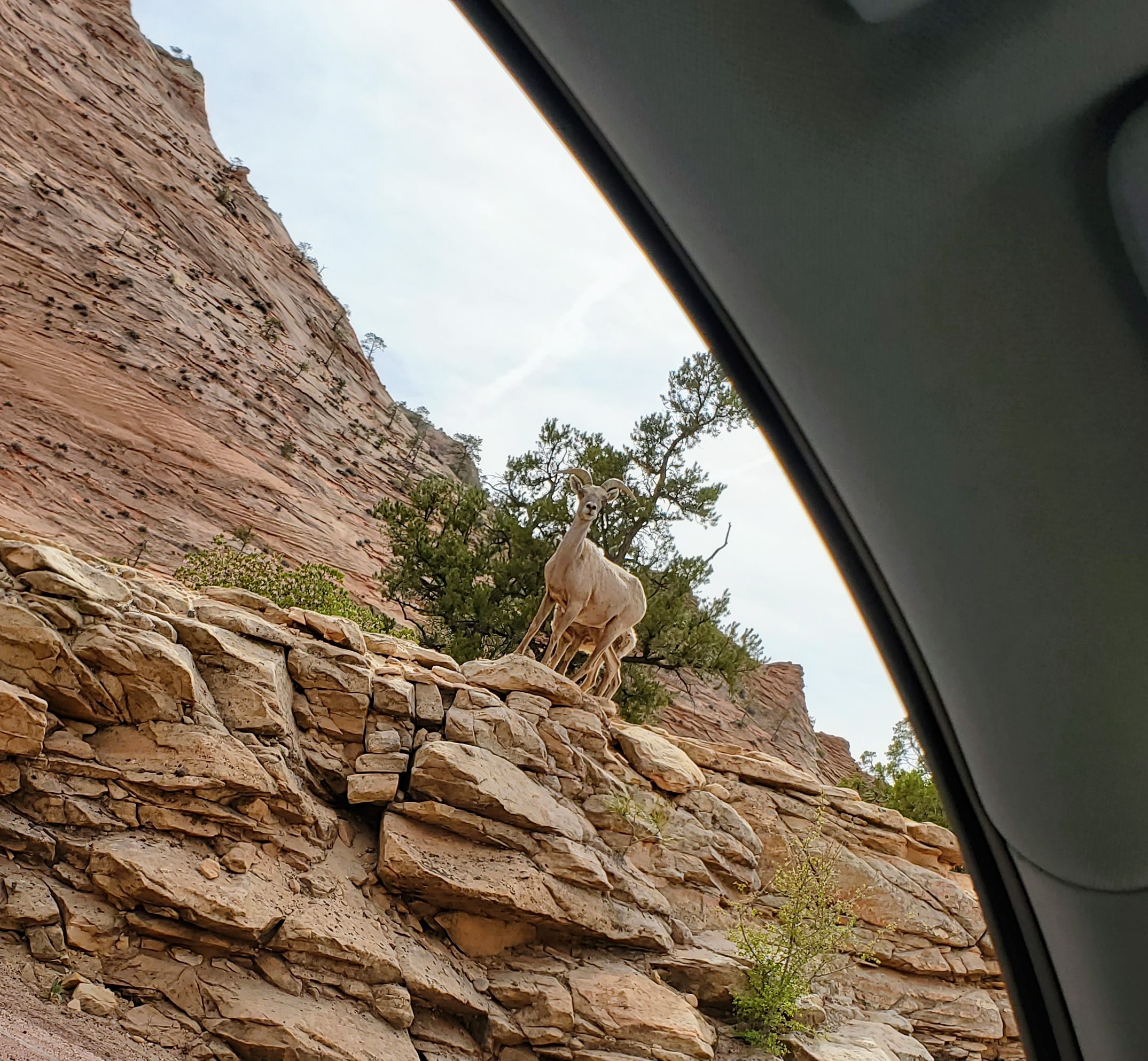
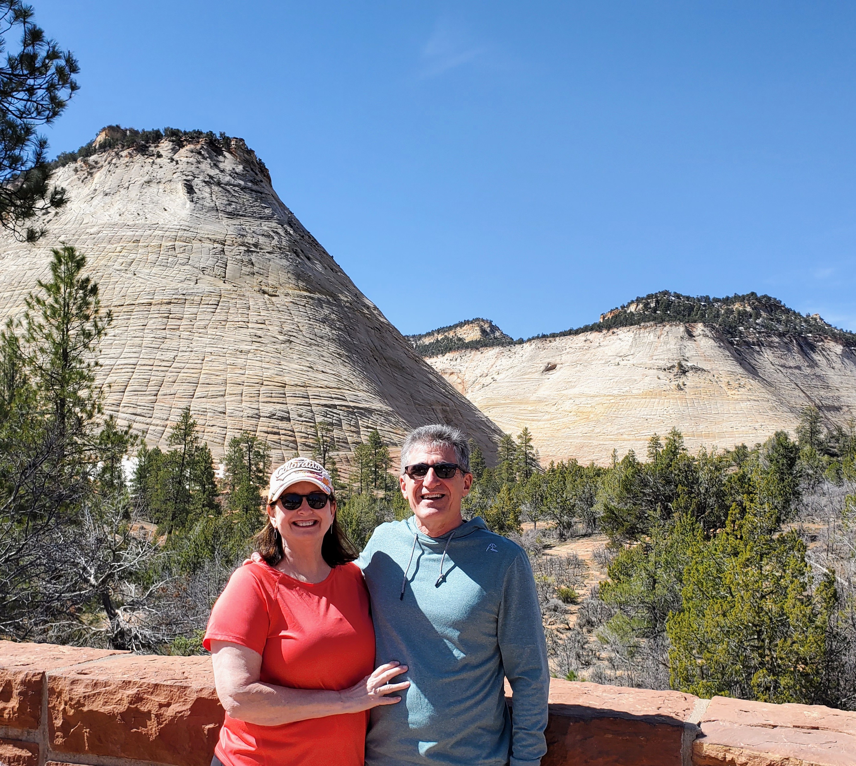
The second day in the park, we drove the Zion-Mount Carmel Highway to Zion’s east entrance. This scenic highway has a tunnel, hairpin switchbacks, elevation changes and great views of Zion. It runs north/northeast and leads to Bryce Canyon or The Grand Canyon . This was a stunning drive with plenty of eye candy. There are many pull-offs, lookouts, parking areas and a few trailheads to stop and explore along the way. This route took us through the mile-long Zion-Mt. Carmel Tunnel, a modern engineering marvel for its time. We enjoyed walking along a sandy bank of the Virgin River, seeing bighorn sheep, and “checking” out the impressive Checkerboard Mesa.

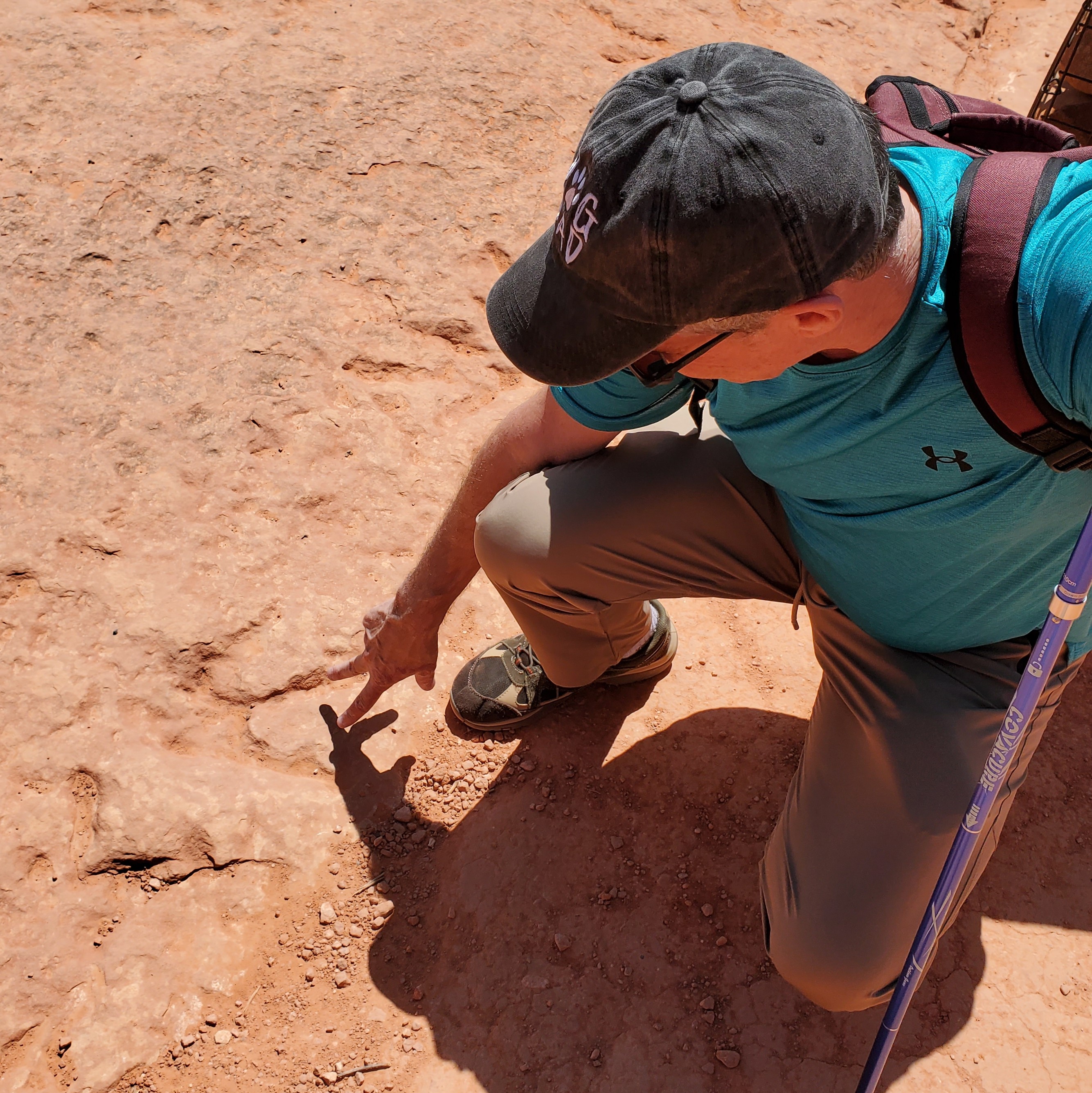
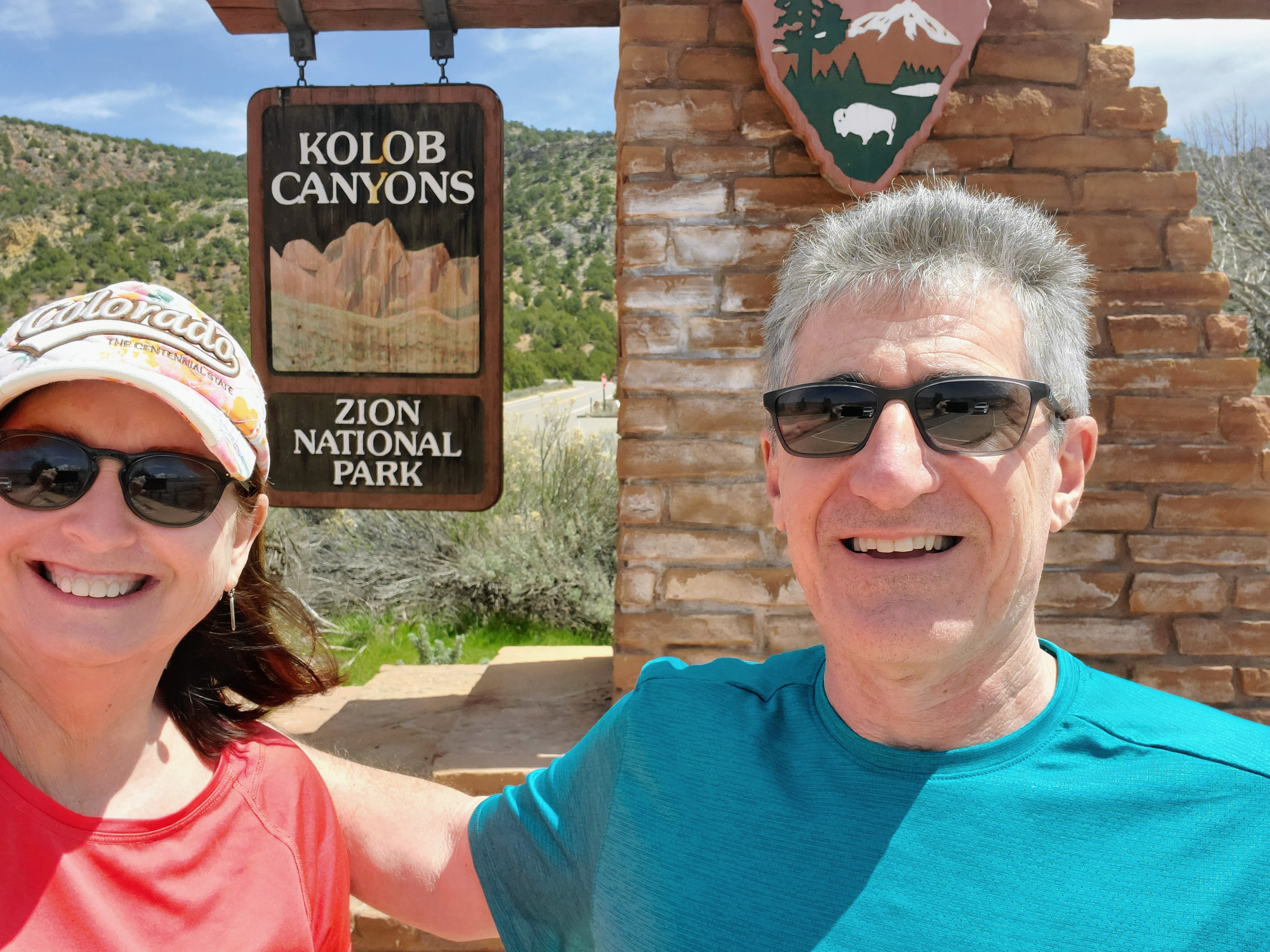
After a delicious lunch in Springdale, we drove to the Kolob Canyon entrance on Zion National Park’s western border. This section of the park is much less popular than the main part but was just as majestic. If you want to immerse yourself into the more “wilderness” part of the park, this is your place. The towering rock formations, finger canyons, arches and quiet scenic trails of Kolob Canyon are a forty-five minute drive from the more trafficked south entrance. The main park road, the Kolob Canyon Road, is just five short miles but encompasses soaring red canyon walls, stunning high desert vistas and powerful waterfalls. The rangers at Kolob Canyon also gave us directions to two nearby state parks where we saw dinosaur footprints and a slot canyon. It was a fun day!


Zion National Park was established by the U.S. government in 1909. There were indigenous peoples that called this area home for centuries. Stop by the Zion Human History Museum (shuttle stop #2) for a better understanding of the park’s history. Artifacts from Native American tribes that inhabited this area date back to 7000 BC. I find that many of our National Parks have an interesting, albeit a sometimes “dark” history, and this one is no exception.

It is no wonder to me now why Zion National Park is one of the top-rated parks in the United States. It is most deserving of its popularity! Zion turned out to be an easy place to visit. The main canyon is relatively small which means you can see most of the popular sights in just one day. However, you could spend days or weeks in the large backcountry part of the park, if you so choose.
If you want more challenging hikes with epic views or if you are like me and want a more relaxed visit with easier hikes, Zion will most likely leave you starry-eyed and wanting more. There seems to be something here that appeals to everyone – even this old dame with a bum knee!
I’ll see you on the trail.