Tag Archive | Hiking

Sleeping Bear Dunes

Michigan

If your feet are in the sand, you should have a smile on your face!” No kidding. I love this quote.

The truth is, it was difficult to not feel like a kid again while exploring Sleeping Bear Dunes National Lakeshore in northern Michigan a couple of weeks ago. This park was a fabulous place and much, much more than I had expected!

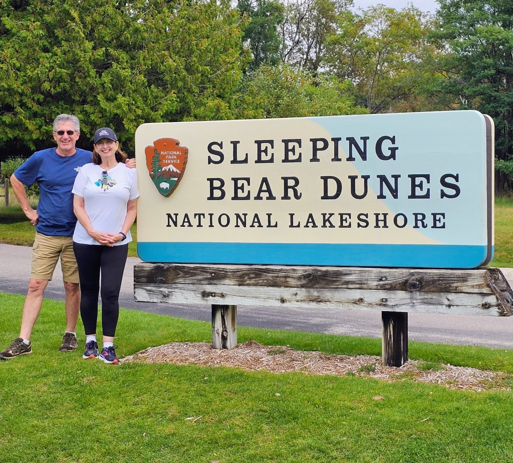
The park is a “National Lakeshore” not a “National Park.” Everything looks like a national park – all the signage, maps, ranger stations, etc. Visitors can even use their National Park passes for their entrance fee. Confused? Me, too.

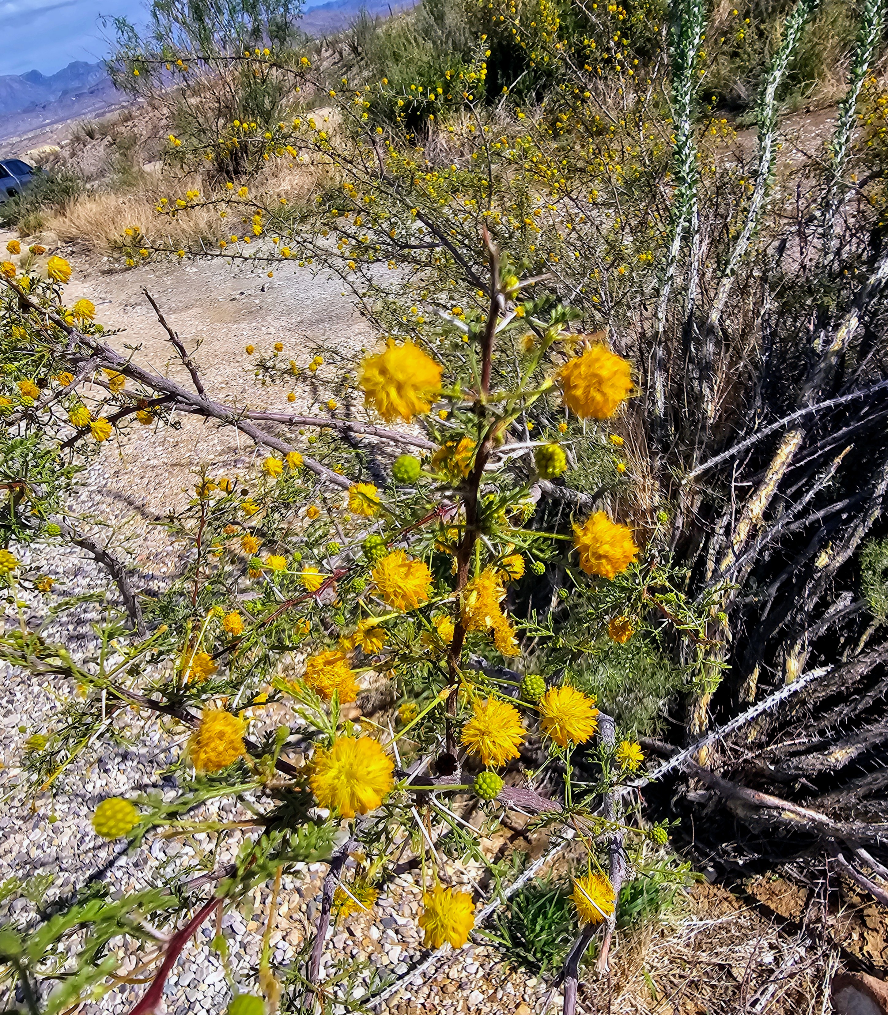
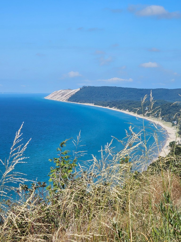
Regardless of what we label this beautiful park, it consists of 72,000 acres of Lake Michigan shoreline and sand dunes formed two million years ago when glaciers advanced and retreated. What we have now is the world’s largest collection of freshwater dunes, with the tallest standing 400 feet high. There are also 26 lakes, various streams, rolling hills and dense forests filled with birch, maple, beech and pine trees.

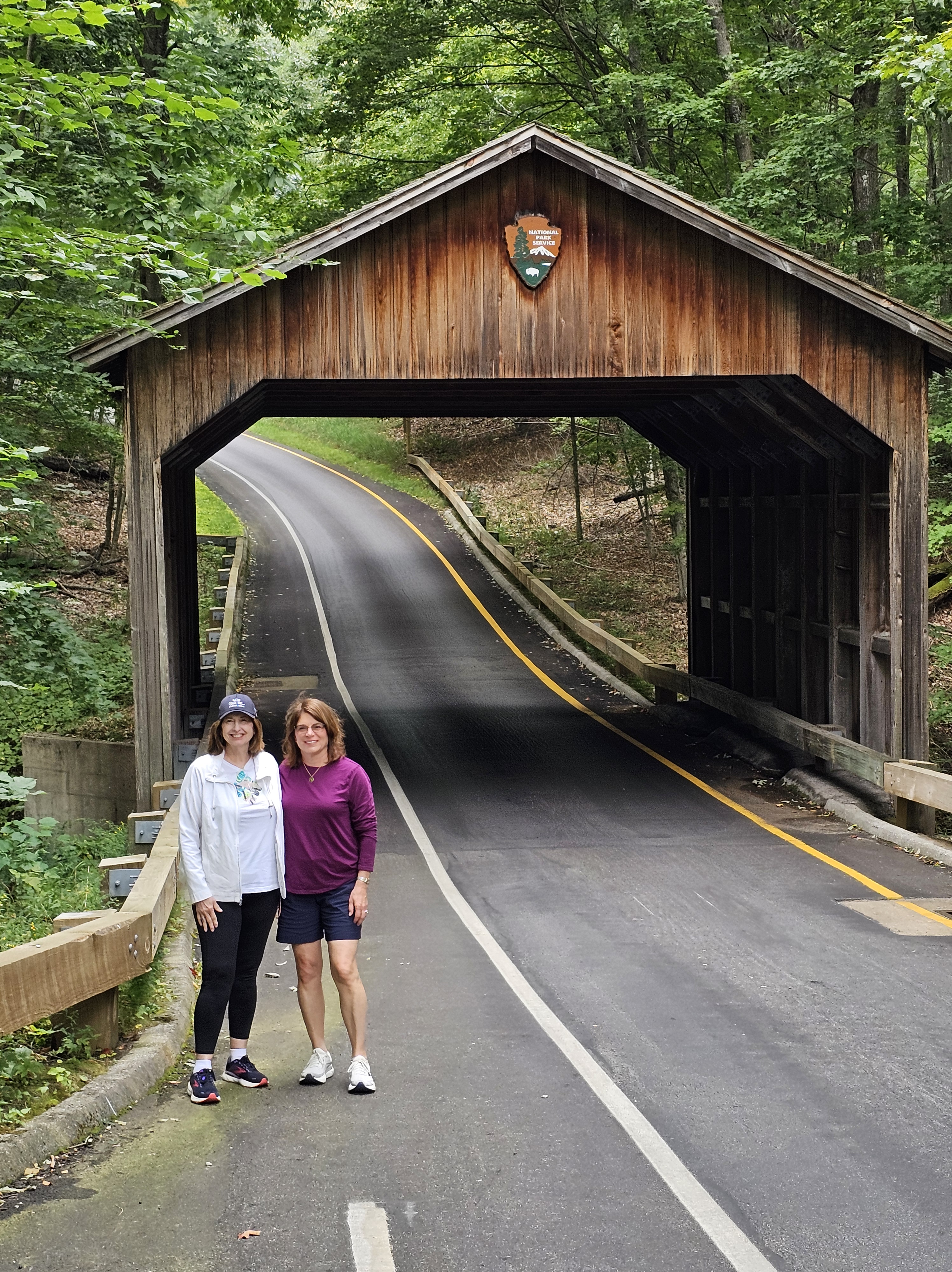
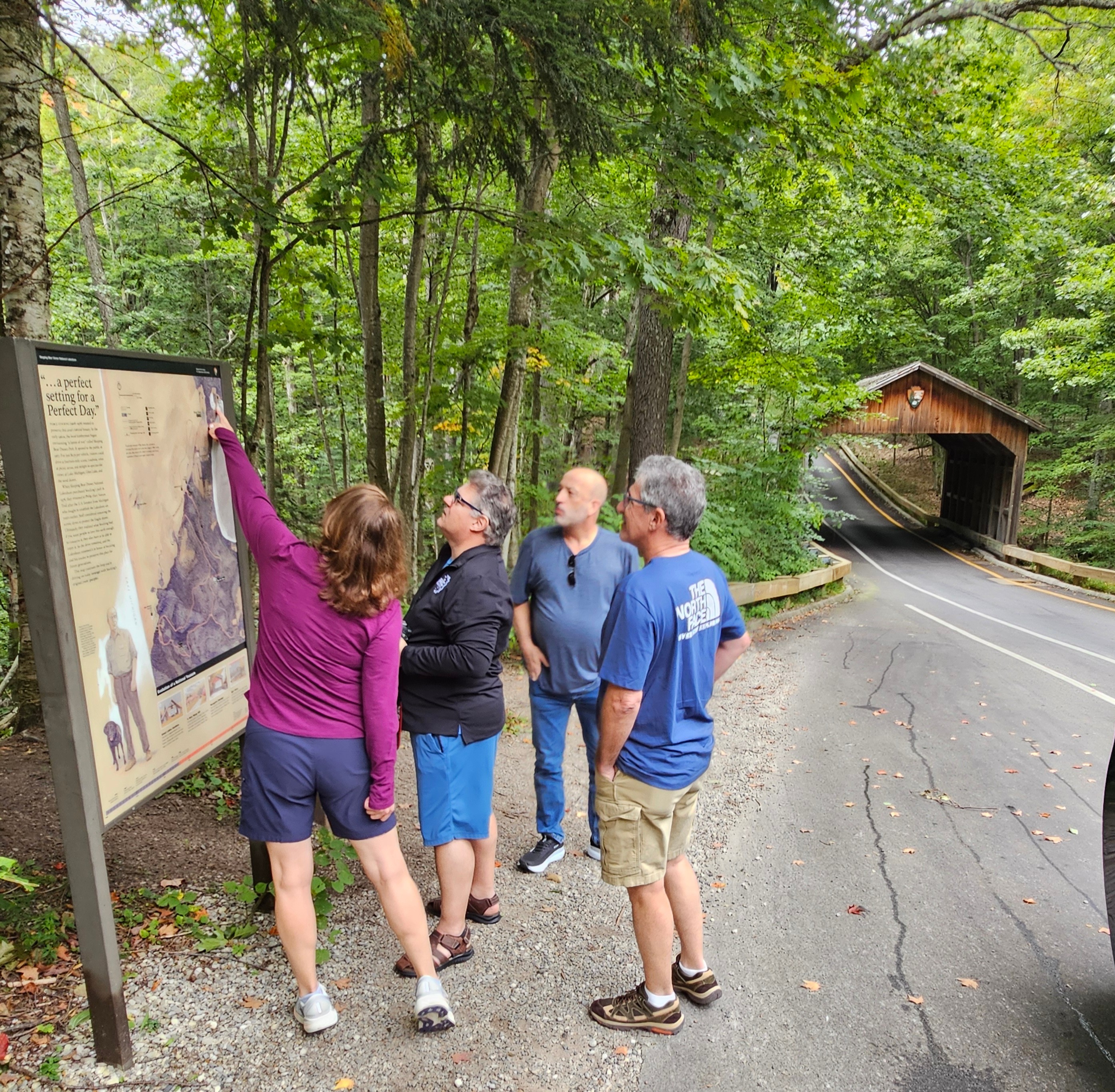
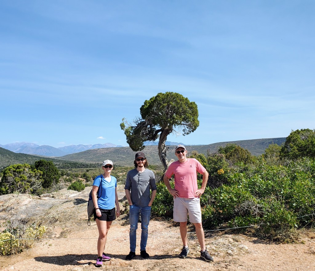
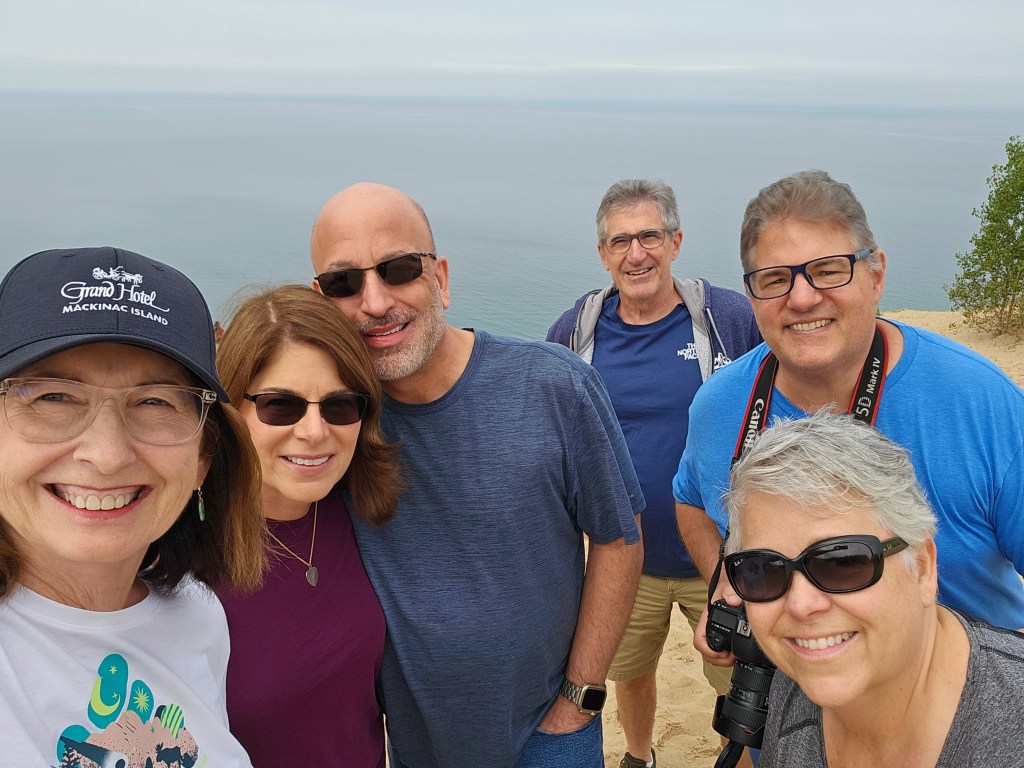
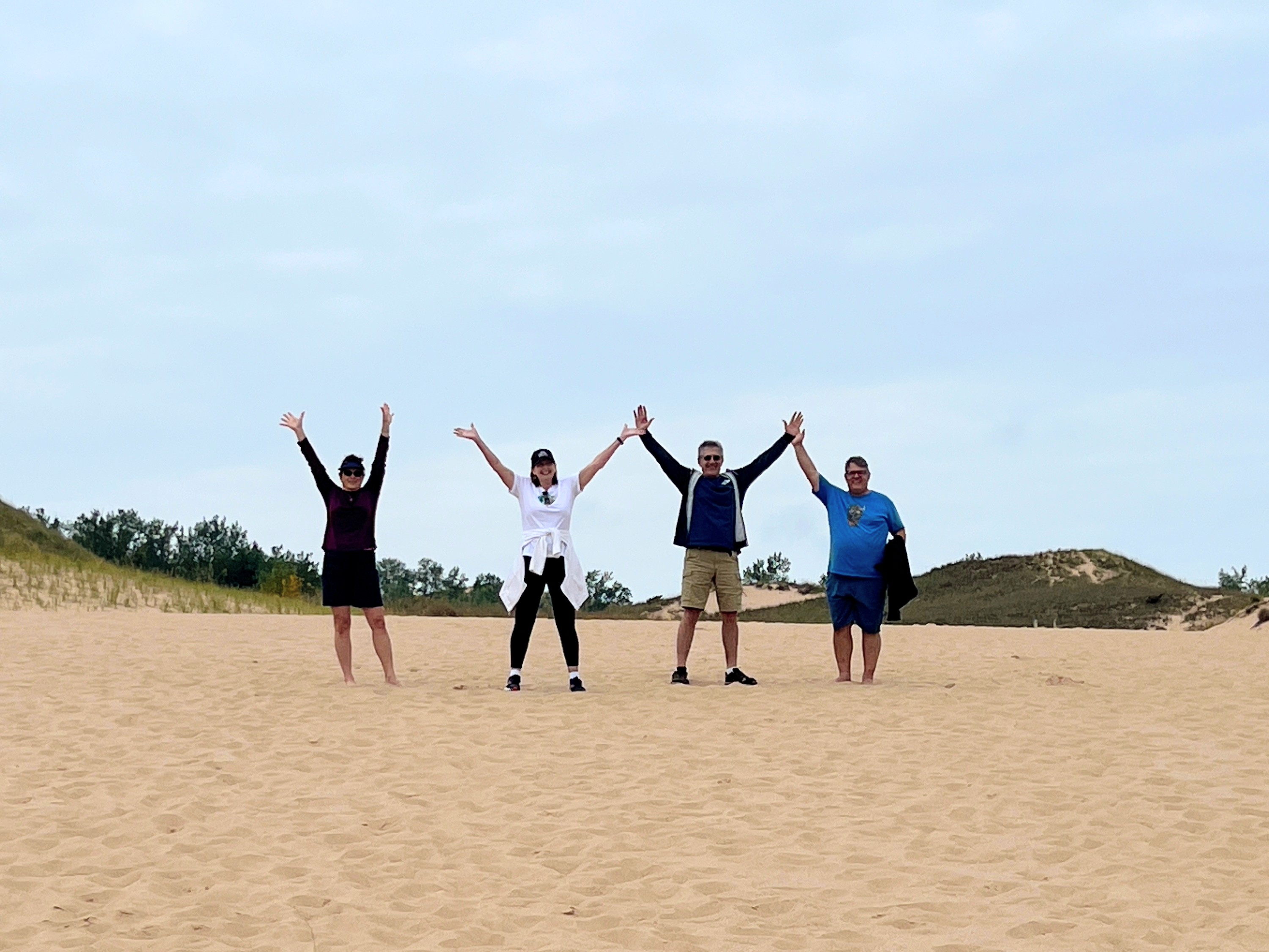
Our group (3 adult couples) began our journey into the park by driving along the Pierce Stocking Scenic Drive. This is a 7.4 mile loop that provides 12 points of interest to stop at along the way, if you so choose. Our first stop was the historic covered bridge for a photo op. This is actually the second covered bridge because the first one was eaten by local porcupines who found the wooden sides to be a tasty treat!

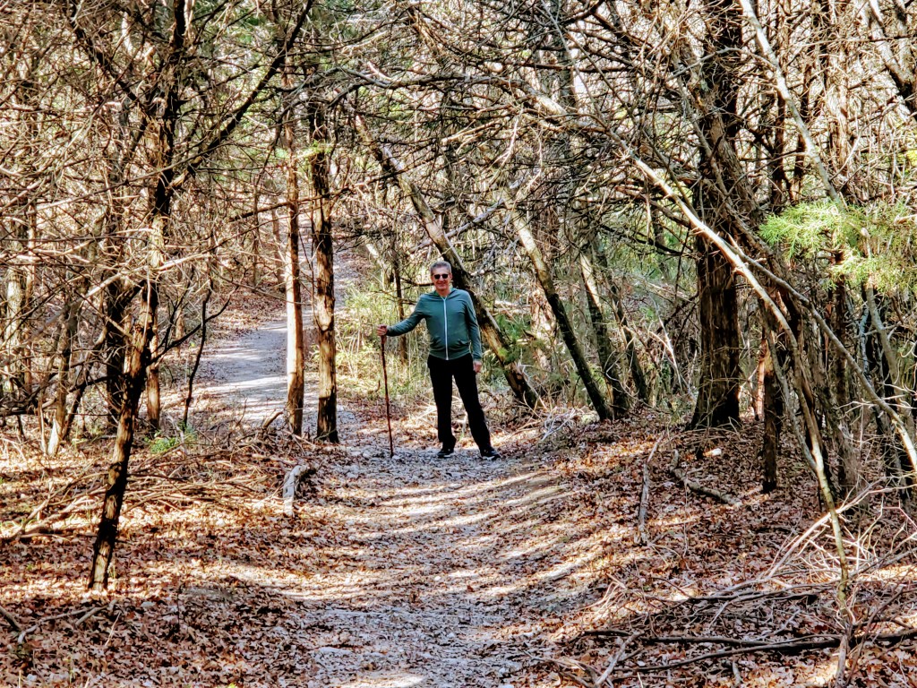
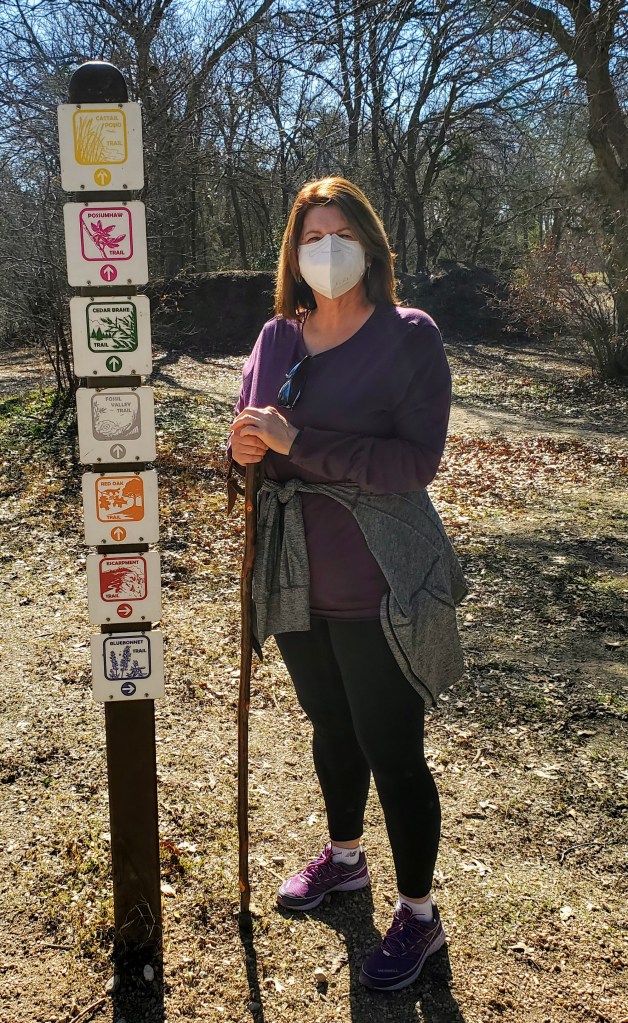
Our next stop along the drive was #3, the Dune Overlook. There was some nice information here on the dune ecology and history of the park. The overlook offered great views of Glen Lake. This stop also serves as a trailhead for a hiking trail that leads over the dunes and down to the Lake Michigan shoreline. Note: There are approximately 50 trails (totaling 100 miles) for hikers and bikers throughout the park, with levels ranging from easy to difficult.

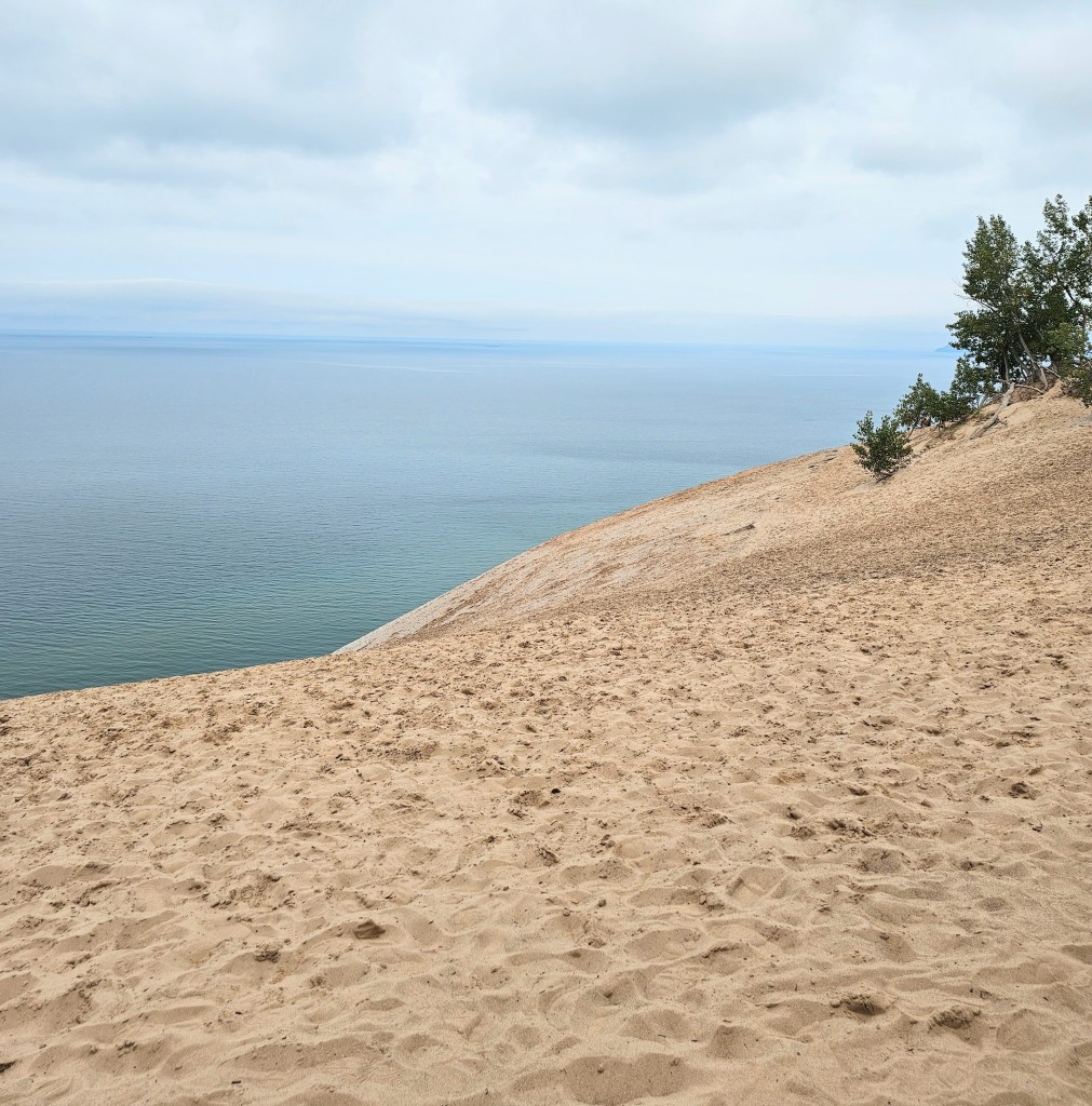
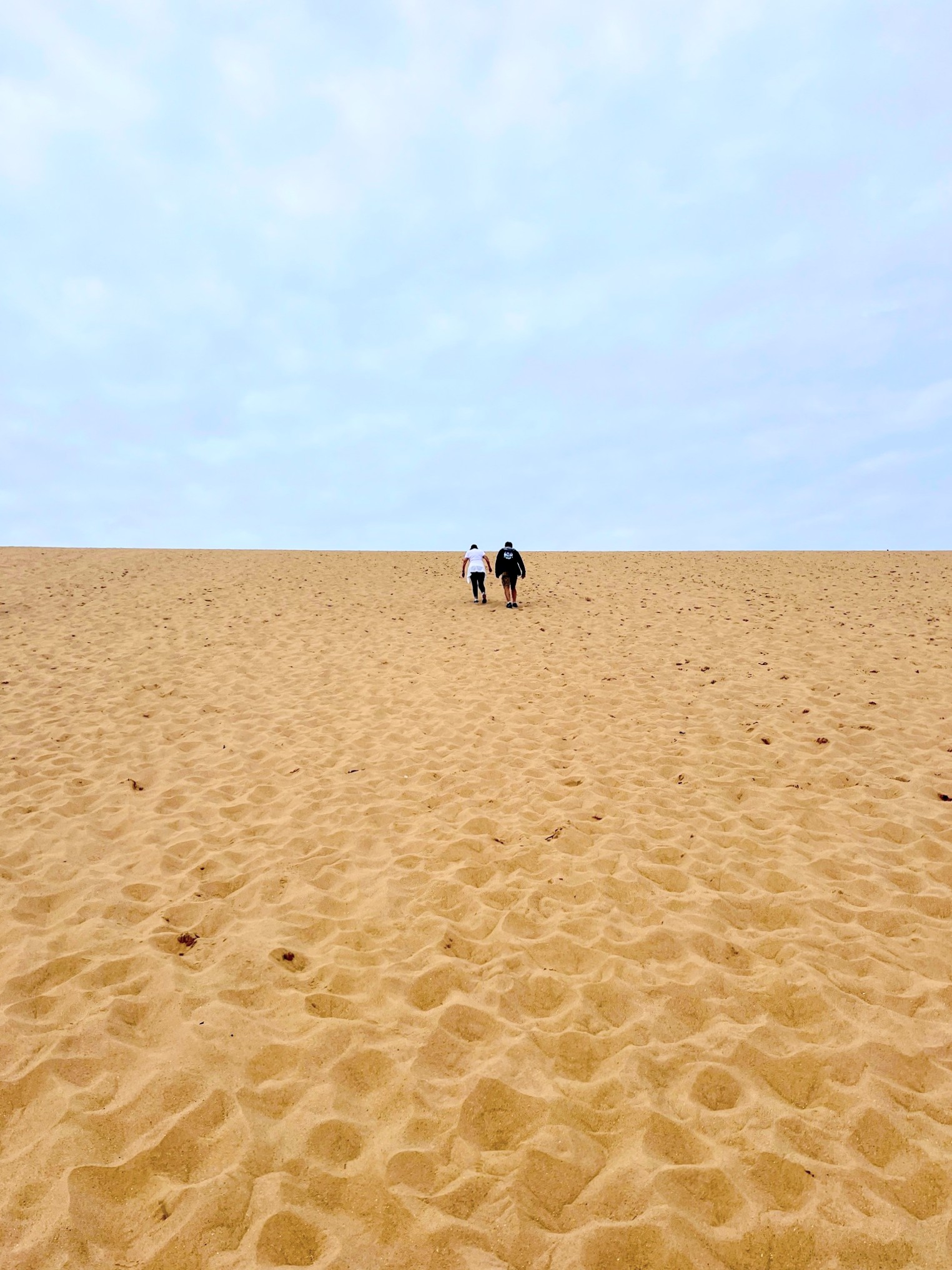
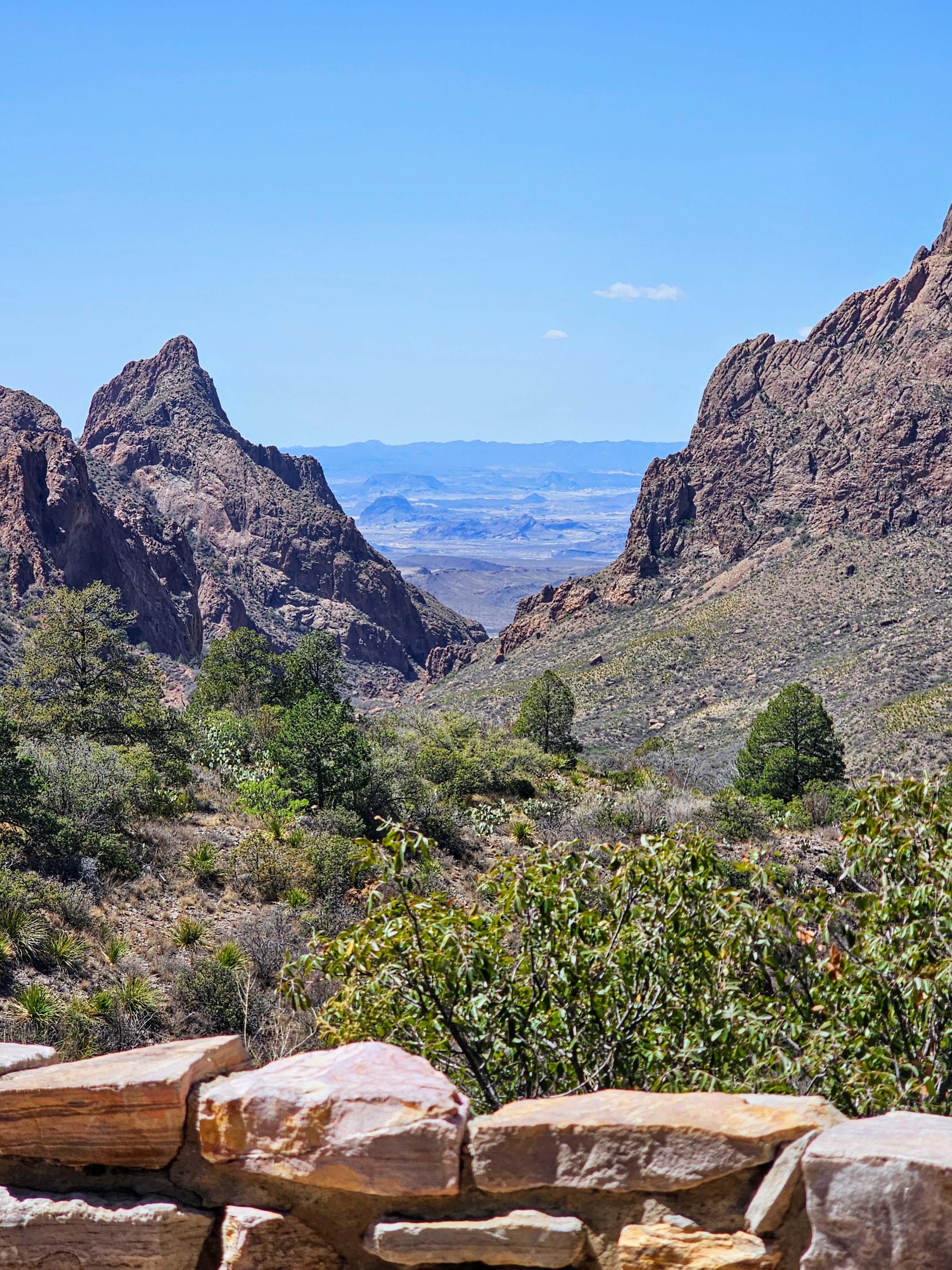
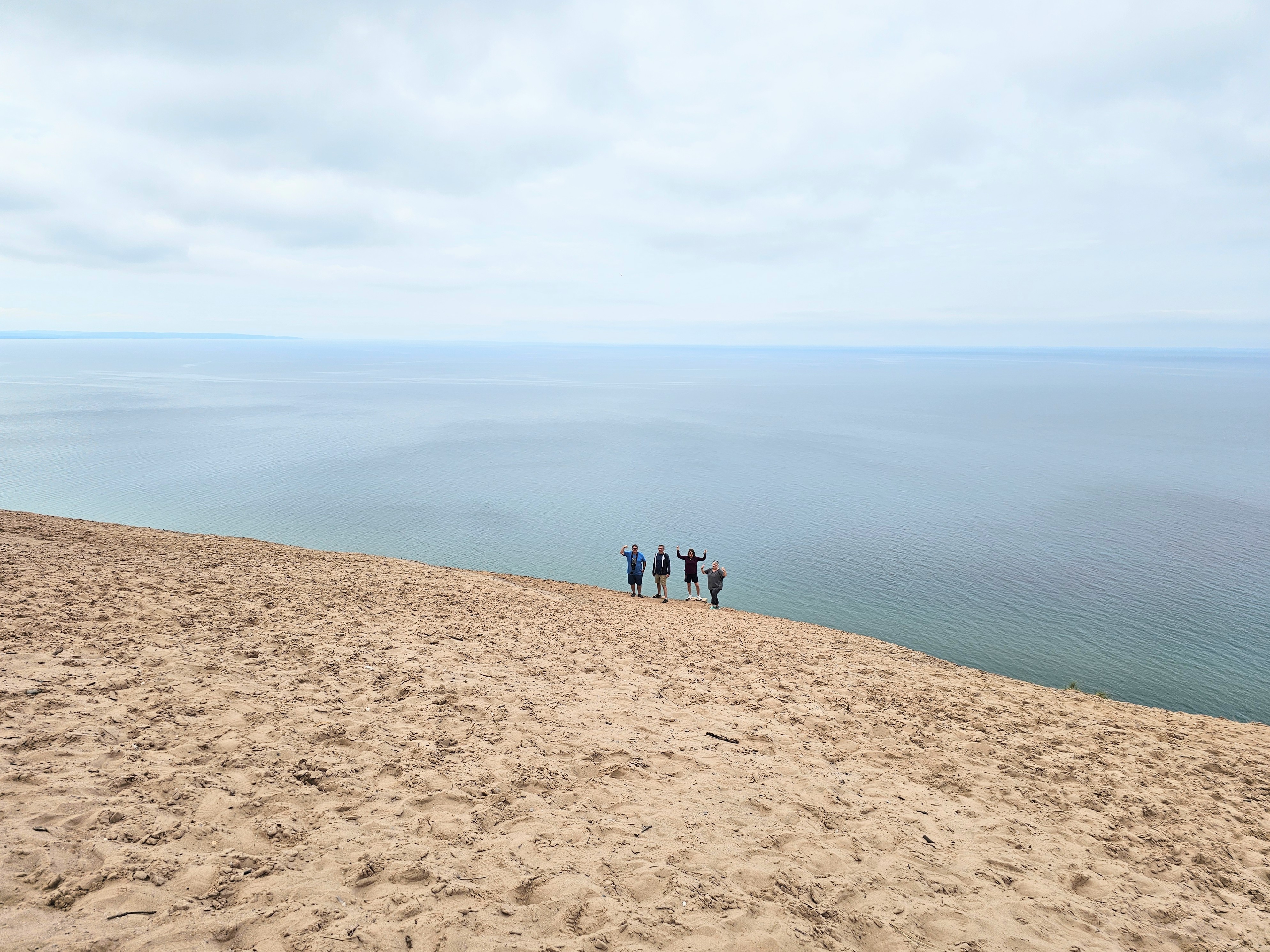
We continue along to our next point of interest in the park, Scenic Drive Stop #9, the Lake Michigan Overlook. This dune stands 450 feet above sea level with a 45 degree incline – you have to see it to believe it! Photos don’t really do this one justice or emphasize the force of gravity. I fully understand why many people call this one the “Dune of Death!”

The shoreline at the base of this tall sand dune is almost vertically straight down from a level area that you enter near the parking area. We could only see a clear beach view, far below us, from a trail to the left side of the dune. People who had made the trek down to the beach were teeny tiny, ant-sized specks from where we stood!

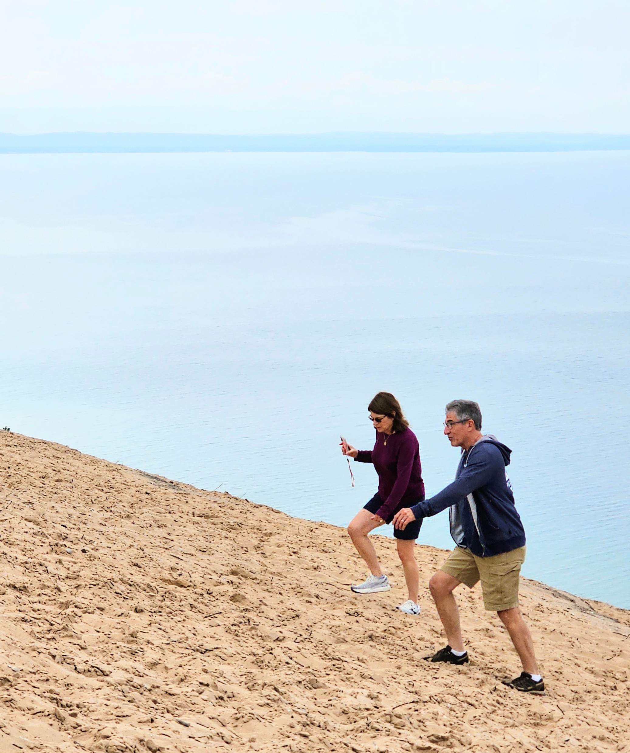
A large sign near the parking area warns that “emergency evacuation” from this sight can cost up to $3000 per person. The message was loud and clear for me! I had read that it takes approximately 15 minutes to walk down the dune, all the way to the bottom, but it can take 1-2 hours to get back up. No thank you! My calves burn just thinking about it.

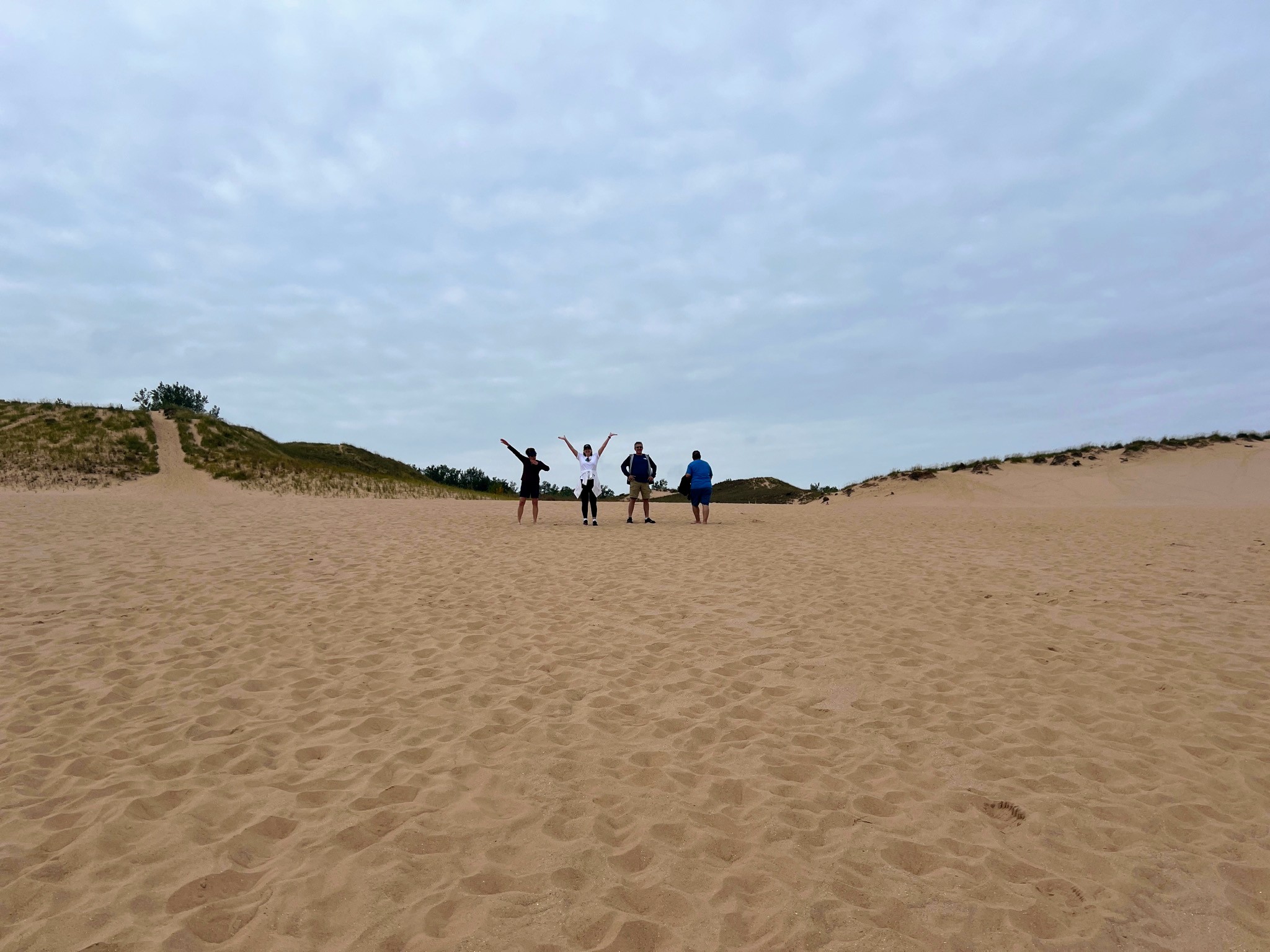
After doing a head count and feeling relieved that we did not lose any of our group here, we loaded up and continued our journey. We made a quick trip to the Visitor’s Center and were on to our next adventure. Our next scheduled stop was the Dune Climb Trail and a picnic lunch. Sandy shoes and gritty socks were a permanent fixture in our day from this point on.

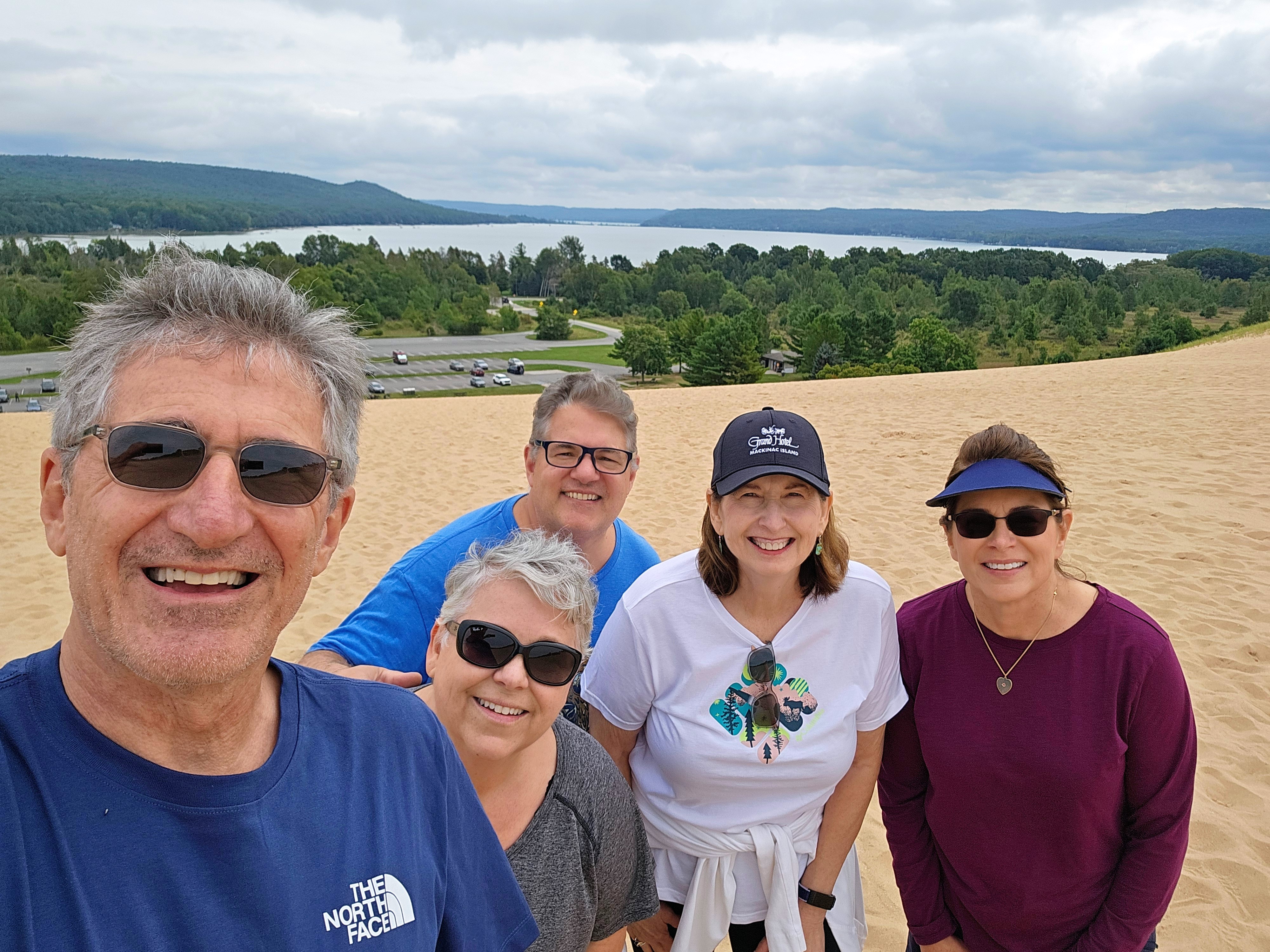
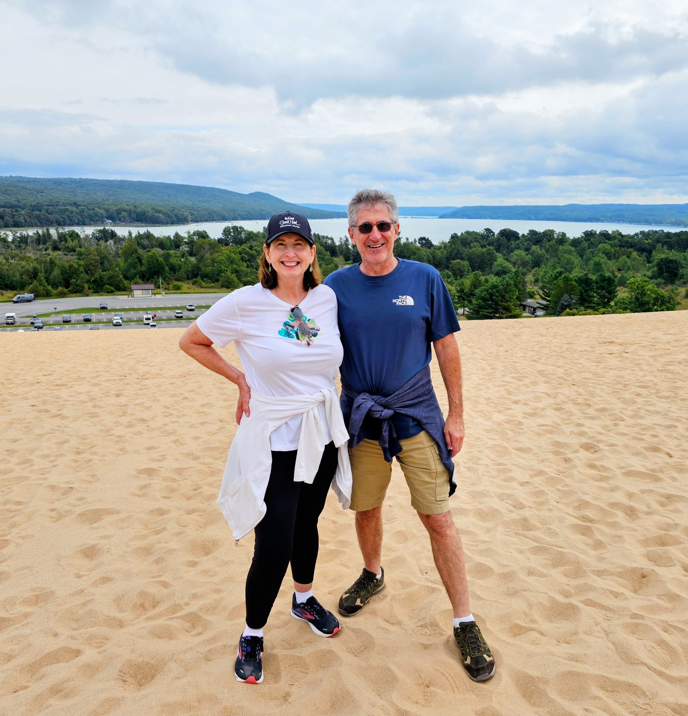
The Dune Climb was my favorite spot of the day (especially after a delicious picnic lunch of Italian deli sandwiches, smoked fish and cookies!). The actual hiking trail here is almost 4 miles long but we felt a sense of accomplishment just making it up and over the first big sand dune! Whether barefoot or in shoes, walking in this deep, fine sand is quite a workout. Sand dune climbing is not for the weak and weary. I was sucking air, big time, by the time I made it to the top – but I did make it!!

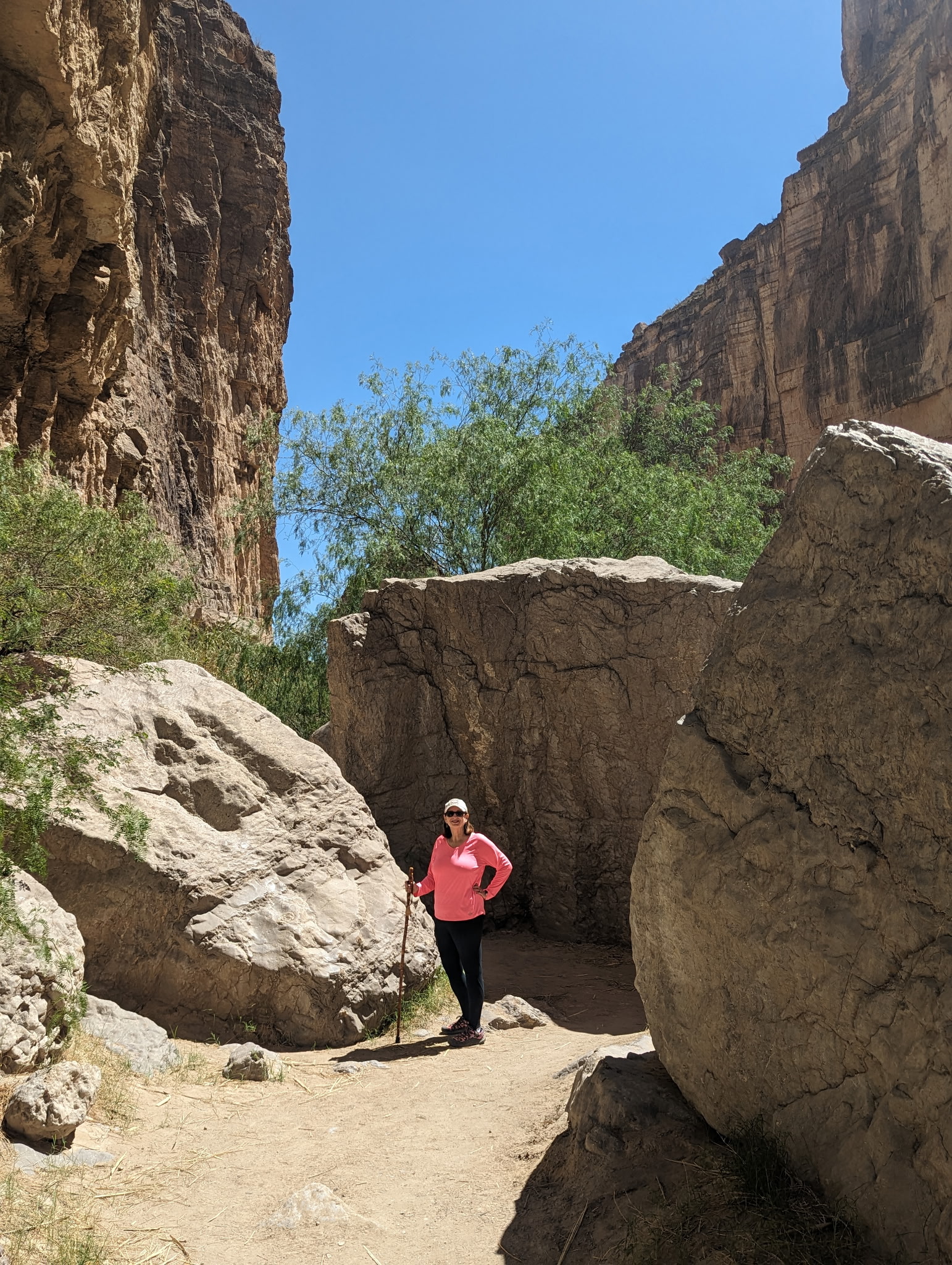
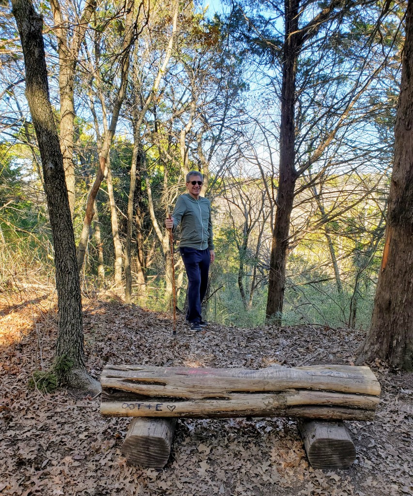
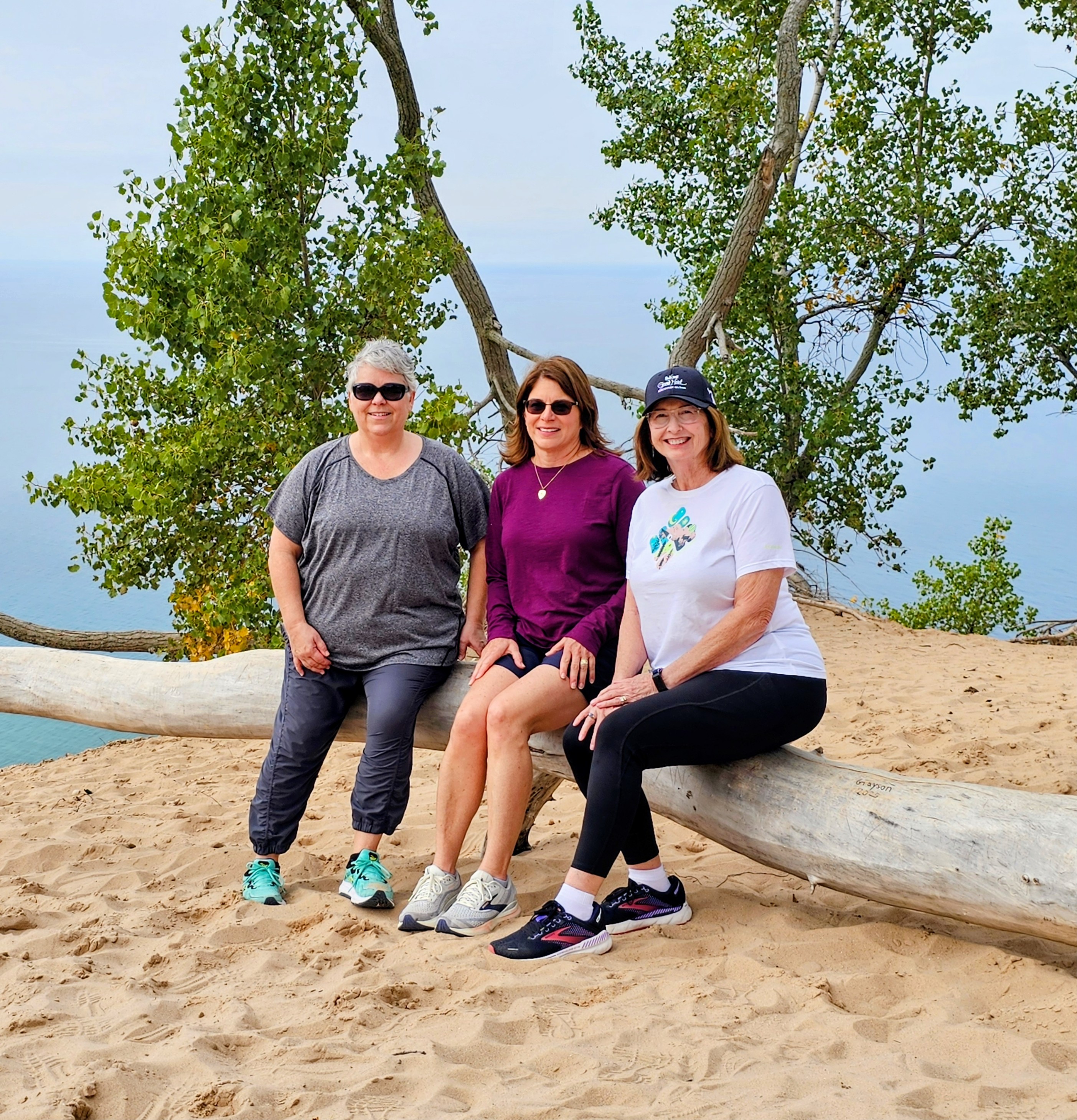
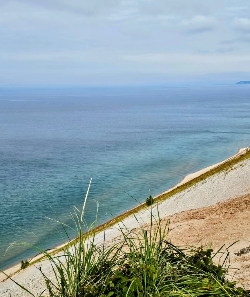
Our final stop in the park was the Empire Bluff Trail. This 1.6 mile “out and back” hiking trail offered fantastic views of the coastline from a high vantage point. The trail was well-packed and led us through a beautiful, shaded forested area before reaching the wooden boardwalk and overlook. The views of Lake Michigan and Sleeping Bear Dunes from this point were spectacular! It gave us a great perspective of where we had been earlier in the day and the gigantic size of the dunes that we had been on.

My friends and family know that I have a huge fear of bears (bear attacks, more precisely). My first interest in this park had me questioning the name. Bears? No, thank you! In fact, there are actually black bears in this area of Michigan but now they mostly live in the forested areas above the dunes. Why the name “Sleeping Bear Dunes?” The name of this park comes from a Native American story that brought tears to my eyes. The Ojibwe legend is as follows:

“Once, long ago, in the land across the great lake, there was a terrible hunger and many people died. A bear and two little cubs were trying to leave that place and come around the lake where there would be more food. They waited for many days on the beach together. But after a while the two little cubs began to whimper with hunger, and so the bear decided to swim across the rest of the lake. They waded into the water, one cub on each side of the bear, and they swam off into the lake a long way. After a while the cubs began to get very tired, and so the bear said, ‘Try hard, the land is not very far.’ And very soon they did come in sight of the land. But gradually the cubs got weaker, and only ten miles away, one cub sank into the water. Soon after the other also drowned. The bear’s heart was broken, but she could do nothing. She waded ashore and lay down, looking out on the water where her cubs had died. Eventually, both of them came to the surface as two little islands, and so the bear still lies there atop the dunes, looking after her children.”

Sniffle. I warned you. Today, the momma bear is seen as one of the big sand dunes and the cubs are seen as North Manitou Island and South Manitou Island, right off the shore. This is not exactly a cheery tale but we did see the story in print as a children’s book.

Regardless of the very sad tale that this park is named for, we had a wonderful, joyful day and made memories that will last a lifetime. Sleeping Bear Dunes National Lakeshore is one of those places where “seeing is believing” because photos just cannot do it justice. It is well worth a visit!

Big Bend National Park

Texas

I finally got to check another national park off my bucket list this past month – Big Bend National Park!

Driving from the Dallas/Ft. Worth area down to Big Bend National Park is about a ten-hour drive. I have lived in Texas for over 40 years and finally got to see parts of this vast state that I hadn’t experienced before. Pumpjacks, cattle, petroleum facilities, windmills and desert landscapes were prevalent along the highways and byways as we headed southwest.

My husband and I stayed in Terlingua, Texas in a cute little luxury A-frame rental (Stardust Big Bend) that was just a few minutes from the park entrance. It was a prefect location for our “home base” and provided all the amenities that we needed. We especially enjoyed relaxing on the covered deck in the late afternoons and watching the dark skies at night from our back porch.

We began our first day in the park with the required photo-op at the official park sign – a “must do” if you travel in my company! There were only 2 cars ahead of us when we reached the park entrance and we didn’t have to wait any time in line. My husband showed our park pass and kindly thanked the park ranger for his service and dedication to our National Parks. We were promptly waved through.

We headed east on the park roads towards the Panther Junction Visitor Center to get our bearings, check maps and closures, and see the exhibits. From there we drove southeast to the Rio Grande Village, the easternmost part of the park. The drive was quite beautiful as morning clouds gave way to clearing skies, allowing the mountains and meadows to come into clear view.

After reaching Rio Grande Village Visitor Center, we got directions to the Rio Grande Village Nature Trail trailhead and began our first trek from a campground parking lot. The trail began in a cool, marshy area but quickly changed to a sandy, rocky trail leading toward the Rio Grande River.

This was a great first hike to experience the park. We stepped over/around quite a large amount of horse & burro droppings on the trail and soon spotted the culprits on the riverbank a few minutes ahead of us. We walked down to the river’s edge for a quick look before heading up a steep, rocky incline that afforded us great views of the river valley below. We only saw 3 other hikers on this entire trail.

This was the first place we spotted homemade “wares” (pottery, sculptures, fabric pieces, walking sticks, blankets, etc.) for sale. The items were displayed on rocks or boards with handprinted cardboard signs indicating prices and where to leave your money. We kept wondering how, when and by what manner do these people cross the river and set these up? We came across these “little stores” in all areas of the park but never saw any of the actual vendors. My husband read later that items purchased from these spots along the trails can actually be confiscated at the U.S. Border Patrol. Sad, but true.

Back to the hiking – we followed this trail up onto a high lookout point and enjoyed the view below. As we stood on the rocky precipice, we could see all the colors of the Chihuahua Desert. There were green marshy areas and cacti, white sandy river banks, yellow/brown water, blue skies, grey burros, black and white horses, and brown rocky terrain. There were also red ocotillo blooms and my red face from the exertion of the uphill climb! Going back down was much easier, thankfully.

Fun!!

After a picnic lunch back at the visitor center and some much-needed hydration, we were off to hike the Boquillas Canyon Trail located just a few minutes away. There were a few cars in the trailhead parking lot here and we encountered maybe a dozen people on this trail. The trail had quite a few ups and downs before leveling off and following along the river. The path was mostly rock and packed dirt. This ended up being a very pleasant stroll that took us about an hour roundtrip.

At one point, we were quietly walking down the trail in a shady area and came upon three “free-range” cattle napping beside the path. This was certainly not something we turn a corner and see everyday! Luckily, they were friendly, sleepy or both.

The trail eventually led us to the entrance of a high limestone gorge and the end of the hike. It was a very scenic spot with high walls and big boulders and was well-worth the effort to see. We enjoyed the view for a few minutes before turning around and heading back. We had hiked over six miles our first day and it was over all kinds of terrain.

Day one was complete. We were both tired and hungry and more than ready for dinner and a much-needed shower. We both laughed as I literally poured sand out of my hiking shoes and onto the floor back at our rental. You know you have had a great day when your shoes are full of dirt!

Day two began with an early morning drive to the southwestern part of the park. We drove the thirty-mile Ross Maxwell Scenic Drive and headed to Santa Elena Canyon, the most popular spot in Big Bend. The drive to Santa Elena Canyon was very picturesque and we made several stops along the way. The landscape was constantly changing – desert, ancient volcanoes, mountains, canyons, hoodoos, etc. As we got closer to the border, we could see the area where the large rock walls appeared to be separated, forming the canyon. That was going to be our destination.

The Santa Elena Canyon Trail parking lot was fairly full and we did see more people here than all the other places in the entire park combined. The trail began from the parking lot and soon crossed Terlingua Creek. Luckily for us, it was not muddy and was more of a dry creek bed on this day. We did have to climb up a steep bank and follow a dense, winding trail to the actual start of the canyon hike.

This trail was listed as “moderate” and we saw several people turn around on the first leg, which was quite strenuous. The trail began by going up a rocky ledge, full of switchbacks, without any guardrails at the top. I tried to hang on the inside as much as I could and not look down! Once we got over the first half of this hike, the second half was a piece of cake and leveled off along the river bank.

This was a two-mile round-trip trail located between sheer cliffs and towering rock walls with the sleepy Rio Grande River in between. The United States was on one side – Mexico was the on the other. The path led us through huge boulders and rocks until it ended on a sandy bank where the canyon wall met the river. What you see here is the narrowest point in the entire Santa Elena Canyon and it was a spectacular sight. It was very quiet. It was very peaceful. It was very easy to understand why this place was so popular. Gorgeous scenery!

We heard an owl “hooting” up above us while we were standing there on the canyon floor. It called out several times and the sound echoed through the canyon walls as we made our way back to the trailhead. This was one of those days that will forever be etched in my memory. It was such a beautiful, natural place.

After a picnic lunch near the parking lot, with a curious roadrunner on our table, we headed to the Castalon Visitor Center. We made a brief stop there and then drove onward towards the Chisos Basin. This was located more in the central area of the park and is where most of the park’s mountains and forests are located.

The park road gained elevation as it climbed into the Chisos Mountain Basin, a scenic valley surrounded by craggy mountains. This area is the heart of Big Bend and is home to the only mountain range totally contained within a single national park. This area is also home to black bears and (gulp) mountain lions!

There was a campground, ranger station, lodge, restaurant and grocery store here. There was ample parking and we walked the Window View Trail for great views of the park from this high vantage point. This trail had been closed earlier in the week due to “bear activity” so we didn’t hang around too long!

We took a few pics and bought some ice cream to enjoy before our drive back down the mountains into the Chihuahuan Desert and on to Terlingua. We had enjoyed two full days in Big Bend National Park and I really wished we had had one more full day. Three days would have been perfect for a trip here – two days was a little rushed. We never made it to the northern part of the park to Persimmon Gap and I regret not having time to see the fossilized rocks and petroglyphs in certain areas. Sigh.

Overall, we had a great trip. The park was more impressive than I anticipated. The weather turned out to be prefect and there were no crowds anywhere. We felt like we had the park to ourselves. There were no complaints with any part of our trip except for needing more time (and the l-o-n-g drive back home). There were no encounters with rattlesnakes, scorpions, bears or mountain lions – only roadrunners, javelinas, burros, cows, jackrabbits, wild horses and birds.

Official park T-shirt, check. Official park sign photo, check. Official park sticker, check. Hiking shoes held together and didn’t come apart at the soles, check.

All-in-all, this was another very enjoyable national park visit! I highly recommend.

Olympic National Park

Subscribe to continue reading

Subscribe to get access to the rest of this post and other subscriber-only content.

Glacier National Park

Montana

view at Logan Pass

I have an unhealthy fear of bears. The grizzly bear attack in the book/movie “The Revenant” still haunts me to this day. With that being said, why in the world did I choose Glacier National Park as a vacation destination? This is the one park where your chances of running into a grizzly bear or black bear on a trail, on the road, or in a parking lot are well above zero. Bear spray is a necessity at all times. Just great. What had I gotten myself in to?

I planned an itinerary, booked a cabin and rental car, got our park passes, purchased our vehicle registration, reserved our park road permits, booked flights to Kalispell, and my husband and I were off to great adventures. Montana, here we come. A canister of bear spray would become my newest and most valuable accessory.

West Glacier entrance

Why did we choose to visit Glacier National Park in spite of the bear population? Glacier National Park is one of the most beautiful of the US national parks and is nicknamed the “Crown of the Continent.” The park encompasses over one-million acres of glacier-carved peaks and valleys, two mountain ranges, pristine turquoise lakes and streams, meadows full of wildflowers, numerous waterfalls and ancient evergreen forests. It was established as a national park in 1910 after the Blackfeet tribe ceded the area to the government. Glacier National Park is the 10th most visited park (3.1 million annual visitors) making it not only one of the most beautiful, but also one of the most popular national parks to visit in the United States.

Grinnell Lake in Many Glacier

More park visitors over the last couple of years caused restrictions to be put in place that prevent overcrowding within the park, hence purchasing vehicle passes/registrations was necessary prior to our trip. We appreciated that the crowds were very manageable throughout our visit and we never had long lines or traffic problems.

tunnel on Going-to-the-Sun Road

There is one main highway that cuts through the center of the park, the Going-to-the-Sun Road (GTTSR). The scenic GTTSR connects the west entrance to the park with the east entrance (50 miles/2 hours drive time). We drove it easily and without any access issues due to the pre-purchased passes that were required for each vehicle driving within the park boundaries.

our cozy little cabin

I found us a great little Vrbo rental in Essex, Montana that bordered the southern edge of the park, perfectly located about halfway between the west and east entrances to the park. The cabin was clean, cozy, comfortable and well-stocked. We cooked breakfast each morning, packed up our picnic lunch, went on our daily adventure, and returned each evening to cook/grill our dinner. A large mule deer welcomed us on our very first morning and a mink and chipmunks scampered around near our firepit each day. We had found a great little “home away from home.”

behind Lake McDonald Lodge
the beautiful lobby at Lake McDonald Lodge

Day #1 – We drove through the West Glacier entrance that morning and headed to Lake McDonald, the largest lake in the park. We explored the historic Lake McDonald Lodge (built in 1914) and grounds before taking a boat ride on the beautiful lake. After a picnic lunch, we drove the Going-to-the-Sun Road and stopped at several turn-outs to view McDonald Creek and the amazing scenery along the way. Mid-afternoon, we parked and hiked The Trail of the Cedars. This was one of our favorite hikes! The trail was a raised boardwalk or gravel trail that winds its way through a thick forest of towering cedar trees. The highlight for us was the view of Avalanche Gorge from the trail with its turquoise water tumbling down colorful moss-covered rocks. The damp weather made it feel like we were exploring a rainforest. Even though it was a drizzly afternoon, nothing could take away from the beauty of this trail. We loved it!

Avalanche Gorge as seen from the Trail of the Cedars
hiking the Trail of the Cedars

Walking back to our parked car after our hike, we heard our names being yelled from the parked car at the crosswalk. Really?! The people in the car were actually close friends from our hometown in Texas. One million acres of national park, 1749.5 miles away from home, and we happened to be at the exact same place at the exact same time. It was just plain weird! All you math geniuses can figure out those odds – it hurts my head just to think about it.

Mick & Lisa Tune, our friends from Rockwall, Texas
McDonald Creek along the GTTSR

Day #2 – We got an early start and drove east to the park’s St. Mary’s entrance. We had a morning boat ride scheduled on beautiful St. Mary’s Lake that included a hike to a waterfall. It was a gorgeous day and we enjoyed our morning adventures. David and I found a little restaurant nearby in the park and had a great lunch (huckleberry pulled pork stuffed baked potatoes!) and continued our drive on The Going-to-the Sun Road with a few scenic stops along the way. We found ourselves at Logan Pass that afternoon, the highest point of the Going-to-the-Sun Road (6646 feet) and located along the Continental Divide. The road in this area had only opened 4 days prior to our visit due to the difficulty of snowplowing such late, heavy snows. The scenery at this high elevation was amazing! We parked and hiked the Hidden Lake Trail as far as we could but it was quite difficult with the packed, icy snow underfoot. Seeing all the snow, the jagged mountains, fields of wildflowers, waterfalls, marmots, ground squirrels, and big horn sheep made for a very memorable afternoon and gave us some great photo ops!

ready for our St. Mary’s Lake boat ride
selfie at Logan Pass
Bighorn sheep at Logan Pass

Day #3 – David and I ventured to Two Medicine, a less-popular part of the park that we entered not far from East Glacier that feels off-the-beaten-path. This day actually turned out to be one of our favorites. The drive in had beautiful views and the crowds were sparse. We hiked to Running Eagle Falls, a sacred Native American burial site that celebrates an infamous female warrior and tribal leader. It was easy to feel the spirituality of this place. The double falls were very unusual and we spent quite a bit of time here. We hiked for a bit on a nature trail and soon decided it was lunch time. We drove a short distance to Two Medicine Lake and found a table at the General Store overlooking the picturesque lake with Sinopah Mountain towering in the background. Good food, great views.

Running Eagle Falls in Two Medicine
Two Medicine Lake and Mount Sinopah

After our picnic lunch and a cold huckleberry soda, we were ready for our next hike. We parked at a trailhead and headed up to Apikuni Falls. This was a tough hike for me due to the incline and it was very hot and humid. There were very few people on this trail and we were on a constant lookout for bears. Luckily, we made it to the falls and back without getting eaten. By late afternoon, we headed back out of Two Medicine admiring the scenery and the colorful wildflowers that lined the road and meadows in this scenic valley that is adjacent to the Blackfeet Reservation.

hiking at Two Medicine

We stopped for huckleberry bear claws near East Glacier when we saw our first bear! It appeared to be a younger bear and we spotted it running through a pasture near some horses. The horses seemed a little nervous at first but soon went back to grazing. The bear found a pizza box in the pasture that fully captured his/her attention for quite a while. This is exactly how I wanted to see a bear – from a distance and from the safety of my car!

bear near East Glacier

Day #4 – This was the day we ventured to Many Glacier, located on the farthest side of Glacier National Park from our cabin. Many Glacier is on the northeast side of the park and was the most difficult to get to. With that being said, I felt it was the most scenic part of the park. We arrived at Many Glacier early in the morning to secure a parking place, which worked in our favor. We spent the morning exploring the historic hotel and grounds and enjoyed a coffee while waiting for our scheduled boat tour.

Many Glacier Hotel from Swiftcurrent Lake

The Many Glacier boat tour was a “two-parter.” The tour began on the shores of beautiful Swiftcurrent Lake. We cruised across the lake, docked, disembarked and then walked 0.2 mile (over a steep hill) to the shores of Lake Josephine. We then boarded another small boat and cruised to the head of Lake Josephine. We disembarked there to do a self-guided hike to Grinnell Lake. This was a beautiful trail that led us through wooded areas, over streams, along narrow hillsides and over a swinging bridge before we arrived on the shoreline. Grinnell Lake had beautiful turquoise waters and was surrounded on three sides by towering mountains and snowy glaciers. It was breathtaking! David and I sat and ate a picnic lunch on a fallen log and took in all the beauty around us. We were even lucky enough to spot a grizzly bear loping through snowfields on the opposite side of the lake before it disappeared into a valley on the far side of the lake. Bear sighting number two….check! We also saw a huge bull moose standing waist-deep in Lake Josephine on our return boat trip. Wildlife abounds!

selfie at Lake Josephine
Lake Josephine with Salamander Glacier and Grinnell Glacier in background

We returned to the Many Glacier Hotel later that afternoon after an amazing day. We located the bar and treated ourselves to a Huckleberry Margarita, a snack, and a short rest before the long ride back to our cabin. Another unforgettable day was in the books.

hiking to Grinnell Lake from Josephine Lake

Day #5 – We woke to another cloudy, drizzly day but decided not to let it stop our exploring. We headed back to West Glacier and spent the day at Apgar Village on the shores of Lake McDonald. We walked the shoreline, snapped a few iconic “colored rock” photos, hiked a wooded trail, shopped in the gift stores, and enjoyed coffee/lunch/huckleberry ice cream during the hours we spent there. It was a very relaxing day. On the way back to our cabin, we stopped at the Goat Lick overlook to see a herd of mountain goats that hang out on some rocky cliffs. We saw several of them!

the iconic “rock photo” at Lake McDonald
baby mountain goat

We then returned to the cabin, cleaned up, and drove back to West Glacier where we had dinner reservations. David and I wanted a nice meal on our final night and we enjoyed a lovely dinner at the Belton Chalet Restaurant. It was delicious and made for a great ending to a great trip. We returned our unused bear spray, packed up, and left for home the following morning.

We made memories that will last a lifetime. GNP, thanks for an unforgettable trip!

See you on the trails!

cloudy morning on Lake McDonald
Lake McDonald selfie
near the entrance to St. Mary’s
on the Trail of the Cedars
McDonald Creek from the GTTSR

West Glacier entry

Dinosaur Valley State Park

Glen Rose, TX

One day, a long time ago, a family of plant-eating longnecks was walking along the muddy water’s edge grazing on yummy plants and ferns. Unbeknownst to them, a herd of hungry meat-eaters was hot on their trail. Let’s just say the day ended quite poorly for the plant-eaters.

What we are left with today at Dinosaur Valley State Park is the fossilized footprint evidence of this journey and the encounter. The round, elephant-like footprints were the plant-eaters and the three-toed prints were the meat-eaters. Over 100 million years ago, many types of animals lived in this shallow Mesozoic sea area. Tidal pools and coastal swamps covered what is now the state of Texas. Today, these lower Cretaceous rocks are where we find the Paluxy River and its shoreline containing hundreds of dinosaur prints.

One area within the park contains so many preserved footprints that it is named “The Ballroom” due to hundreds of tracks moving in all directions – as if they were all dancing (or trying to keep from being eaten!). Some of the prints are on the dry limestone creek beds, some are in shallow water, and some have (unfortunately) eroded over time. The park provides detailed maps showing all the track sites.

When I stood looking at some of these well-preserved footprints, I could barely wrap my head around seeing something from 105 million years ago. How is that even possible? It was the highlight of my trip, for sure.

Besides seeing the dinosaur prints in the park, my husband and I did quite a bit of hiking with our yorkie “trail dog.” There are over 20 miles of hiking trails running all through the park and the beautiful Paluxy River Valley. Trails lead into and along the river, up over limestone ridges, through shady cedar brakes, and beside grassy prairie lands. I really enjoyed our walks alongside the clear, shallow river spotting unusual rocks, dinosaur tracks, crawfish, and fish. We also saw lots of lizards, animal tracks, and beautiful wildflowers along the grassy and wooded trails.

A few of the trailheads start near the popular and more crowded attractions within the park. The Blue Hole (definitely green) looked like a family-friendly swimming area, as there were quite a few people there. The Main Track Site had the most visitors with ample parking and easy access to prints on dry land for close-up viewing. When we ventured off on many of the other trails, there were fewer people.

I suggest wearing good hiking shoes for all the varying terrain (rocks, dirt, roots, gravel) and bringing a pair of water shoes to get up close and personal to some of the tracks in shallow water and for river crossings on some trails. Pack a picnic lunch, bring plenty of water, and enjoy the park and all it has to offer!

Reservations are highly recommended as the park limits the numbers of visitors per day. The cost for a one-day pass is $7 per car. Overnight camping is also available with reservations.

See you on the trail!

Black Canyon of the Gunnison

Montrose County, CO

Another Covid-19 vacation is in the books! My family is vaccinated but we are still trying to avoid crowds when traveling. We have spent the past year renting homes/cabins and cooking most of our meals when out of town. This rural southwest part of Colorado seemed like the perfect place to check out a National Park and visit with our adult children for a few days. It turned out to be a great trip.

We took a morning flight from DFW to Montrose. The direct flight was only an hour and thirty-eight minutes – quick trip! The Montrose airport was small (4 gates) and very easy to navigate. Getting our rental Jeep was a breeze. Our Vrbo house actually ended up being a convenient ten minute drive from the airport. So far, so good! We were ready to explore the area.

The first excursion to check off our list: The Black Canyon of the Gunnison National Park. This area has only had National Park status since 1999 and I was not that familiar with it prior to our trip. After seeing a few pics on a National Park social media page recently, it got on my radar. Though not as popular as the Grand Canyon, it certainly seemed less crowded and had some spectacular views with towering walls, spiky peaks, narrow openings and startling depths. I put in a little bit of research, found out how to get there, and off we went!

The Black Canyon National Park entrance was only twenty minutes from downtown Montrose and the drive up to the park was quite scenic as our elevation changed (and ears popped!). This route took us to the park’s visitor center that featured cool displays, info on the canyon, picnic areas, restrooms, a gift shop, campgrounds, a nature trail and a great observation platform. It was well worth a stop. I got a map, a walking stick and went on my merry way.

The route through the park along the South Rim Road was easy to drive and well-marked. It allowed us beautiful views of the Black Canyon from many overlooks, most of which only required short walks. I loved seeing all the different landscapes, plants and trees along the way. Hiking there can be as simple as strolling to the various viewpoints and overlooks or as challenging as a 2,700 foot descent down into the inner-canyon to the Gunnison River, which we didn’t do (because we are sane people!).

The Black Canyon itself was breathtakingly beautiful with its dark, solid granite canyon walls that tower almost 3,000 feet above the greenish river snaking far, far below. The canyon gets its name due to the fact that certain parts of the gorge only get thirty total minutes of sunlight per day. The walls literally look black due to the shadows. It is very, very narrow and very deep! For you geology nerds, the canyon has some of the world’s oldest exposed rock that dates back two billion years to the Precambrian era. Today the impenetrable, steep cliffs provide homes and protection to the world’s fastest bird, the peregrine falcon.

We enjoyed many of the twelve lookout points along the rim with Pulpit Rock, the Painted Wall and Dragon Point being my favorites. The Painted Wall is the highest cliff (tallest vertical wall) in Colorado. From the rim down to the river, it stands 2250 feet high and as my daughter described it, “it looks like a big ole slab of marbled steak.” It is a huge, dark granite wall with wide, white “marble” streaks running through it. The size is somewhere in the neighborhood of ginormous!

At Dragon Point, the Painted Wall was across the gorge from us and far below was the Gunnison River. The river actually looked very curvy and small from our vantage spot so high above. Our view was quite deceiving. The Gunnison River actually drops an average of 43 feet per mile through the canyon, which is six times more than the Colorado River through the Grand Canyon – just to put it in perspective.

If we had more time, I would have liked to experience the canyon from the bottom up. There is a road at the park entrance that follows a steep, switch-back route into the canyon’s depths. This would certainly be a memorable day for hiking, fishing, kayaking or rock climbing. I would have loved to have seen the mighty river up close and personal. Maybe next time…

The Ute Tribe that inhabited these tribal lands for thousands of years referred to this area as “much rocks, big water.” I don’t think anyone could have said it any better.

.

Beavers Bend State Park

Hochatown, OK

Our pandemic trips continue and we recently revisited Beavers Bend State Park and Broken Bow Lake in Oklahoma for a long weekend. We had rented a cabin and stayed in this same area earlier in the fall and enjoyed it so much that we decided to go back.

Sweetwater Cabins has some lovely rentals in this area and we chose one this time called Just-A-Swingin. The cabin was appropriately named, with a porch swing on the lower level, and had a beautiful, open-concept interior. The neighborhood is a hilly, pine-forested area just minutes off the highway and a stone’s throw away from the park entrances. Location, location, location! This cabin was perfect.

My husband and I had taken our yorkie on the last visit and she did so well that she was invited along again this trip! She seemed to enjoy hiking the nature trails with us so we are turning this nine-pound, nine-year-old spoiled lap dog into a decent trail dog!

We were lucky enough on this trip to experience great weather again. We grilled hamburgers on our deck the first night and prepared for two days of hiking to follow. Our days were full of activity and our evenings were quiet and lazy – just the way we like it!

The first full day inside the park, we chose the Beaver Lodge Nature Trail for our first hike. This was a 1.2 mile hike that started at the base of the Broken Bow Lake’s hydro-electric dam and was a great one-way hike with gorgeous scenery. The trail head was a little tricky to find since it began away from the dam’s parking lot, across a stream, and was not marked. Once we spotted some people coming off the trail, it was much easier to locate and follow.

This trail led us through a forested area, along a high ridge, and stayed parallel to the Mountain Fork River. I enjoyed the busy sounds of the rushing water and the wind in the pines. It was a truly beautiful hike. We saw several trout fishermen in the water and a few tourists climbing on the river boulders. We hiked until the trail became too narrow and treacherous and turned back around.

We explored the shoreline on the way back, climbed over some boulders, and took a short rest in the middle of the rushing water on a rocky plateau . This is where “said trail dog” plunged into the shoulder-deep water after slipping on a mossy rock. She was wet and smelly but took it like the true trooper she is!

After lunch, we were back on the trails. Our next destination was the Lakeview Lodge Trail. This is a 1.4-3.5 mile trail that started at Lakeview Lodge on Broken Bow Lake. There were three loops to chose from and it is meant to be hiked in a clockwise direction. The trail had beautiful pine trees, great views of the lake, clear streams, colorful rocks and a varied terrain. It was very quiet and peaceful. We never saw anyone else on the trail and I was quite surprised that we didn’t see any wildlife other than birds. If there had been a chance of stumbling upon a wild animal, this would have been the place!

Day one was in the books. After a delicious dinner picked up from Rolling Fork Takery (wings and potato salad), all three of us were tired and ready for a good night’s sleep.

Day two found us inside the state park again on the 3/4 mile Pine Ridge Nature Trail. The trail looped like a figure-eight and winded through an evergreen forest, a lagoon, a piney ridge, and a floodplain. It was a short trail but had varied vegetation and different elevations that were unlike any other trails. We followed the path up, down and around some very beautiful spots on this easy, shaded walk. Lime green moss, ferns, cane, and new spring flowers were the highlights.

We took a break and explored the main areas in Beavers Bend State Park and played around on the rocks in the Mountain Fork River. We drove through the park and checked out the campgrounds, pony rides, train depot, fishing spots, and kayak/paddleboat/canoe rentals. There was more to do here than we ever imagined! Another trip may be in order.

Our afternoon hike was the toughest of them all. Cedar Bluff Nature Trail is listed as a “moderate trail with minimal terrain.” What the trail guide doesn’t tell you is that the 1-mile hike is all straight uphill through a pine forest! After a little huffing and puffing on my part, we made it to a beautiful rock cropping overlook. At that elevation, we were overlooking the river, bald cypress trees and rocky cliffs below. The stunning views were well worth the effort and we took a few minutes to soak it all in.

We met another couple at this overlook where we exchanged pleasantries and took each other’s photo before we headed off. Hiking down the trail was a much easier than the hike up!

We picked up a pizza and salad on the way back to the cabin and had a quiet dinner. All three of us were tired but energized from all that we had seen and done. Once again, our trail dog had done extremely well and exceeded expectations (she also slept the entire way home!).

Another great trip to Beavers Bend State Park was in the books. I would love to return in the early fall to hike a few more trails and see the colorful foliage. I highly suggest this area for a quick weekend getaway or for a longer stay to do more activities with family or friends. Check it out if you haven’t already – it is beautiful country.

I hope to see you on the trails soon!

Cedar Ridge Nature Preserve

Dallas, Texas

During this pandemic, all travel plans had to be postponed. Since I am one who craves adventure and loves to visit new places and see new things, my only option has been exploring local nature preserves, parks and trails. My husband and I have a list of day trip options to choose from so that we can get outdoors and explore new places while socially distancing and staying safe.

We have had a couple of “just okay” excursions (trashy urban parks). Our latest really enjoyable outing was to Cedar Ridge Nature Preserve which is located about twenty minutes southwest of downtown Dallas. This is a 600 acre tract of “hill country-like” land that I didn’t even know existed!

Our research revealed that the park is maintained by Audubon Dallas and includes 10 miles of walking trails (13 trails total) that loop through a hilly, heavily-forested area that is well-known for its unusual topography. We were sold! Cedar Ridge Preserve sounded like a great choice for an excursion so we packed a picnic lunch, loaded up, and made the 45 minute drive.

We arrived mid-morning on a warm, sunny weekend and the parking lot was packed. Note to self: next time get an earlier start! The main park buildings, education center and water fountains are closed due to the pandemic (restrooms were open). I highly suggest bringing your own water or snacks and wearing sturdy shoes for the trails.

Once inside the preserve, there was a large signage board where the trail heads begin. It shows a detailed map of all the trails, routes, and the distances. There is also information depicting plants and animals you may encounter. There seemed to be trails for all skill levels. We began with the 1 mile Bluebonnet Trail and it was lovely and not crowded. The trail is unpaved with natural rocks, roots, and leaves this time of year. The Bluebonnet Trail had a gentle terrain with a lookout point midway that overlooked the valley and Joe Pool Lake. We also took a few minutes to stand in a “nature blind” to watch a rare bird species (black-capped vireos) dart to and from a watering hole. There was a wide variety of prairie grasses, trees, mosses, plants, cacti and birds that we spotted along the way.

After looping back to the main trailhead, we chose an intermediate trail for our next hike. This second trail had more limestone hills, good canopy cover, several bridges, and more steps. This more diverse terrain was rich with juniper, honeysuckle, yucca, sumac, prickly pear, oak and other types of native trees, grasses and wildflowers. It also granted us a pretty good workout!

There are trails with varying degrees of difficulty. Some are very flat. Some have more inclines, descents, and more cardio challenges. No matter what trail you choose, you will not be able to miss the unique and beautiful limestone hills, bluffs, and ridges that resemble the terrain found in and around the Texas Hill Country.

I was really impressed with this little slice of nature within the Dallas metro area and thoroughly enjoyed my day here. I think we all deserve a place where we can unplug, get outdoors, breathe fresh air, exercise and connect with nature in a personal way. Cedar Ridge Nature Preserve is a bright spot among all the asphalt, heavy traffic, and the grind of our daily lives. Check it out!

I’ll see you on the trail!

Note: Dogs on leashes are welcome. The preserve requires no fee but suggests a $3 donation. Check the website before venturing out due to closures of the park and trails during the pandemic.

Beavers Bend

Oklahoma

It was time for a break! I needed a break from the house and a change of scenery from the four walls that have kept me contained since the pandemic hit in March. Between Covid-19, the husband working from home, canceling vacations, not dining out and social distancing – I was itching for a means of escape. An Oklahoma, long weekend getaway seemed like a perfect solution.

I researched, booked a cabin, packed up the dog, prepped food, loaded supplies and headed north across the Red River for a few days.

The drive from our home (the Dallas area) was a little over two-and-a-half hours. We traveled small highways and drove through many rural Texas towns with sprawling farmland and ranches. We actually stayed a few miles north of the actual town of Broken Bow in Hochatown (“Hoach”-a-town), Oklahoma where the entrances to Beavers Bend State Park are located.

I had booked a pet-friendly cabin through airbnb (Sweetwater Cabins) located on Eagle Mountain and just minutes from the park entrances. We lucked out and had a luxurious new cabin located in a very quiet, wooded area in a beautiful neighborhood. The cabin was perfect for us and we couldn’t have asked for more.

I had never been to this area of Oklahoma so I mapped out some hiking trails and things to do in Beavers Bend State Park and Hochatown State Park. The first day, we drove into each of the three nearby park entrances, walked along the shorelines, visited the marina, and hiked nearby trails. We watched the sunset over the lake. We marveled at the numerous white-tailed deer and colorful fall foliage. It was very peaceful and a perfect place to relax and immerse yourself with nature. Note: Dogs are welcome inside the park as long as they are leashed.

The second day, we woke up to a misty morning and had to wait until noon for the skies to clear. We loaded up Scarlett, the yorkie, and headed to the Forest Heritage Tree Trail. This was a 1.1 mile trail that began at the Forest Heritage Center Museum. This very scenic path led us past a large Indian sculpture and meandered along the shale floodplain of Beaver Creek, across a bridge, through the woods, and back to the Forest Heritage Center, with informational signs along the way telling the history of the area. The fall foliage was beautiful and the towering pines were marked in white to keep us on the path. With the exception of a few places where we wanted to climb on rocks and cross the creek, this was an easy trail, and perfect for a nine-pound canine on a leash. She loved every minute!

It would be hard to run out of things to do here at Beavers Bend and we really needed one or two more days. One could go hiking, biking, boating, fishing, golfing, jet skiing, kayaking or canoeing. One could also just enjoy the geographical beauty of this area – the beautiful Broken Bow Lake and Mountain Fork River, the pine and hardwood forests, and the rocky shale cliffs. We found it to be a fantastic way to reconnect with nature, to view spectacular scenery and remain socially distant. You could choose to do as much – or as little – as you want to do.

Along the highway near the park entrances, there is a one-mile strip with pizza parlors, wineries, souvenir shops, breweries, go-cart tracks, mini-golf, a saloon, coffee shop, cafes, etc. Due to Covid-19 we did not frequent any of these places but there seemed to be a very lively business going on regardless of the pandemic. To each, his own.

If you plan to visit in the future, cabins are available for rent throughout the resort area. Some are rustic and some are breathtakingly luxurious. Rentals range in size and style and feature any and all amenities. There are tiny houses and huge homes that sleep 24 people. There are also plenty of RV sites, tent campsites, and Lakeview Lodge – if you prefer more of a hotel-style stay.

A couple of days here turned out to be the perfect little vacay for my family. We enjoyed the fresh air and hiking trails. We enjoyed cooking all our meals and relaxing in our cabin. We especially enjoyed not having to enter a public facility or deal with crowds or congested hiking trails. I will definitely be returning in the future!

If you would like any additional information, please do not hesitate to ask about my experience. I would gladly welcome comments and other people’s experiences!

Yosemite Valley

California

IMG_20190408_064531960

In early April this year, my husband and I visited California and explored three national parks – Sequoia National Park, Kings Canyon National Park, and Yosemite National Park. My previous blog detailed our trip to the first two parks and our journey along the Majestic Mountain Loop. Now we venture on to Yosemite.

After spending a busy couple of days exploring the previous two parks, we drove to Oakhurst, California and spent the night in this lovely little town located fourteen miles south of the entrance to Yosemite National Park. We felt like we needed some rest, a good meal (had some great Italian food!), and some time spent outside of the rental car. It turned out to be a smart choice for us.

We awoke that next morning, had a great breakfast, and began our short drive to the park. It was only a twenty minute drive until we crossed the border into the park but little did I know that Yosemite Valley and our hotel were at least 90 minutes ahead. The slow speed limit, road construction, winding roads, morning traffic, and park entry lines took a little longer than expected. Luckily, the drive was entertaining. We spotted mule deer by the roadside. I enjoyed seeing the snow that was still packed on the shaded sides of the road from the heavy winter snowfall. We passed through acres and acres of total devastation from last summer’s horrendous forest fires (this caused the traffic delays with crews removing trees and debris from the main road). Overall, it was an enjoyable and very scenic drive. About an hour into the park, following the curvy mountain roads – we entered Wawona Tunnel.

IMG_20190406_120110936

All I can say here is WOW!

You exit the tunnel and you are at Tunnel View, the first of many astonishing sights. This view places you at one end of the valley looking straight out at Half Dome, El Capitan, granite walls, waterfalls, rivers, and vast evergreen forests. I understood immediately why this valley is referred to as “one of the most beautiful places on earth.” The Yosemite Valley is only seven miles long and two miles wide and this lookout point pretty much presents it to you in all its glory.  We parked in one of the large parking lots and joined dozens of others taking photos from this gorgeous, panoramic spot.

090

After this photo-op stop, we  drove down into the valley and followed the circular one-way road that leads you past all of the major Yosemite landmarks. Sights that I had only seen in books, photos, and on screens appeared before me in real life: Half Dome, El Capitan, Bridalveil Falls, Yosemite Falls, Cathedral Rocks, Arches Rock, and the Merced River. Everything was larger, higher, brighter, and more spectacular than I had ever imagined. I stood in the footsteps of John Muir and Ansel Adams and soaked it all in – another one of life’s “pinch me” moments.

097

David and I were lucky enough to stay at the historic Majestic Yosemite Lodge (awesome place!) located within the park. The parking, rooms, restaurants, amenities, and location couldn’t have been any better. We could easily walk to several of the park sights or catch a shuttle at the hotel to venture farther. The free park shuttles run every 20-30 minutes and allow you to “hop on / hop off” at any stop within the valley – they were very convenient and saved us a lot of time.

077

We hiked up to the rock-strewn base of the three-tiered Yosemite Falls. We hiked to the base of Bridalveil Falls and got drenched with the ice-cold spray. We walked the trails through Ahwahnee Meadow and stood still as a herd of deer fearlessly walked by us. We stood and gazed up at the gigantic El Capitan. We enjoyed the visitor’s center and  the film that covered the history of the park. We browsed through the Ansel Adam’s Gallery and saw photographs from this area that brought him fame and fortune. We walked along the Merced River and relaxed a bit on the beautiful, sandy Cathedral Beach. We sat out on the hotel lawn one evening after a fantastic dinner and watched the stars in the night sky. We took a two-hour guided bus tour of the valley and learned a lot about Yosemite’s history, geography, geology, wildlife, and sights we saw along the way that are not in the guide books. When all was said and done, we crammed as much into two days as we possibly could and enjoyed every second!

066081IMG_20190407_132243720

There was no way we could see as much as we wanted to in such a short amount of time, but we gave it our best effort. Yosemite National Park actually covers 1200 square miles and over 95% is wilderness, with the valley being a very small part of the whole park. Luckily, April turned out to be a perfect month to visit. The temperatures ranged from the fifties at night to the seventies in the day – and we experienced warm days, blue skies, spring flowers, and fewer tourists than other months of the year.

IMG_20190407_131512817

The hotel, the weather, and the sights of Yosemite Valley were all better than we could have ever anticipated. Everything seemed to work in our favor. My one and only wish that was not fulfilled was a bear sighting! Maybe next time…

IMG_20190407_130726246_HDRIMG_20190407_115642687_HDRIMG_20190407_150822539_HDR058072