Tag Archive | hoodoos

Bryce Canyon National Park

Utah

A friend recently told me that we would spend all of our time at Zion National Park “looking up” and all of our time at Bryce Canyon “looking down.” That statement couldn’t have been more spot-on!

My husband and I spent two full days exploring Zion and dedicated one full day to seeing Bryce Canyon. Bryce Canyon National Park was spectacular and definitely lived up to all the hype. We could have easily spent more time there if our schedule had allowed.

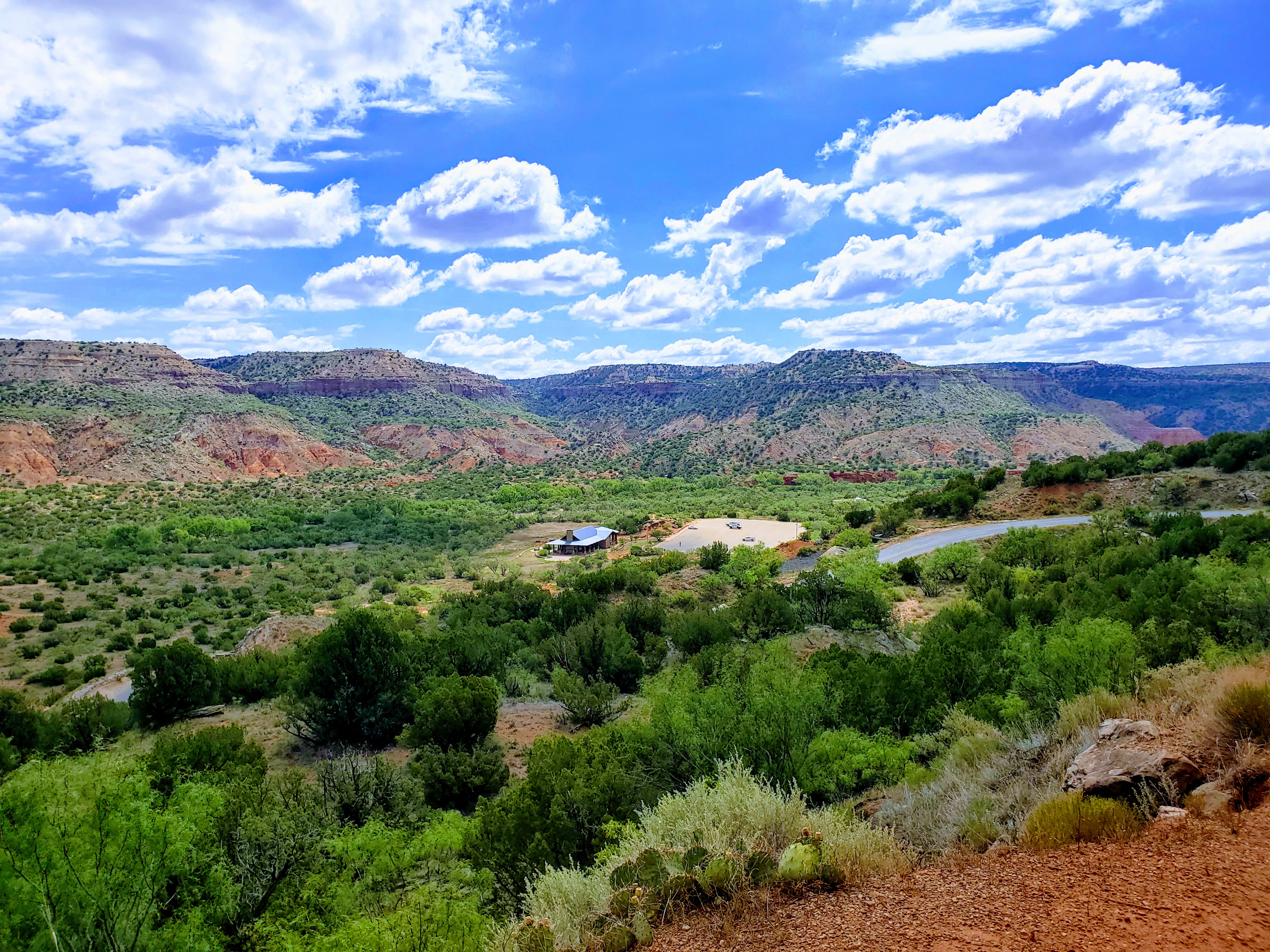
Bryce Canyon is located in southern Utah and is one of Utah’s Mighty Five National Parks (between Zion and Capitol Reef). It is approximately four hours from both Las Vegas and Salt Lake City. We traveled to Bryce from Zion and it was a scenic 80 mile drive that we easily drove in under two hours.

Bryce Canyon seems to be a little underrated and is always overshadowed by Zion, though I have never heard of anyone visiting Bryce and being underwhelmed. We certainly were not. Both parks have colorful orange and red rocks but that is where the similarities end. Bryce’s geology is very different. Both are fantastic parks in their own way and certainly deserve a visit.

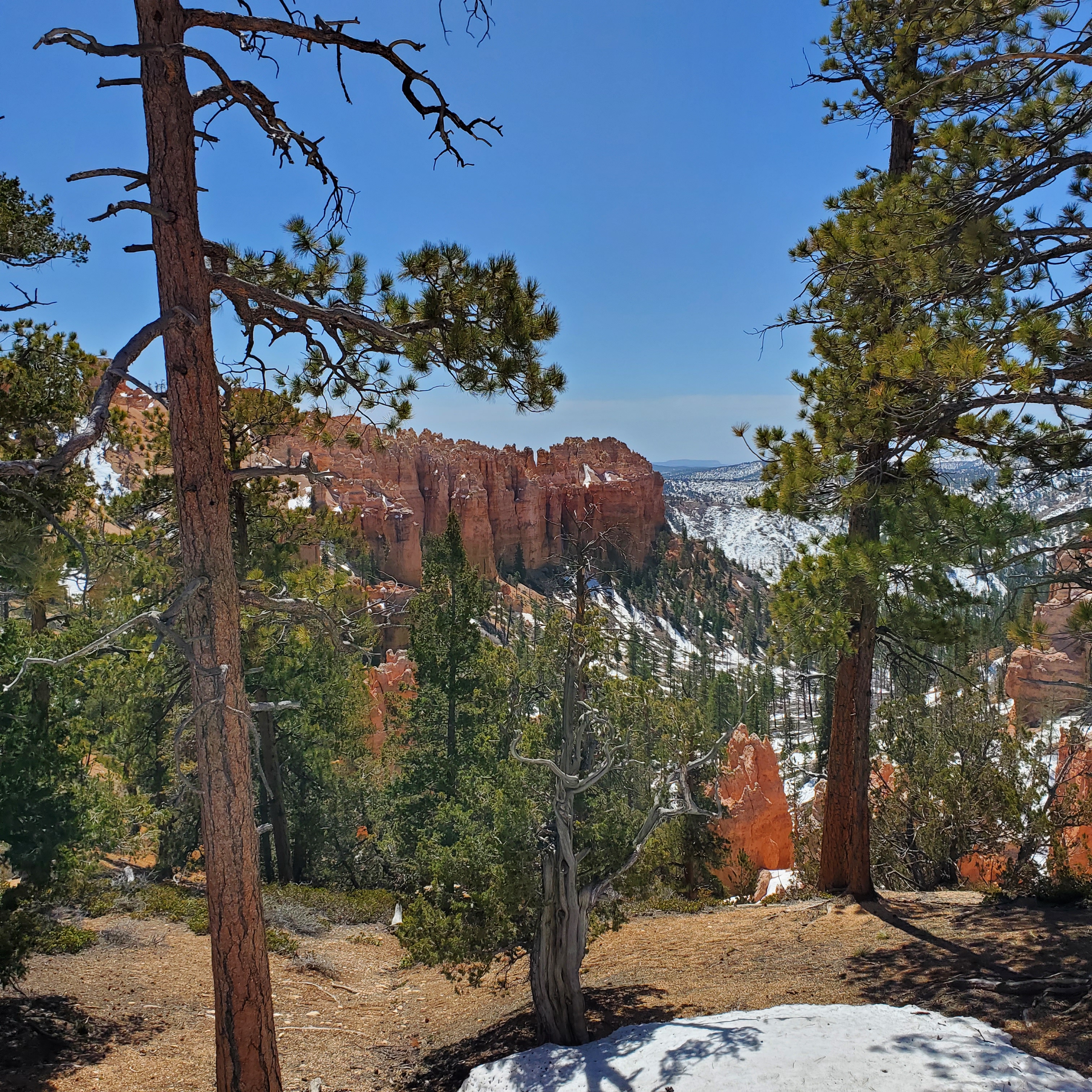
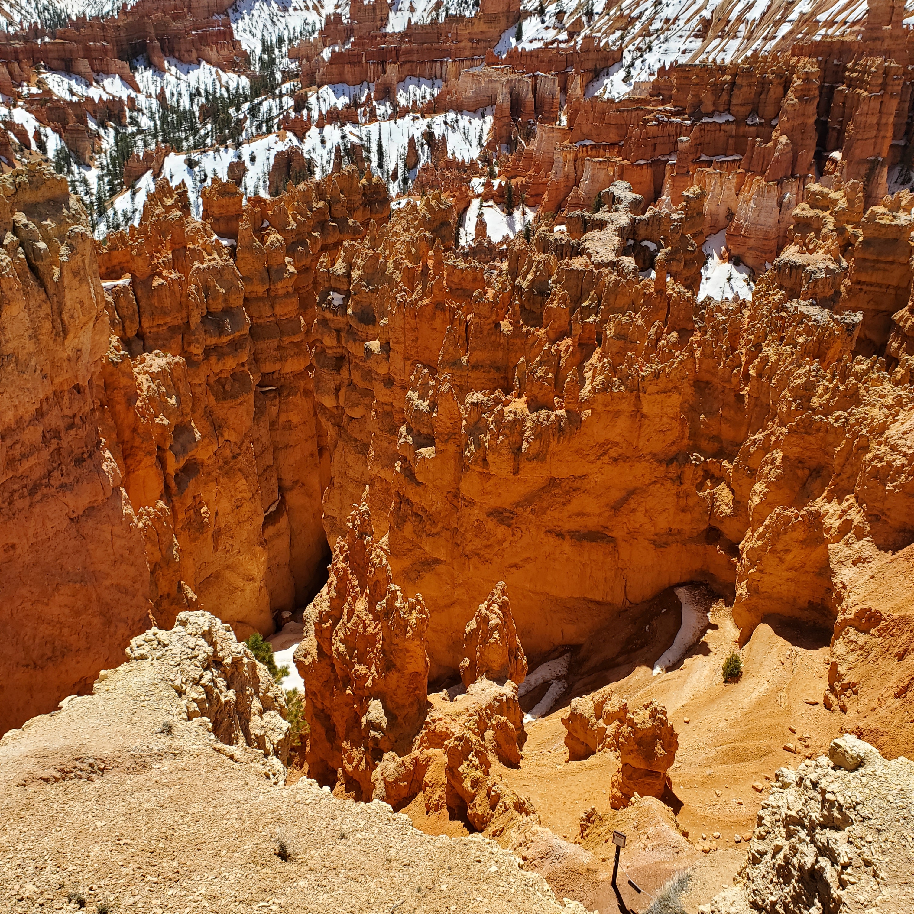
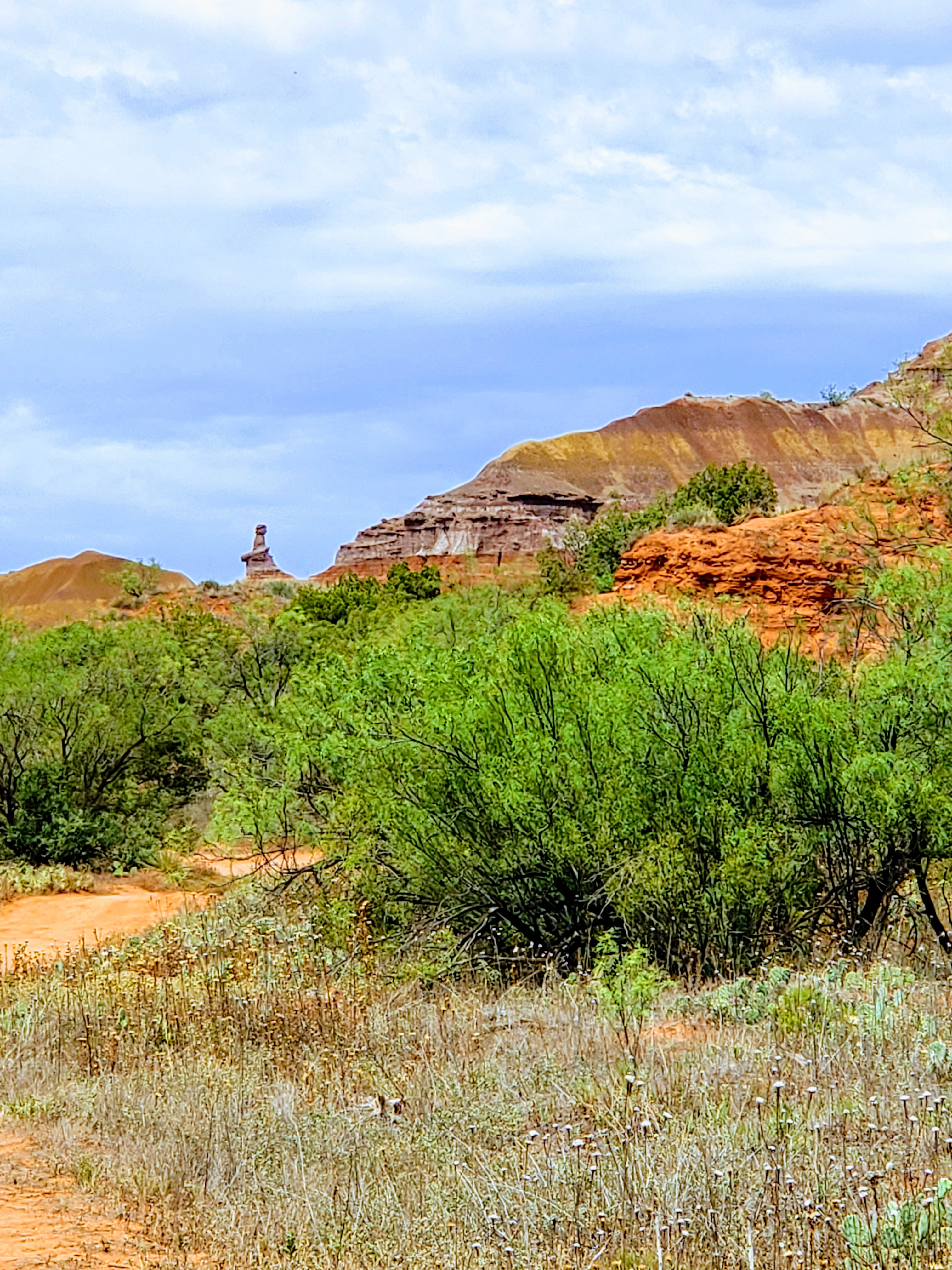
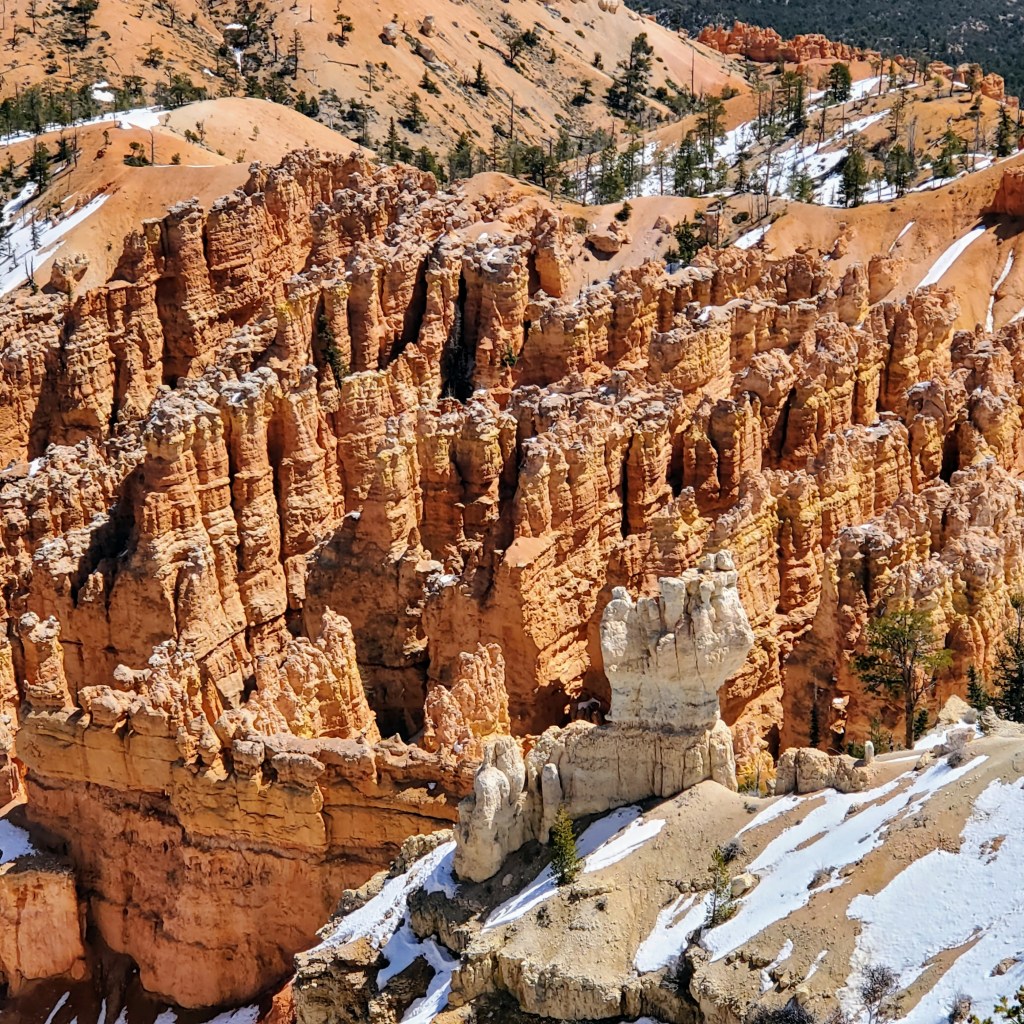
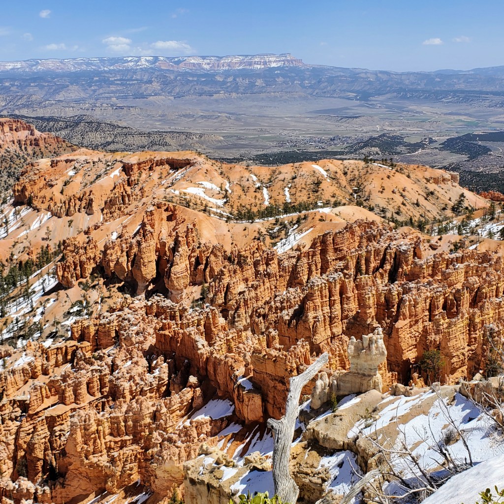
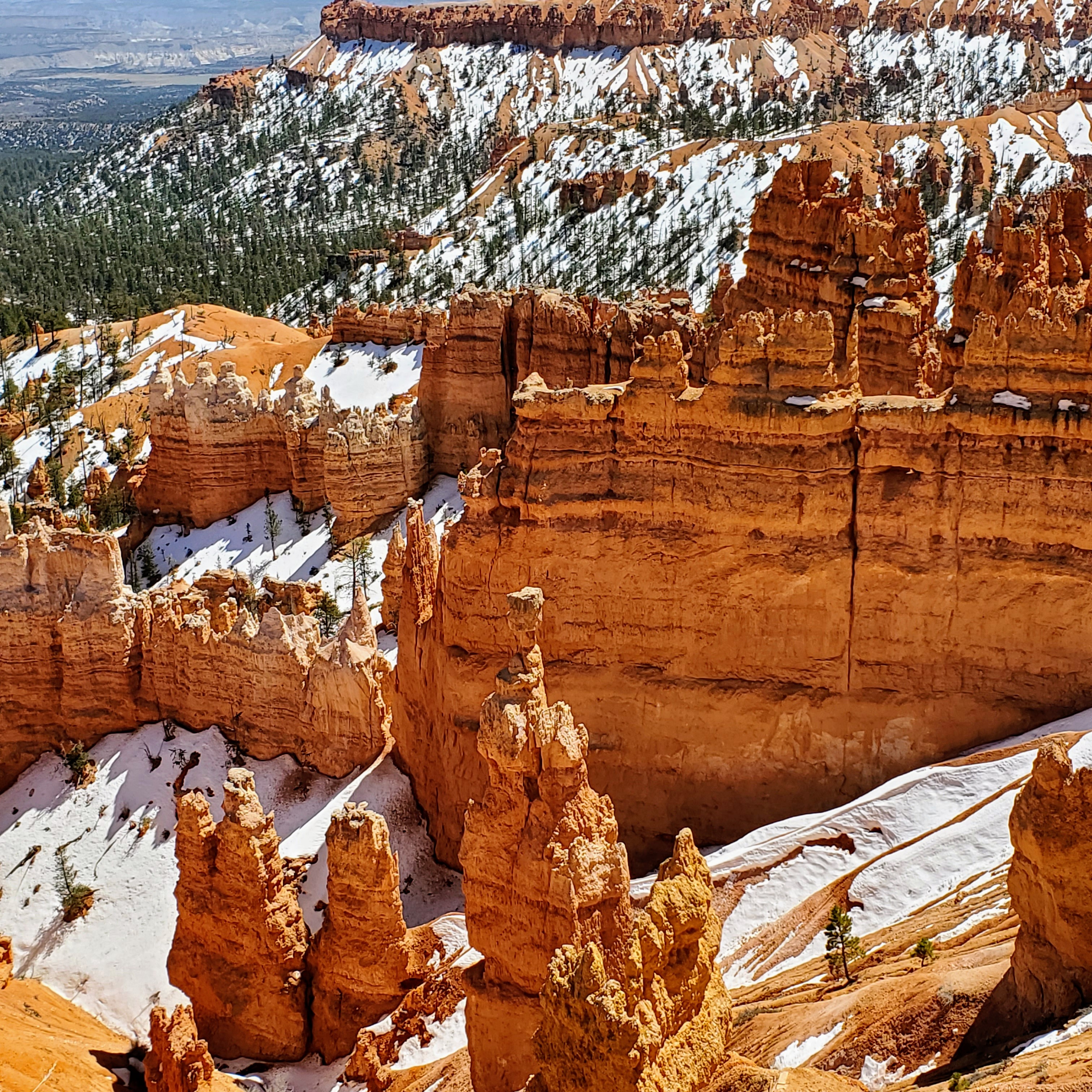
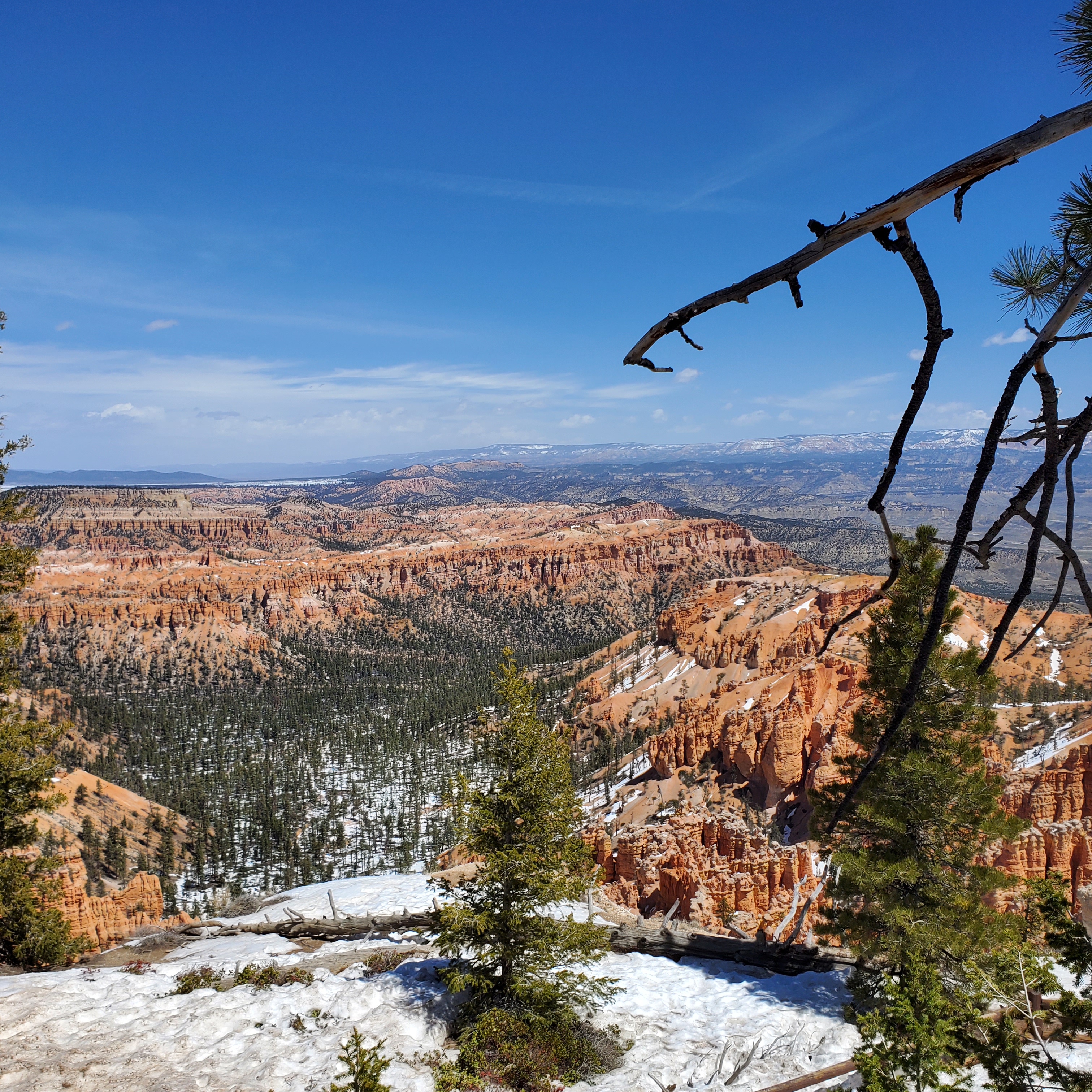
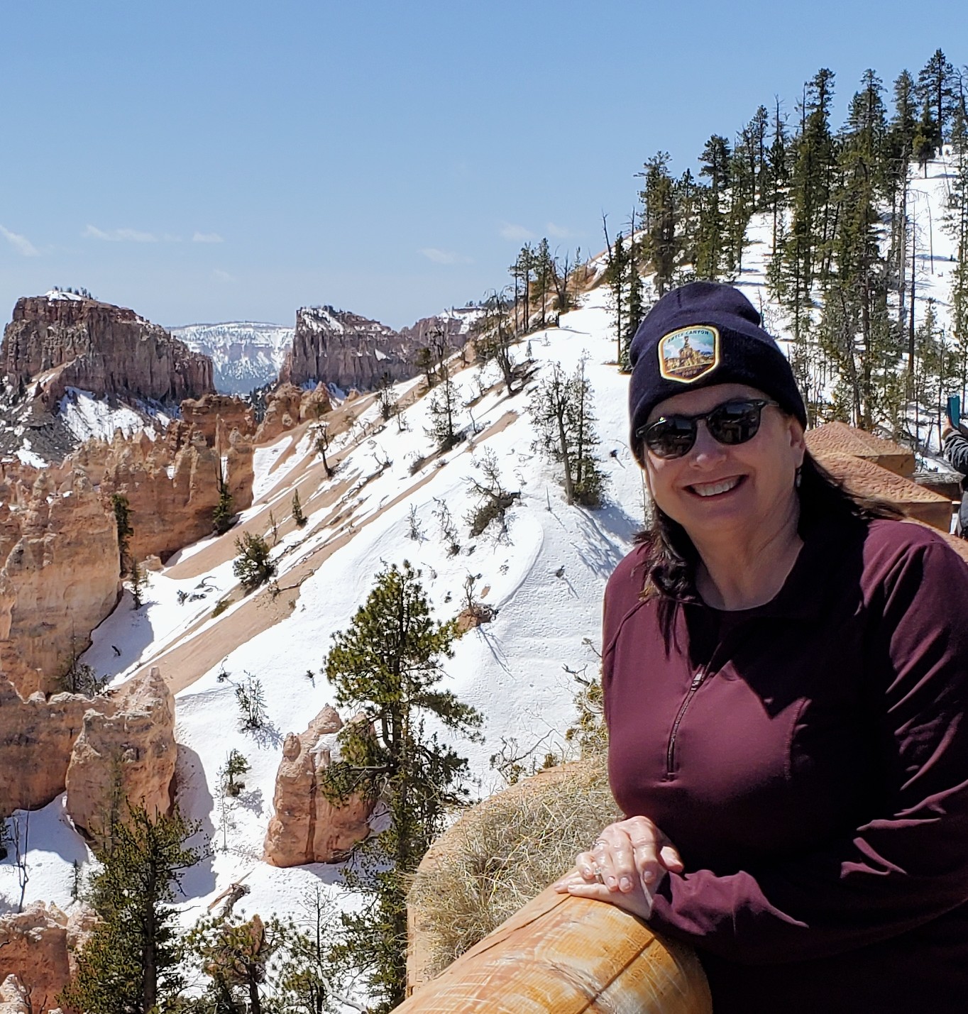
Bryce Canyon was certainly unlike anything that I have ever seen before. The park is filled with red, orange and white towering rock formations known as hoodoos. These spiky limestone “pillars” have been formed by water and wind erosion over millions of years. What we see today seems like something out of a fairytale land or maybe even another planet. Some rock formations appear to be delicate and fragile – others look like strong rock columns that have been stacked by giants. Beautiful, unusual and mesmerizing – all at once. Every view seems different with the sun and shadows constantly changing the colors. When you add in the white sandy hills, the remaining snow drifts and the green tree line in the far distance, the views are truly amazing.

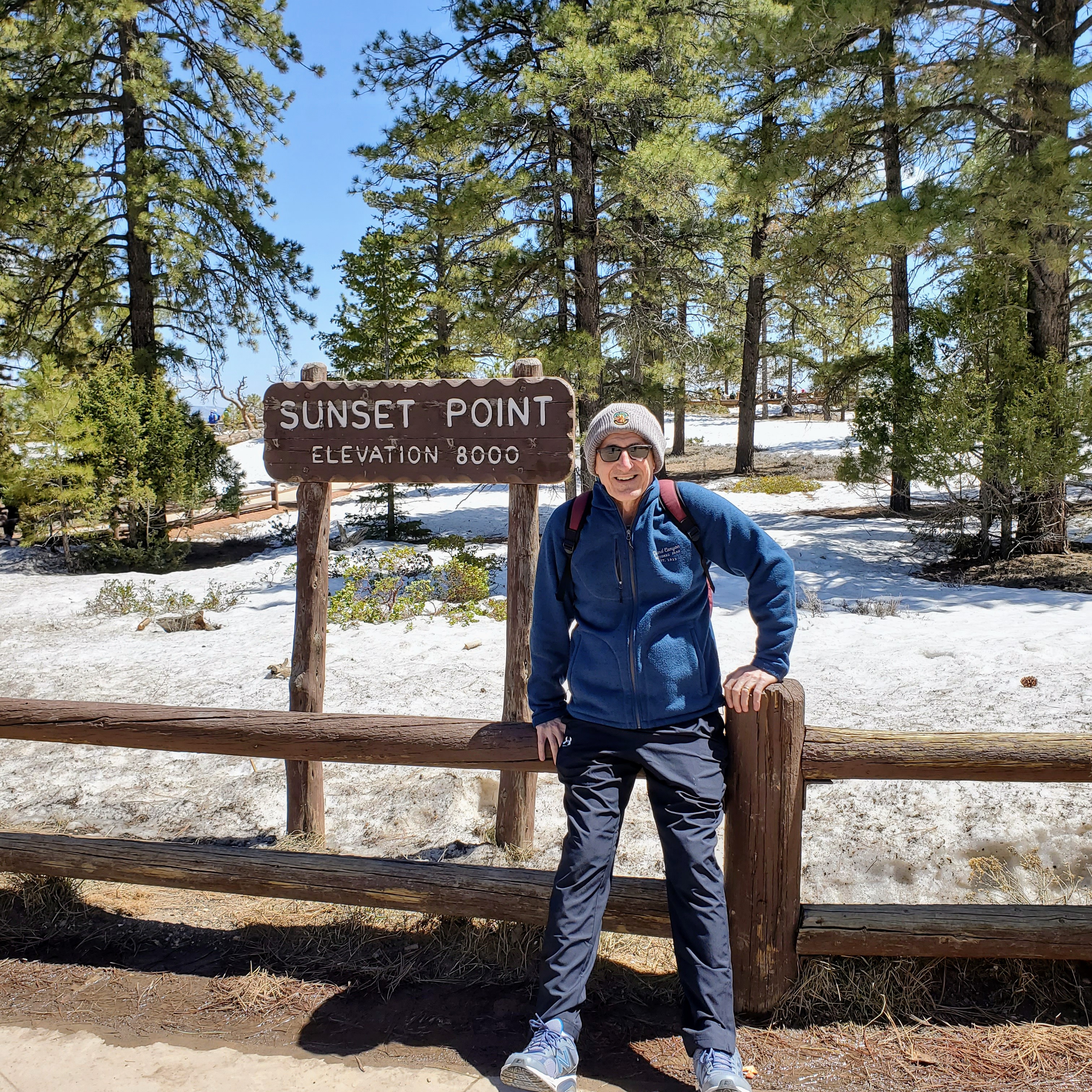
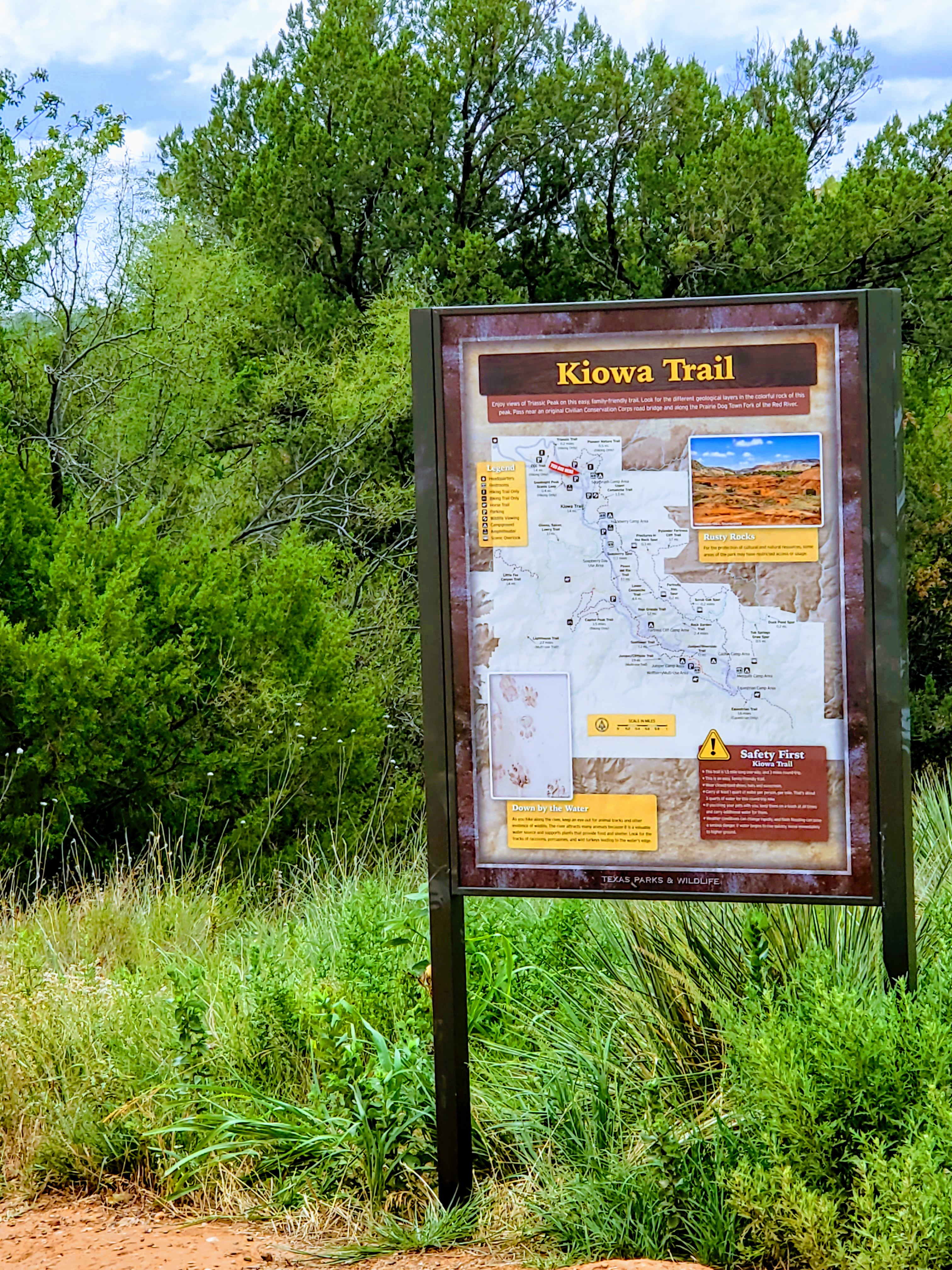
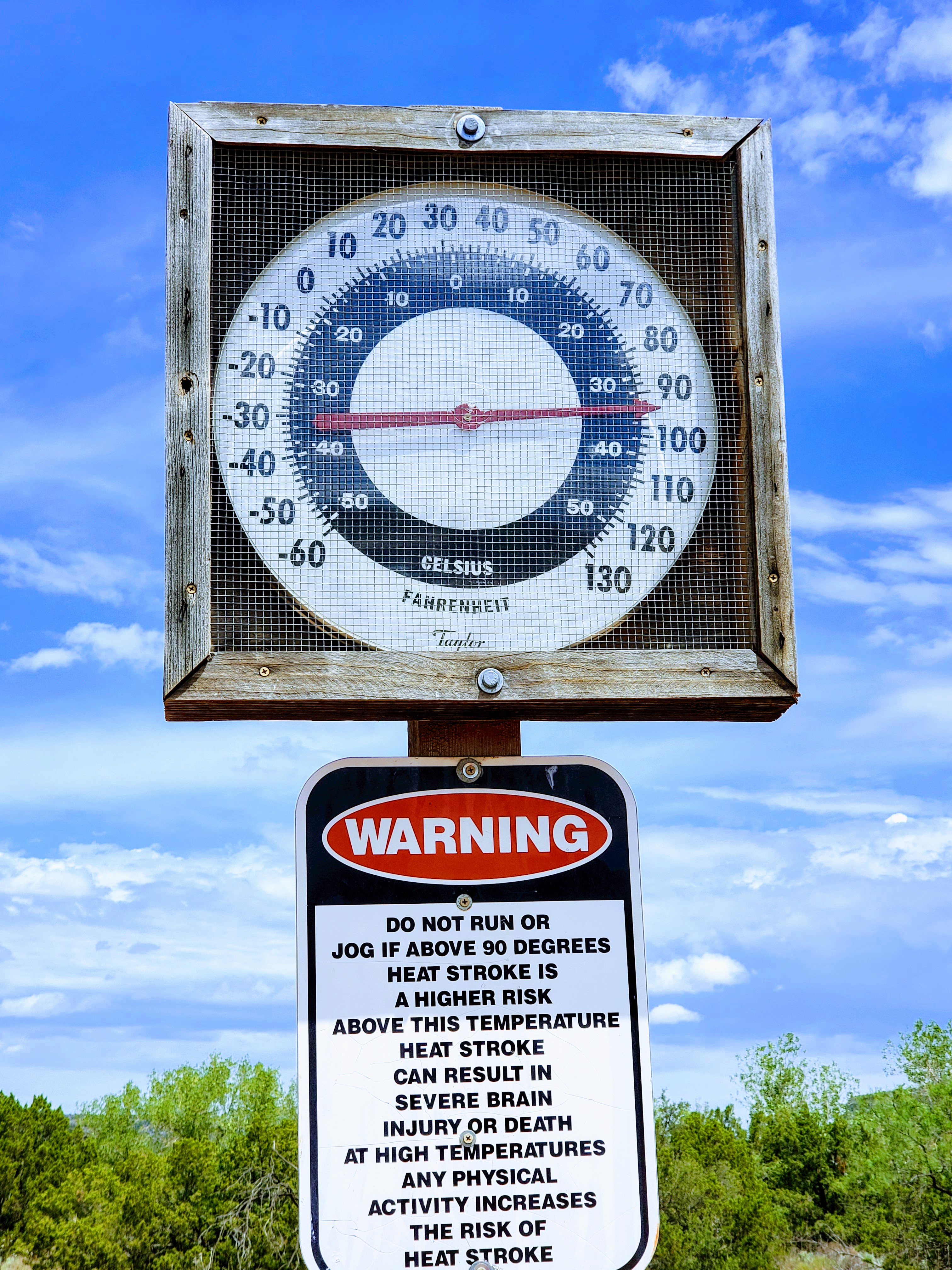
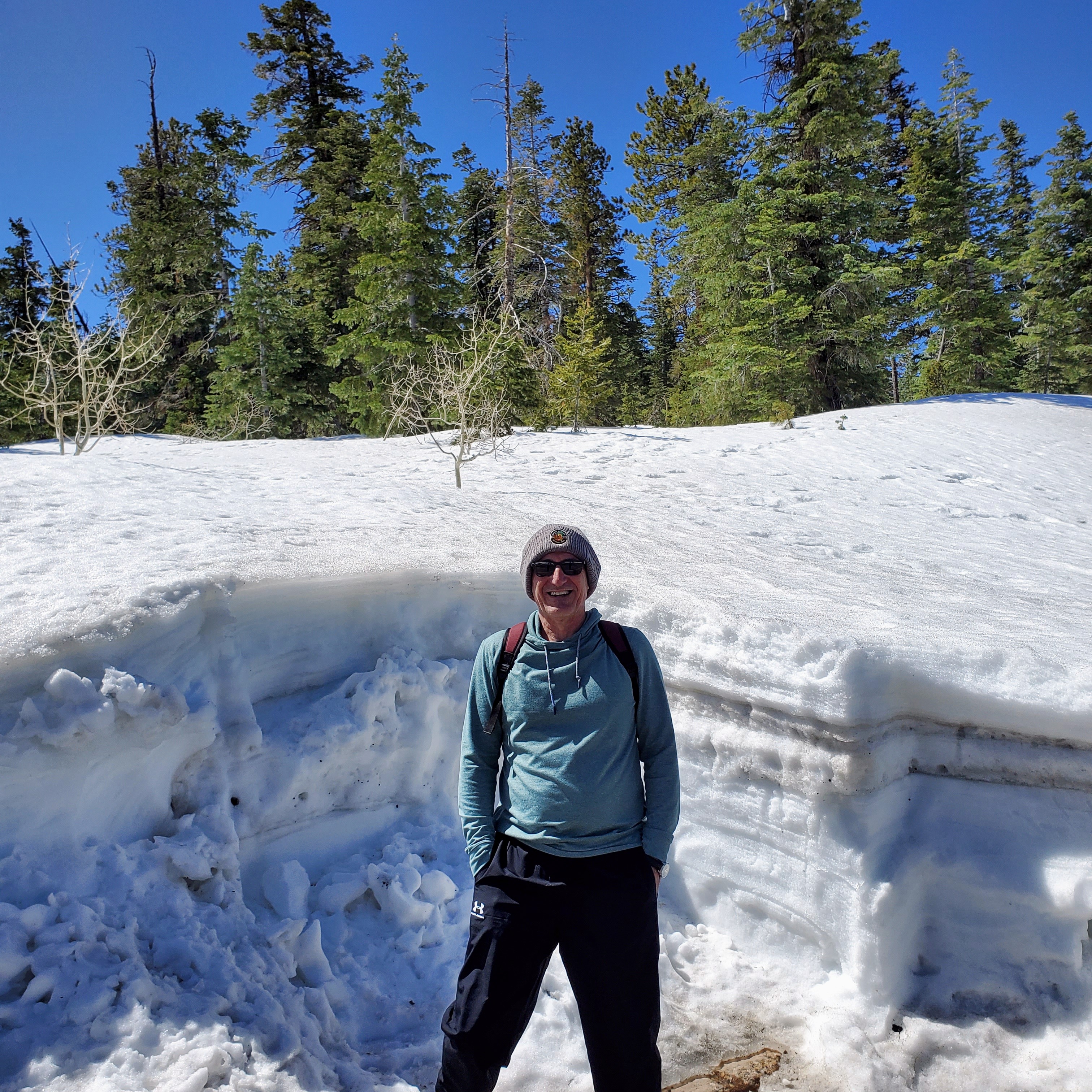
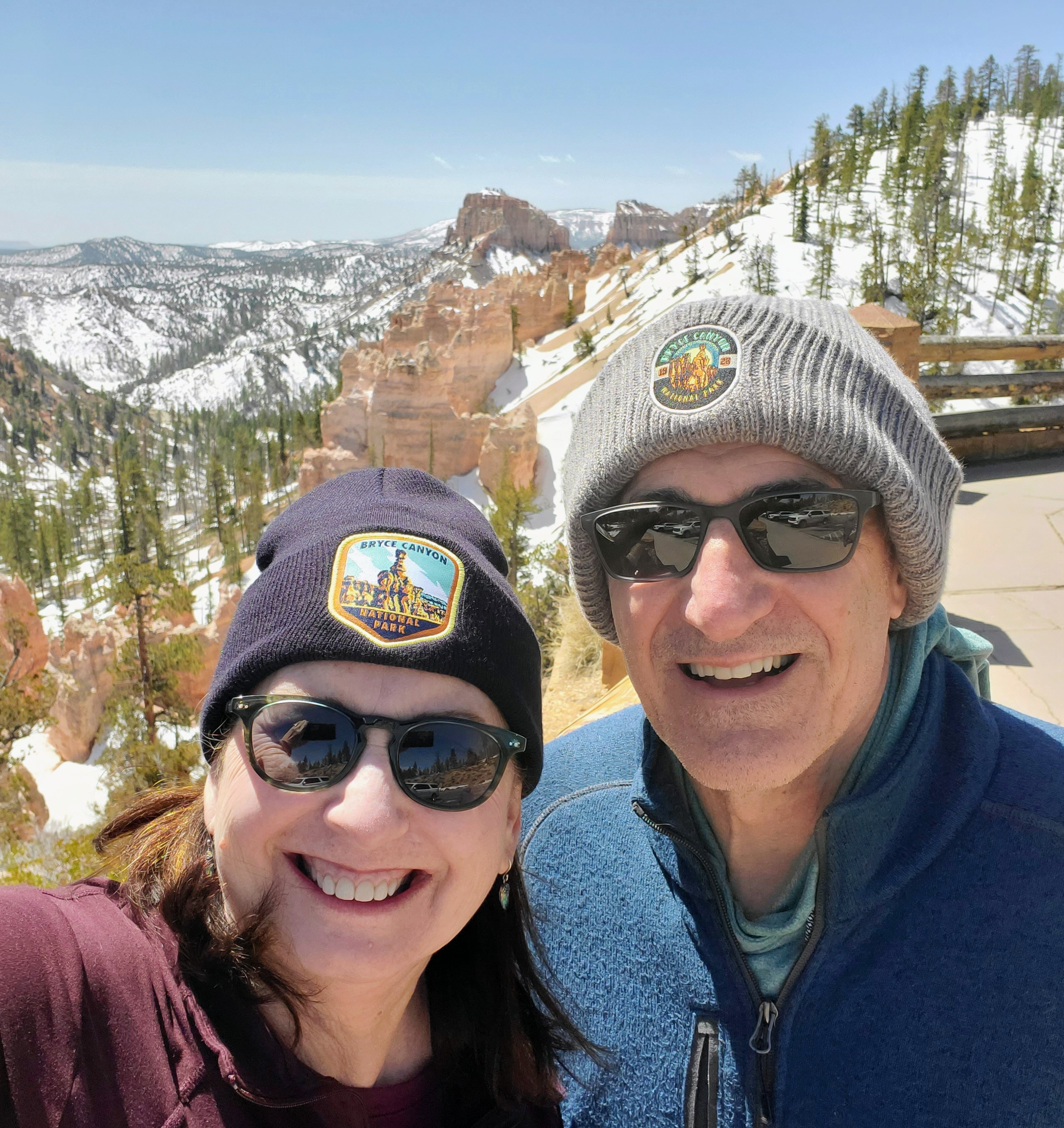
We arrived at the park entrance mid-morning and our first stop was the Bryce Canyon Visitor Center. We learned of the road and trail closures (due to snow/ice), picked up maps, and bought souvenirs. David and I seem to have a habit of always underestimating the weather in certain places we visit, whether it is due to altitude, winds or unpredicted cold fronts. It is now a joke with us to see how much money we spend in each park buying hoodies, jackets, hats, etc. for things that we could have easily packed and brought from home, but didn’t. We now have a wide and varied collection of items with many park logos, including our new knit caps from Bryce Canyon. The wind at that altitude was brutal!!

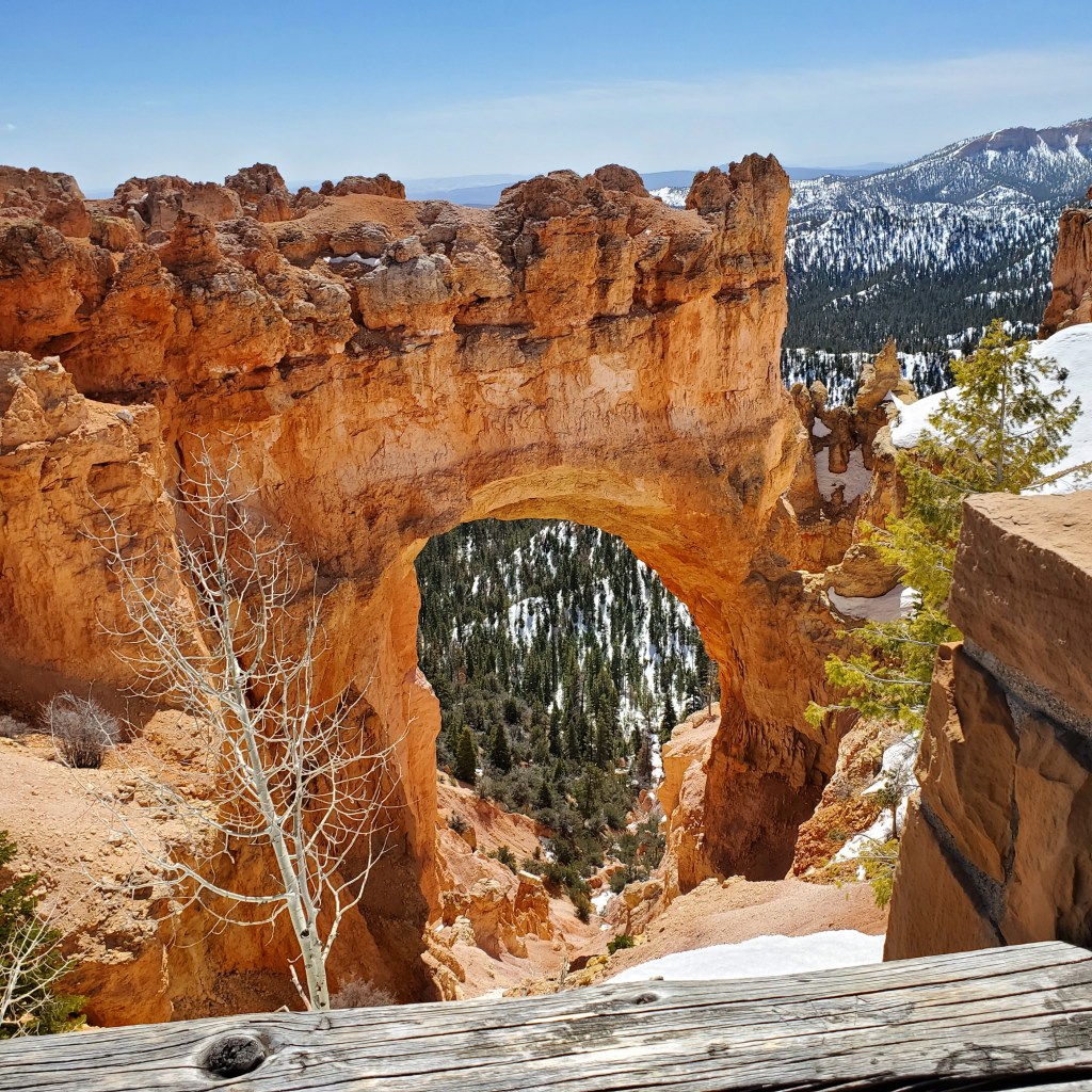
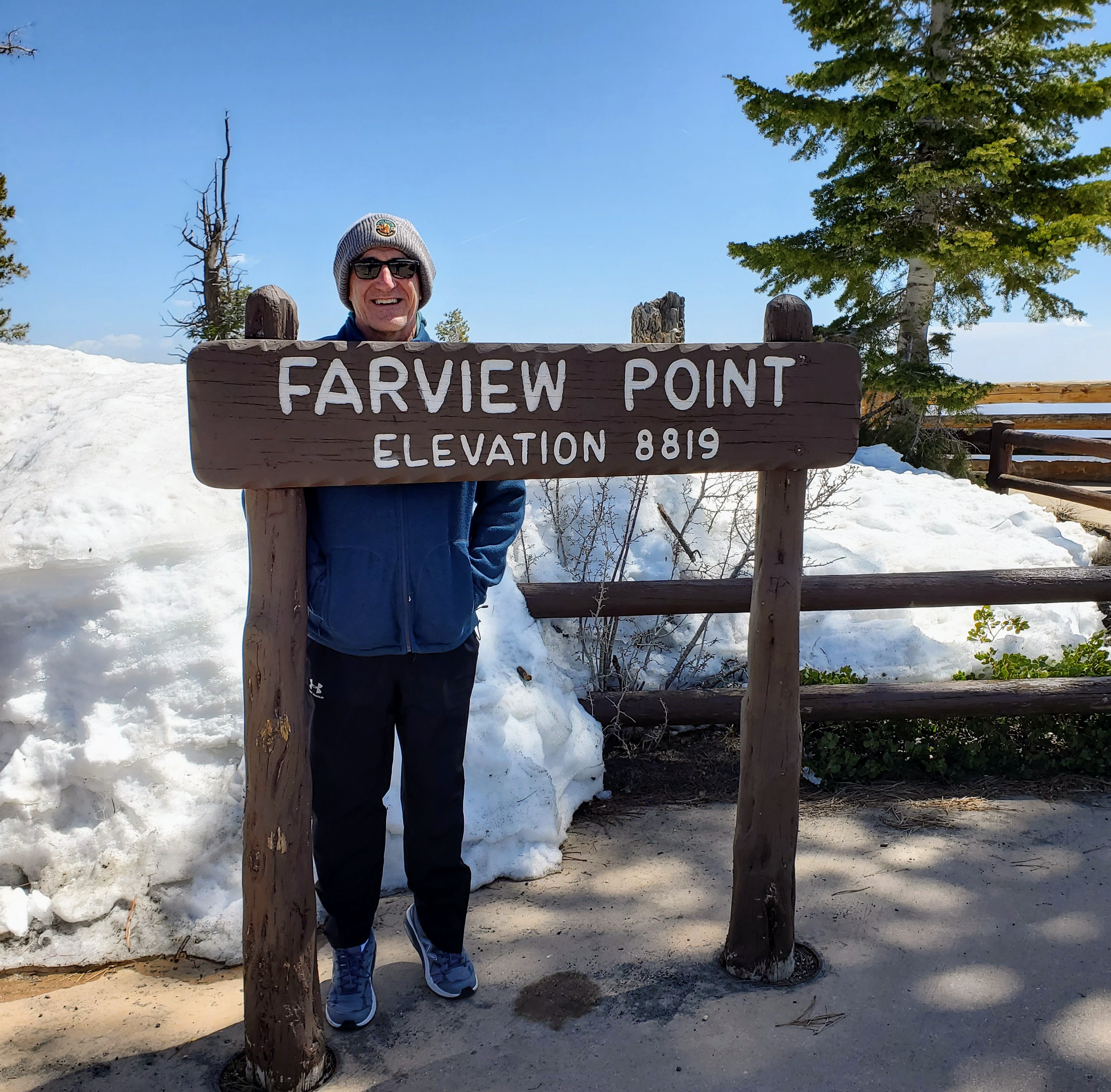
We left from the Visitor’s Center and decided to drive the Bryce Canyon Scenic Drive to the farthest point and work our way back to the park entrance. The route runs 18 miles (one way) to Rainbow Point. Unfortunately, with all the late and heavy snows, the road had not been snowplowed to that point and we could only go as far as the Natural Bridge Overlook. Our first official views of Bryce Canyon were at Natural Bridge and they did not disappoint. Wow!

One of my favorite stops was at Bryce Point, which runs along the Rim Trail. We parked and walked along the paved section of the trail that overlooked the Bryce Amphitheater. This section is an expansive area along the canyon floor where thousands of hoodoos stand like silent soldiers. There is no other place in the world that has as many hoodoos as Bryce Canyon! There are various viewpoints along the six-mile Rim Trail where you can walk/stand and marvel at all these unusual rock formations far below. Fantastic photo ops!

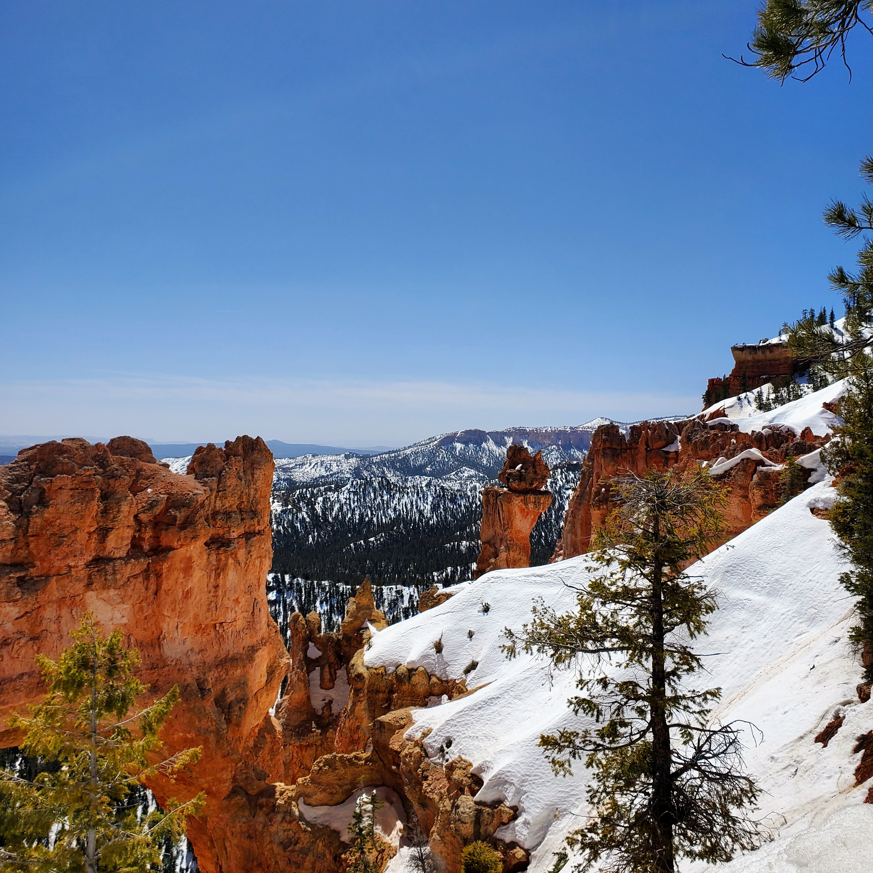
Sunset Point was another very scenic stop along our drive through the park. This is the point where the Navajo Loop Trail and Queen’s Garden Trail begin and where you can view Thor’s Hammer. This seemed to be the most popular viewing spot in the park and the only place where we saw full parking lots and small crowds. The hoodoos and views from this observation point were certainly the reason why it was so appealing.

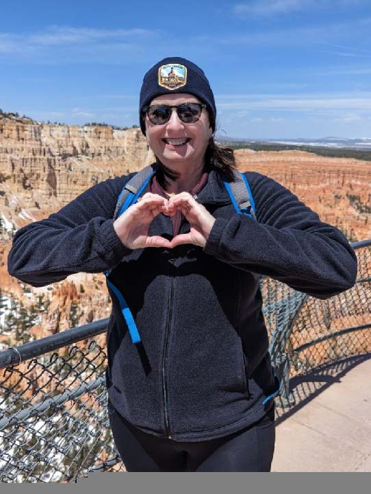
The canyon rim along these overlooks sits at an elevation around 9,000 feet. This particular day was clear and sunny with warm temperatures. The elevation and light winds made it feel much cooler than expected. Snow still covered much of the park (especially in shadows) and many trails were closed due to icy conditions. It was easy to see why the high altitude and cool temps make Bryce a prime vacation spot in the heat of the summer months.

Bryce Canyon National Park is relatively small and you can see the highlights in one full day, including the 13 vantage points along the Bryce Canyon Scenic Drive and maybe do a short hike or two. If you are more serious hikers, you may want to spend at least a couple of days in the park.

This visit to Bryce ended up being a perfect day for us and we were so glad that we got to experience the park in all its glory. As a side-trip from Zion, it was an easy drive and well worth the effort. Even though some roads and trails in the park were still closed, we thoroughly enjoyed not fighting for parking and pushing through crowds. No regrets!

See you on the trail!

Palo Duro Canyon

Canyon, Texas

20200727_102729_original

I have found the perfect trip to take during these days of Covid-19!

Why not check out Palo Duro Canyon State Park and visit our nation’s second largest canyon? Consider it a mini Grand Canyon and one of Texas’s best kept secrets. This park covers 30,000 acres and is located a few miles outside of Amarillo in the Texas Panhandle. Palo Duro Canyon offers spectacular views, fun outdoor activities, lots of fresh air and few social interactions with others. Why not get a change of scenery, have a great time and enjoy nature  – all while social distancing? Win, win!

20200727_094619_original

My husband and I recently drove to Palo Duro Canyon (6 hours from DFW) and stayed in a wonderful cabin (Skyhouse @ Dove’s Rest Cabins) five minutes away from the park entrance and spent two days in the park. If you go, be sure to purchase your State Park day passes on-line a few weeks in advance due to limited availability. Tickets are only $8 per vehicle per day and the park is currently open 7:00 a.m. until 7:00 p.m.

20200726_101842_original

The morning we arrived, there were only a couple of cars ahead of us checking into the park. After entering through the main gate, there were 16 miles of paved roads ahead of us that descended 800 feet to the canyon floor. We stopped along the park road several times and enjoyed fantastic scenic views, historical sites and markers, picnic tables, miles of hiking trails and the visitor center (with limited hours). There were also public restrooms, biking trails, horseback riding trails, a souvenir shop with grill, camping areas suitable for day trips, and overnight tent camping. Several areas were closed due to the pandemic, including the outdoor amphitheater and park cabins, but there was still plenty to see and do.

20200727_102821_original

We were there on a Sunday and Monday and may have seen two dozen people – tops! The parking lots, trails and roads were nearly empty. We passed a couple of people on each trail we were on. The most people we saw in one place happened to be at a snow cone stand at one of the major trail heads. It was great!

20200726_083802_original


Our first morning hike in the park was on the Pioneer Nature Trail that looped down to the river and back. It is a popular place to spot Texas horned lizards/toads/frogs (my daughter graduated from TCU so I will hereafter refer to them as horned frogs!). We found three snake skins (yikes! lots of rattlesnakes in the canyon), small lizards, tons of red ants (horned frog food), and a half-eaten coyote pup skeleton.  Near the end of our hike on this trail, lo and behold, we came across a Texas horned frog. He froze, we took pics, and went on our merry way. I was a happy camper!

20200726_090442_original

We then hiked a short distance off-trail around the site of the historic Battle of Palo Duro Canyon where the high red walls and percolation caves (caused by wind and water) reminded us of the rock formations in Sedona. This whole area has that eerie “battlefield” feeling I have felt other places – it just makes me feel sad and uneasy remembering the history and loss of life here. The vibe is unsettling and disturbing. You can read more about what happened here at the end of this article.

20200726_095026_original

Back on the main road, we chose the Sunflower Trail for our next hike and it was my favorite of the trip. This trail led us alongside a creek on one side and a large red, Permian wall on the other. This 300 million-year-old wall had beautiful horizontal veins of shiny white gypsum running through it. Most of the trail was shaded by tall cottonwoods and the clay-like ground underfoot was filled with animal tracks. We recognized raccoon, deer, rabbit, bobcat, coyote, and mountain lion tracks. I don’t think I would want to be on this trail at night! We also had to avoid stepping in piles of wildlife scat along the way that was teeming with iridescent dung beetles. The circle of life is alive and well in the canyon!

19774_original

20200726_104029_original

The following day began at the visitor center where we enjoyed the scenic view from the overlook at the canyon rim. We drove halfway down into the canyon and hiked off-trail again to climb a large prominent rock that overlooked the canyon floor. The views from there were amazing. This trail was full of cacti and the climb was not easy but I made it! We had to be very careful where we were stepping and constantly be on the lookout for snakes, scorpions and centipedes. Many things were ready and willing to stick, bite or sting!

20200727_104934_original

We hiked back to our car, drove a little further into the canyon and parked near the Kiowa trail head. We walked along the Kiowa Trail and followed a dry creek bed through mesquite groves for great views of another prehistoric Permian wall formation that gives the river its red color. We didn’t spot any wildlife here but saw many animal trails and tons of grasshoppers that would suddenly fly up and scare the bejesus out of you!

20200727_120845_original

20200727_115412_original

Later that afternoon we found ourselves at the Lighthouse trail head. This is the most popular trail and leads to the iconic Lighthouse Rock “hoodoo,” the symbol of the park. This is a six-mile hike round trip and where most of the park’s heat-related injuries and deaths for people and pets occur. We were warned to not start this hike if the temp was above 80 degrees (it was) and not unless you have at least one gallon of water per person (we didn’t). We decided to hike down the trail far enough to see the Lighthouse, take a pic, and head back – which is what we did. We then made a beeline to the snow cone stand in the parking lot! 

Note: the canyon floor is always 10 to 15 degrees warmer than the temperature on the canyon rim. It was hot! hot! hot!!

20200727_123255_original20200727_122938_original

Afterward our much-enjoyed snow cone, we made a couple of brief stops at pull-outs and had a picnic lunch. We saw more beautiful rock formations, a big green lizard, and a turkey.  After two full days of exploring the park and canyon, our trip was coming to a close. We enjoyed it immensely and I would love to visit again in the spring or fall when temps are a little cooler. One major highlight of our trip (besides the gorgeous scenery) was that the lack of crowds could not be beat!

20200727_112736_original

More information on the park itself:

People have been a part of this scenic canyon for 12,000 years where they hunted large herds of mammoth and giant bison. More recently, the Apache, Comanche and Kiowa Native American tribes called this canyon home. They left behind rock art, arrowheads, and pottery shards that clue us into their way of life here. Early Spanish adventurers exploring the canyon, named it Palo Duro, Spanish for hard wood. The visitor center has a video and some of these artifacts, fossils and relics if you are interested.

20200726_112913_original

For you history buffs – a large part of this canyon’s history centers around the Red River War and the Battle of Palo Duro Canyon (mentioned above) which was an ongoing battle between the U.S. Army and the Plains Indians. In 1874, the U.S. Calvary attacked a large camp of Comanches, Kiowas, and Cheyennes at dawn. Many in the camp fled throughout the canyon while the army attacked the surprised natives, captured 1,500  horses (and killed 1,100 after taking their picks), burned all the teepees, food, clothing, tools, and provisions. With no horses or winter supplies, the remaining Native Americans had no choice but to surrender themselves to the reservations. A marker now stands in the far end of the canyon and details this battle. As you stand in this spot, it is easy to visualize the haunting event that took place on these grounds and to imagine the sounds of the guns and the screams of the frightened people and horses. It is a bitter pill for me to swallow.

20200726_093746_original

 With the Native Americans out of the way, the canyon and surrounding area quickly moved into the “ranch era.” The resident buffalo were hunted almost to extinction for their hides and their carcasses were left to rot and be eaten by scavengers. The few small buffalo herds that remained were run out by the ranchers to make way for longhorns. The State of Texas bought this land for the park in 1933 after it had been used as a cattle ranch since the late 1800s.

20200727_102800_original

Currently Palo Duro Canyon State Park is ranked the “number one” State Park in Texas and ranks in the “top twenty” of U.S. State Parks according to several travel guides. No surprise there!

My husband and I thoroughly enjoyed our days spent in the park. It was a great little trip and a nice change of scenery. If you are a fan of the outdoors and enjoy hiking, rock formations and wildlife and don’t mind red dirt, cacti, and being up close and personal with nature – plan your trip today. I hope to go back soon so maybe I will cross paths with you there.

See you on the trails!

20200727_182331_original (1)20200726_112916_original